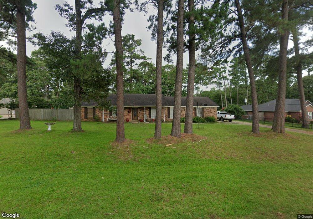
2010 Candy St Pinehurst, TX 77362
Pinehurst NeighborhoodEstimated Value: $305,910 - $435,000
Studio
2
Baths
1,844
Sq Ft
$202/Sq Ft
Est. Value
About This Home
This home is located at 2010 Candy St, Pinehurst, TX 77362 and is currently estimated at $372,978, approximately $202 per square foot. 2010 Candy St is a home located in Montgomery County with nearby schools including Decker Prairie Elementary School, Tomball Intermediate School, and Tomball Junior High School.
Ownership History
Date
Name
Owned For
Owner Type
Purchase Details
Closed on
Nov 7, 2006
Sold by
Modrzejewski Cynthia Ann
Bought by
Modrzejewski John Allen
Current Estimated Value
Purchase Details
Closed on
Jul 16, 1993
Sold by
Frey John M and Frey Sharon L
Bought by
Modrzejewski John
Purchase Details
Closed on
Aug 1, 1990
Sold by
Frey John R
Bought by
Modrzejewski John
Create a Home Valuation Report for This Property
The Home Valuation Report is an in-depth analysis detailing your home's value as well as a comparison with similar homes in the area
Home Values in the Area
Average Home Value in this Area
Purchase History
| Date | Buyer | Sale Price | Title Company |
|---|---|---|---|
| Modrzejewski John Allen | -- | None Available | |
| Modrzejewski John | -- | -- | |
| Modrzejewski John | -- | -- |
Source: Public Records
Mortgage History
| Date | Status | Borrower | Loan Amount |
|---|---|---|---|
| Closed | Modrzejewski John Allen | $0 |
Source: Public Records
Tax History
| Year | Tax Paid | Tax Assessment Tax Assessment Total Assessment is a certain percentage of the fair market value that is determined by local assessors to be the total taxable value of land and additions on the property. | Land | Improvement |
|---|---|---|---|---|
| 2025 | $2,948 | $259,881 | $55,102 | $204,779 |
| 2024 | $2,571 | $251,933 | -- | -- |
| 2023 | $2,571 | $229,030 | $55,100 | $183,100 |
| 2022 | $3,846 | $208,210 | $55,590 | $170,470 |
| 2021 | $3,637 | $189,280 | $38,070 | $151,210 |
| 2020 | $3,750 | $187,100 | $38,070 | $149,030 |
| 2019 | $3,606 | $182,640 | $38,070 | $147,270 |
| 2018 | $2,929 | $166,040 | $14,310 | $151,730 |
| 2017 | $3,281 | $157,650 | $14,310 | $143,340 |
| 2016 | $3,154 | $151,570 | $14,310 | $143,340 |
| 2015 | $2,545 | $137,790 | $14,310 | $123,480 |
| 2014 | $2,545 | $130,220 | $14,310 | $115,910 |
Source: Public Records
Map
Nearby Homes
- 2102 Candy St
- 0 Candy St
- 1801 Coe Rd
- 2210 Lucretia St
- 2007 Diane St
- 2103 Diane St
- 2111 Diane St
- 14419 Timbergreen Dr
- TBD Stagecoach Rd
- 14319 Timbergreen Dr
- 35425 Woodtrace Cir
- 15019 Timbershire Ct
- 15245 Shady Oaks Dr
- 1301 Knollbridge Point Ln
- 1211 Mere Dr
- 15450 Shady Oaks Dr
- 603 Terri Ln
- 15823 Stagecoach Rd
- 15937 Stagecoach Rd
- 1025 Goodson Loop
- 2006 Candy St
- 2018 Timbergreen Cir
- 2011 Candy St
- 2103 Candy St
- 2007 Candy St
- 2010 Timbergreen Cir
- 2002 Candy St
- 2026 Timbergreen Cir
- 2107 Candy St
- 2102 Coe Rd
- 2006 Coe Rd
- 2002 Timbergreen Cir
- 14506 Courtney St
- 2034 Timbergreen Cir
- 2106 Coe Rd
- 14510 Jason St
- 2110 Candy St
- 14502 Courtney St
- 14502 Courtney St Unit 1
- 1926 Timbergreen Cir
Your Personal Tour Guide
Ask me questions while you tour the home.