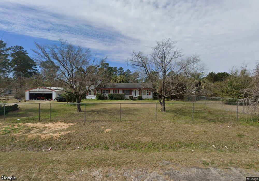
2010 Cannon Bridge Rd Cordova, SC 29039
Estimated Value: $98,000 - $191,000
2
Beds
1
Bath
1,420
Sq Ft
$112/Sq Ft
Est. Value
About This Home
This home is located at 2010 Cannon Bridge Rd, Cordova, SC 29039 and is currently estimated at $159,092, approximately $112 per square foot. 2010 Cannon Bridge Rd is a home located in Orangeburg County with nearby schools including Edisto Primary, Edisto Primary School, and Edisto Elementary School.
Ownership History
Date
Name
Owned For
Owner Type
Purchase Details
Closed on
Aug 11, 2023
Sold by
Kemmerlin Walter A
Bought by
Wotring Mary Jo M and Cain Ebonee N
Current Estimated Value
Home Financials for this Owner
Home Financials are based on the most recent Mortgage that was taken out on this home.
Original Mortgage
$60,000
Outstanding Balance
$58,607
Interest Rate
6.71%
Mortgage Type
New Conventional
Estimated Equity
$100,485
Purchase Details
Closed on
Sep 23, 2022
Sold by
Zmitrovich April R
Bought by
Kemmerlin Walter A
Purchase Details
Closed on
Apr 13, 2015
Sold by
Rast Rex F
Bought by
Zmitrovich April Rast
Purchase Details
Closed on
May 18, 2006
Sold by
Kemmerlin Patty R and Rast Rex F
Bought by
Rast Dorothy
Purchase Details
Closed on
Apr 11, 2006
Sold by
Rast Dorothy V
Bought by
Rast Rex F and Baltzegar Charles
Create a Home Valuation Report for This Property
The Home Valuation Report is an in-depth analysis detailing your home's value as well as a comparison with similar homes in the area
Home Values in the Area
Average Home Value in this Area
Purchase History
| Date | Buyer | Sale Price | Title Company |
|---|---|---|---|
| Wotring Mary Jo M | $80,000 | None Listed On Document | |
| Kemmerlin Walter A | -- | -- | |
| Zmitrovich April Rast | -- | -- | |
| Rast Dorothy | -- | None Available | |
| Rast Rex F | -- | None Available |
Source: Public Records
Mortgage History
| Date | Status | Borrower | Loan Amount |
|---|---|---|---|
| Open | Wotring Mary Jo M | $60,000 |
Source: Public Records
Tax History Compared to Growth
Tax History
| Year | Tax Paid | Tax Assessment Tax Assessment Total Assessment is a certain percentage of the fair market value that is determined by local assessors to be the total taxable value of land and additions on the property. | Land | Improvement |
|---|---|---|---|---|
| 2024 | $2,464 | $5,964 | $816 | $5,148 |
| 2023 | $2,503 | $4,898 | $698 | $4,200 |
| 2022 | $794 | $4,898 | $698 | $4,200 |
| 2021 | $964 | $4,898 | $698 | $4,200 |
| 2020 | $941 | $4,898 | $0 | $0 |
| 2019 | $903 | $4,898 | $0 | $0 |
| 2018 | $783 | $4,178 | $0 | $0 |
| 2017 | $292 | $4,178 | $0 | $0 |
| 2016 | $291 | $2,785 | $0 | $0 |
| 2015 | $203 | $4,178 | $0 | $0 |
| 2014 | $203 | $4,178 | $698 | $3,480 |
| 2013 | -- | $2,877 | $465 | $2,412 |
Source: Public Records
Map
Nearby Homes
- 118 Highland Park Cir
- 1983 Cannon Bridge Rd
- 136 Highland Park Cir
- 147 Podium Rd
- 1811 Cannon Bridge Rd
- 128 Buster Ln
- 1609 Cannon Bridge Rd
- 183 Baycreek Ln
- 123 Peaceful Dr
- 123 Dawsey St
- 110 Red Cedar Dr
- 115 Williams St
- 137 Williams St
- 219 Cannon Bridge Rd
- 29 Meadowcrest Dr
- 17 Knotty Pine
- 2953 Cordova Rd
- 2099 Legrand Smoak St
- 2655 Cordova Rd
- 2636 Cordova Rd SW
- 2010 Cannon Bridge Rd
- 2023 Cannon Bridge Rd
- 2017 Cannon Bridge Rd
- 2036 Cannon Bridge Rd
- 2013 Cannon Bridge Rd
- 201 Highland Park Cir
- 2039 Cannon Bridge Rd
- 2006 Cannon Bridge Rd
- 2009 Cannon Bridge Rd
- 109 Terry St
- 196 Highland Park Cir
- 197 Highland Park Cir
- 2005 Cannon Bridge Rd
- 192 Highland Park Cir
- 115 Terry St
- 192 State Road S-38-1224
- 2045 Cannon Bridge Rd
- 191 Highland Park Cir
- 112 Highland Park Cir
- 108 Terry St