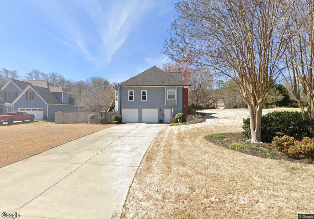
2010 Cedar Point Ln Cumming, GA 30041
Big Creek NeighborhoodEstimated Value: $477,000 - $583,000
4
Beds
4
Baths
1,934
Sq Ft
$272/Sq Ft
Est. Value
About This Home
This home is located at 2010 Cedar Point Ln, Cumming, GA 30041 and is currently estimated at $526,499, approximately $272 per square foot. 2010 Cedar Point Ln is a home located in Forsyth County with nearby schools including Daves Creek Elementary School, South Forsyth Middle School, and South Forsyth High School.
Ownership History
Date
Name
Owned For
Owner Type
Purchase Details
Closed on
Aug 11, 2008
Sold by
Forstrom Liza N
Bought by
Gallo Vincent and Gallo Miriam E
Current Estimated Value
Purchase Details
Closed on
Oct 30, 2006
Sold by
Colbert Wendy B
Bought by
Forstrom Liza N and Forstrom Suzanne A
Home Financials for this Owner
Home Financials are based on the most recent Mortgage that was taken out on this home.
Original Mortgage
$150,000
Interest Rate
6.31%
Mortgage Type
New Conventional
Create a Home Valuation Report for This Property
The Home Valuation Report is an in-depth analysis detailing your home's value as well as a comparison with similar homes in the area
Home Values in the Area
Average Home Value in this Area
Purchase History
| Date | Buyer | Sale Price | Title Company |
|---|---|---|---|
| Gallo Vincent | $243,500 | -- | |
| Forstrom Liza N | $233,000 | -- |
Source: Public Records
Mortgage History
| Date | Status | Borrower | Loan Amount |
|---|---|---|---|
| Previous Owner | Forstrom Liza N | $150,000 |
Source: Public Records
Tax History Compared to Growth
Tax History
| Year | Tax Paid | Tax Assessment Tax Assessment Total Assessment is a certain percentage of the fair market value that is determined by local assessors to be the total taxable value of land and additions on the property. | Land | Improvement |
|---|---|---|---|---|
| 2025 | $702 | $199,200 | $68,000 | $131,200 |
| 2024 | $702 | $183,816 | $60,000 | $123,816 |
| 2023 | $614 | $186,660 | $60,000 | $126,660 |
| 2022 | $710 | $121,184 | $32,000 | $89,184 |
| 2021 | $678 | $121,184 | $32,000 | $89,184 |
| 2020 | $675 | $117,420 | $32,000 | $85,420 |
| 2019 | $679 | $116,776 | $32,000 | $84,776 |
| 2018 | $677 | $106,092 | $24,000 | $82,092 |
| 2017 | $692 | $109,536 | $24,000 | $85,536 |
| 2016 | $690 | $107,536 | $22,000 | $85,536 |
| 2015 | $619 | $83,576 | $18,000 | $65,576 |
| 2014 | $544 | $78,136 | $0 | $0 |
Source: Public Records
Map
Nearby Homes
- 2040 Orr Rd
- 1330 Rogers Mill Ln
- 1120 Beech Ct
- 2420 Bronze Ct
- 2325 Melrose Trace
- 8355 Ainsworth Dr
- 8930 Cobblestone Ln
- 2550 Wellsley Ln
- 7047 Bennington Ln
- 4965 Cheltenham Place
- 3711 Melody Mizer Ln
- 4865 Cheltenham Place
- 1460 Badingham Dr
- 7030 Bennington Ln
- 1255 Bookhout Dr
- 1065 Bookhout Dr
- 2071 Vicki Ln
- 7022 Bennington Ln
- 3930 Medley Way
- 3635 Crowchild Dr
- 2020 Cedar Point Ln
- 2035 Bethany Spring Trace
- 2005 Cedar Point Ln
- 2030 Cedar Point Ln
- 2020 Bethany Spring Trace
- 2010 Bethany Spring Trace
- 2030 Bethany Spring Trace
- 2045 Bethany Spring Trace
- 2055 Cedar Point Ln
- 1950 Bethany Spring Trace
- 2040 Cedar Point Ln
- 2040 Bethany Spring Trace
- 1925 Bethany Spring Trace
- 2085 Cedar Point Ln
- 2055 Bethany Spring Trace
- 1930 Bethany Spring Trace
- 2050 Bethany Spring Trace
- 1710 Cardinal Dr
- 2050 Cedar Point Ln
- 1630 Cardinal Dr