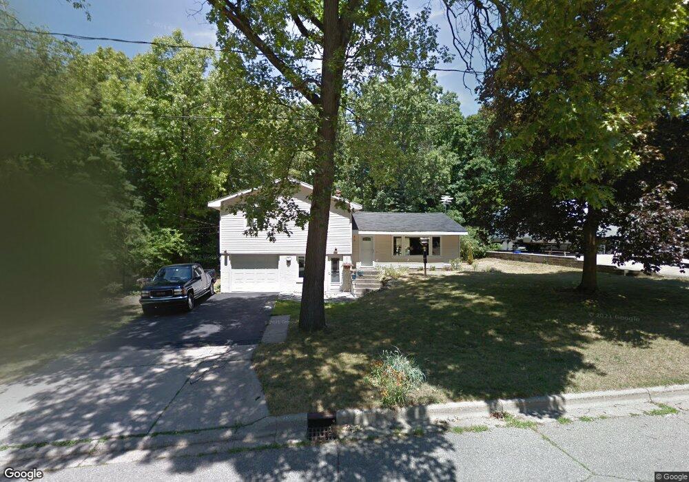
2010 Charter Ave Portage, MI 49024
Estimated Value: $237,000 - $290,000
3
Beds
2
Baths
1,572
Sq Ft
$164/Sq Ft
Est. Value
About This Home
This home is located at 2010 Charter Ave, Portage, MI 49024 and is currently estimated at $258,113, approximately $164 per square foot. 2010 Charter Ave is a home located in Kalamazoo County with nearby schools including Woodland Elementary School, Portage Central Middle School, and Portage Central High School.
Ownership History
Date
Name
Owned For
Owner Type
Purchase Details
Closed on
Jul 16, 2007
Sold by
Keim Jeff Michael
Bought by
Keim Karen Doreen
Current Estimated Value
Purchase Details
Closed on
Aug 14, 2006
Sold by
Fletcher Lisa Ann
Bought by
Wnuk Lisa A
Purchase Details
Closed on
Jul 18, 2006
Sold by
Fletcher Scott W
Bought by
Fletcher Lisa A
Purchase Details
Closed on
Dec 3, 2002
Sold by
Fletcher Lisa A and Wnuk Jacqueline A
Bought by
Fletcher Scott A and Fletcher Lisa A
Home Financials for this Owner
Home Financials are based on the most recent Mortgage that was taken out on this home.
Original Mortgage
$71,000
Interest Rate
6.25%
Create a Home Valuation Report for This Property
The Home Valuation Report is an in-depth analysis detailing your home's value as well as a comparison with similar homes in the area
Home Values in the Area
Average Home Value in this Area
Purchase History
| Date | Buyer | Sale Price | Title Company |
|---|---|---|---|
| Keim Karen Doreen | -- | None Available | |
| Wnuk Lisa A | -- | None Available | |
| Fletcher Lisa A | -- | None Available | |
| Fletcher Scott A | -- | -- |
Source: Public Records
Mortgage History
| Date | Status | Borrower | Loan Amount |
|---|---|---|---|
| Previous Owner | Fletcher Scott A | $71,000 |
Source: Public Records
Tax History Compared to Growth
Tax History
| Year | Tax Paid | Tax Assessment Tax Assessment Total Assessment is a certain percentage of the fair market value that is determined by local assessors to be the total taxable value of land and additions on the property. | Land | Improvement |
|---|---|---|---|---|
| 2025 | $3,060 | $96,400 | $0 | $0 |
| 2024 | $2,694 | $94,300 | $0 | $0 |
| 2023 | $2,568 | $79,300 | $0 | $0 |
| 2022 | $2,775 | $77,600 | $0 | $0 |
| 2021 | $2,682 | $73,900 | $0 | $0 |
| 2020 | $2,623 | $69,800 | $0 | $0 |
| 2019 | $236 | $64,000 | $0 | $0 |
| 2018 | $0 | $63,200 | $0 | $0 |
| 2017 | $0 | $55,200 | $0 | $0 |
| 2016 | -- | $57,800 | $0 | $0 |
| 2015 | -- | $54,400 | $0 | $0 |
| 2014 | -- | $53,300 | $0 | $0 |
Source: Public Records
Map
Nearby Homes
- 7337 Starbrook St
- 7717 Julie Dr
- 7784 Primrose Ln
- 7403 Rockford St
- 1828 Woodland Dr
- 1318 Ashton Woods Ct
- 7160 Crown Pointe Cir
- 2087 Lion Gate Dr
- 2076 Lion Gate Dr
- 1902 W Centre Ave
- 7104 Rockford St
- 2600 W Centre Ave Unit +/- 1 Acre
- 2351 W Centre Ave
- 7639 Dunross Dr
- 7464 Saint George Cir
- 7481 Turnberry Ct
- 1524 Greenview Ave
- 6827 Marlow St
- 2604 Radcliffe Ave
- 6803 Bluegrass St
- 1930 Charter Ave
- 2030 Charter Ave
- 1922 Charter Ave
- 7606 Andrea Ln
- 2029 Charter Ave
- 2001 Schuring Rd
- 7533 Oakland Dr
- 1971 Schuring Rd
- 1914 Charter Ave
- 7616 Andrea Ln
- 7615 Oakland Dr
- 7605 Andrea Ln
- 1831 Schuring Rd
- 7426 Oakland Dr
- 1906 Charter Ave
- 7626 Andrea Ln
- 7615 Andrea Ln
- 7625 Oakland Dr
- 2108 Quincy Ave
- 7508 Oakland Dr