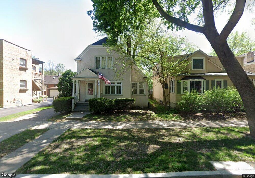
2010 Colfax St Evanston, IL 60201
North Evanston NeighborhoodEstimated Value: $553,000 - $799,000
4
Beds
2
Baths
1,688
Sq Ft
$418/Sq Ft
Est. Value
About This Home
This home is located at 2010 Colfax St, Evanston, IL 60201 and is currently estimated at $704,755, approximately $417 per square foot. 2010 Colfax St is a home located in Cook County with nearby schools including Kingsley Elementary School, Haven Middle School, and Evanston Township High School.
Ownership History
Date
Name
Owned For
Owner Type
Purchase Details
Closed on
Sep 29, 2025
Sold by
Washington Lisa L and Kuzel Dennis F
Bought by
Kuzel Family Trust
Current Estimated Value
Purchase Details
Closed on
Dec 3, 2006
Sold by
Zevitz Linda and Pritchard Linda
Bought by
Kuzel Dennis F and Washington Lisa L
Home Financials for this Owner
Home Financials are based on the most recent Mortgage that was taken out on this home.
Original Mortgage
$354,000
Interest Rate
6.36%
Mortgage Type
Purchase Money Mortgage
Purchase Details
Closed on
Dec 20, 1998
Sold by
Zevitz Michael
Bought by
Zevitz Linda
Home Financials for this Owner
Home Financials are based on the most recent Mortgage that was taken out on this home.
Original Mortgage
$187,000
Interest Rate
6.76%
Create a Home Valuation Report for This Property
The Home Valuation Report is an in-depth analysis detailing your home's value as well as a comparison with similar homes in the area
Home Values in the Area
Average Home Value in this Area
Purchase History
| Date | Buyer | Sale Price | Title Company |
|---|---|---|---|
| Kuzel Family Trust | -- | None Listed On Document | |
| Kuzel Dennis F | $442,500 | Centennial Title Incorporate | |
| Zevitz Linda | -- | -- |
Source: Public Records
Mortgage History
| Date | Status | Borrower | Loan Amount |
|---|---|---|---|
| Previous Owner | Kuzel Dennis F | $354,000 | |
| Previous Owner | Zevitz Linda | $187,000 |
Source: Public Records
Tax History
| Year | Tax Paid | Tax Assessment Tax Assessment Total Assessment is a certain percentage of the fair market value that is determined by local assessors to be the total taxable value of land and additions on the property. | Land | Improvement |
|---|---|---|---|---|
| 2025 | $10,934 | $70,000 | $9,600 | $60,400 |
| 2024 | $10,934 | $48,482 | $9,000 | $39,482 |
| 2023 | $10,467 | $48,482 | $9,000 | $39,482 |
| 2022 | $10,467 | $48,482 | $9,000 | $39,482 |
| 2021 | $10,882 | $44,334 | $6,000 | $38,334 |
| 2020 | $11,309 | $46,293 | $6,000 | $40,293 |
| 2019 | $12,206 | $55,526 | $6,000 | $49,526 |
| 2018 | $10,705 | $42,507 | $5,000 | $37,507 |
| 2017 | $10,441 | $42,507 | $5,000 | $37,507 |
| 2016 | $10,681 | $44,702 | $5,000 | $39,702 |
| 2015 | $9,574 | $38,331 | $4,200 | $34,131 |
| 2014 | $9,498 | $38,331 | $4,200 | $34,131 |
| 2013 | $9,264 | $38,331 | $4,200 | $34,131 |
Source: Public Records
Map
Nearby Homes
- 2310 Brown Ave
- 2336 Grey Ave
- 1915 Grant St
- 2505 Prairie Ave Unit 2K
- 2515 Prairie Ave Unit 1E
- 2509 Pioneer Rd
- 2537 Prairie Ave Unit 2E
- 2201 Central St Unit 3N
- 2201 Central St Unit 1
- 1915 - 2 Grant St
- 2611 Walnut Ave
- 2144 Dewey Ave
- 2324 Central St Unit 2B
- 2646 Eastwood Ave
- 2005 Darrow Ave
- 2622 Harrison St
- 2701 Noyes St
- 2227 Foster St
- 2215 Wesley Ave
- 2717 Harrison St
- 2012 Colfax St
- 2004 Colfax St Unit A
- 2004 Colfax St Unit 1A
- 2004 Colfax St Unit P1
- 2004 Colfax St Unit 2004B
- 2004 Colfax St Unit 2004A
- 2004 Colfax St Unit P2
- 2004 Colfax St Unit B
- 2330 Brown Ave
- 2002 Colfax St Unit P1
- 2002 Colfax St Unit 2002B
- 2002 Colfax St Unit 2002A
- 2002 Colfax St Unit P2
- 2002 Colfax St Unit 1
- 2326 Brown Ave
- 2400 Brown Ave
- 2324 Brown Ave
- 2333 Grey Ave
- 2022 Colfax St Unit 1
- 2022 Colfax St
Your Personal Tour Guide
Ask me questions while you tour the home.