Estimated Value: $276,258 - $429,000
1
Bed
1
Bath
1,200
Sq Ft
$275/Sq Ft
Est. Value
About This Home
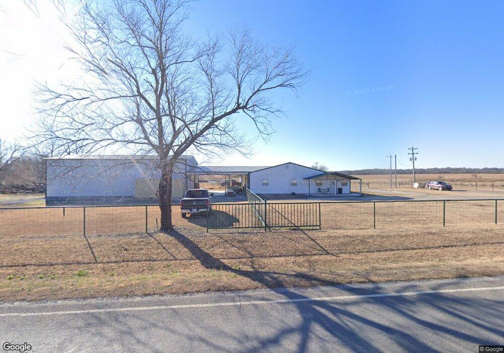
This home is located at 2010 Highway 16, Beggs, OK 74421 and is currently estimated at $330,419, approximately $275 per square foot. 2010 Highway 16 is a home located in Okmulgee County with nearby schools including Beggs Elementary School, Beggs Middle School, and Beggs High School.
Ownership History
Date
Name
Owned For
Owner Type
Purchase Details
Closed on
Apr 13, 2020
Sold by
Hale Patrick Hurley and Hale April D
Bought by
Hale Patrick H and Hale April D
Current Estimated Value
Home Financials for this Owner
Home Financials are based on the most recent Mortgage that was taken out on this home.
Original Mortgage
$169,354
Interest Rate
3.6%
Mortgage Type
Construction
Purchase Details
Closed on
Feb 16, 2001
Sold by
Henson James M and Henson Lena W
Bought by
Hale Patrick Hurley
Purchase Details
Closed on
Feb 17, 1995
Sold by
James Davis
Bought by
James Henson
Create a Home Valuation Report for This Property
The Home Valuation Report is an in-depth analysis detailing your home's value as well as a comparison with similar homes in the area
Home Values in the Area
Average Home Value in this Area
Purchase History
| Date | Buyer | Sale Price | Title Company |
|---|---|---|---|
| Hale Patrick H | -- | None Available | |
| Hale Patrick Hurley | $12,000 | -- | |
| James Henson | $6,000 | -- |
Source: Public Records
Mortgage History
| Date | Status | Borrower | Loan Amount |
|---|---|---|---|
| Closed | Hale Patrick H | $169,354 |
Source: Public Records
Tax History Compared to Growth
Tax History
| Year | Tax Paid | Tax Assessment Tax Assessment Total Assessment is a certain percentage of the fair market value that is determined by local assessors to be the total taxable value of land and additions on the property. | Land | Improvement |
|---|---|---|---|---|
| 2025 | $1,873 | $19,627 | $1,493 | $18,134 |
| 2024 | $1,717 | $19,627 | $1,460 | $18,167 |
| 2023 | $1,656 | $18,500 | $1,440 | $17,060 |
| 2022 | $764 | $9,000 | $1,440 | $7,560 |
| 2021 | $763 | $9,000 | $1,440 | $7,560 |
| 2020 | $711 | $8,483 | $1,440 | $7,043 |
| 2019 | $685 | $8,236 | $1,440 | $6,796 |
| 2018 | $664 | $7,996 | $1,440 | $6,556 |
| 2017 | $603 | $7,763 | $1,440 | $6,323 |
| 2016 | $584 | $7,538 | $1,440 | $6,098 |
| 2015 | $594 | $7,318 | $1,440 | $5,878 |
| 2014 | $569 | $7,105 | $1,440 | $5,665 |
Source: Public Records
Map
Nearby Homes
- 0 Harreld Rd Unit 2527268
- 0 Harreld Rd Unit 2527267
- 18132 W 301st St S
- 0000 W 311th St S
- 19887 W 281st St S
- 8620 N 155 Rd
- 3900 Rizley Rd
- 4320 N 135 Rd
- RC Bridgeport Plan at Meadowview Estates II
- RC Davenport Plan at Meadowview Estates II
- RC Armstrong II Plan at Meadowview Estates II
- 716 N Redbud Ave
- RC Magnolia Plan at Meadowview Estates II
- RC Somerville Plan at Meadowview Estates II
- RC Foster II Plan at Meadowview Estates II
- RC Fenway Plan at Meadowview Estates II
- 708 N Redbud Ave
- 120 N 160 Rd
- 804 W Main St
- 5441 Jackson Rd