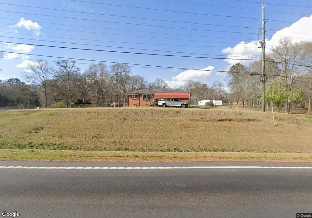
2010 Highway 81 S Covington, GA 30016
Estimated Value: $114,091 - $229,000
--
Bed
1
Bath
1,099
Sq Ft
$153/Sq Ft
Est. Value
About This Home
This home is located at 2010 Highway 81 S, Covington, GA 30016 and is currently estimated at $168,023, approximately $152 per square foot. 2010 Highway 81 S is a home located in Newton County with nearby schools including South Salem Elementary School, Liberty Middle School, and Alcovy High School.
Ownership History
Date
Name
Owned For
Owner Type
Purchase Details
Closed on
Apr 28, 2023
Sold by
Stapp John F
Bought by
Olivas Pedro Ivan Rodriguez and Garcia Noelia Diaz
Current Estimated Value
Purchase Details
Closed on
Dec 31, 2001
Sold by
Whatley Estelle C
Bought by
Stapp John F and Stapp Wanda L
Home Financials for this Owner
Home Financials are based on the most recent Mortgage that was taken out on this home.
Original Mortgage
$55,750
Interest Rate
6.99%
Mortgage Type
New Conventional
Create a Home Valuation Report for This Property
The Home Valuation Report is an in-depth analysis detailing your home's value as well as a comparison with similar homes in the area
Home Values in the Area
Average Home Value in this Area
Purchase History
| Date | Buyer | Sale Price | Title Company |
|---|---|---|---|
| Olivas Pedro Ivan Rodriguez | $1,000 | -- | |
| Stapp John F | $58,700 | -- |
Source: Public Records
Mortgage History
| Date | Status | Borrower | Loan Amount |
|---|---|---|---|
| Previous Owner | Stapp John F | $55,750 |
Source: Public Records
Tax History Compared to Growth
Tax History
| Year | Tax Paid | Tax Assessment Tax Assessment Total Assessment is a certain percentage of the fair market value that is determined by local assessors to be the total taxable value of land and additions on the property. | Land | Improvement |
|---|---|---|---|---|
| 2024 | $695 | $31,280 | $8,160 | $23,120 |
| 2023 | $733 | $30,880 | $9,760 | $21,120 |
| 2022 | $666 | $28,400 | $9,760 | $18,640 |
| 2021 | $518 | $20,960 | $9,760 | $11,200 |
| 2020 | $522 | $19,440 | $8,960 | $10,480 |
| 2019 | $540 | $19,720 | $8,960 | $10,760 |
| 2018 | $225 | $17,000 | $8,960 | $8,040 |
| 2017 | $464 | $17,400 | $8,960 | $8,440 |
| 2016 | $252 | $11,240 | $3,960 | $7,280 |
| 2015 | $263 | $11,560 | $3,960 | $7,600 |
| 2014 | $227 | $10,480 | $0 | $0 |
Source: Public Records
Map
Nearby Homes
- 1985 Highway 81 Unit 94&99
- 1985 Highway 81
- 0 Heaton Rd
- 0 Heaton Rd Unit 7083549
- 0 Heaton Rd Unit 8558169
- 0 Heaton Rd Unit 8383945
- 0 Heaton Rd Unit 8306334
- 0 Heaton Rd Unit 8120983
- 0 Heaton Rd Unit 8022351
- 0 Heaton Rd Unit 3177932
- 0 Heaton Rd Unit 7639192
- 0 Heaton Rd Unit 8528890
- 0 Heaton Rd Unit 7311422
- 0 Heaton Rd Unit 7039687
- 0 Heaton Rd Unit 3180506
- 0 Heaton Rd Unit 8721109
- 0 Heaton Rd Unit 7.02 ACRES 9049927
- 0 Heaton Rd Unit 8220394
- 0 Heaton Rd Unit 8783542
- 0 Heaton Rd Unit 8362854