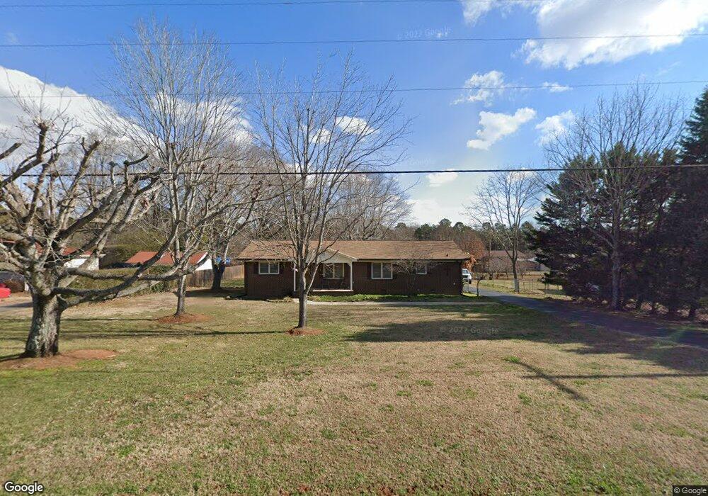
2010 Irish Potato Rd Unit 15 Concord, NC 28025
Estimated Value: $275,000 - $394,000
3
Beds
2
Baths
1,480
Sq Ft
$231/Sq Ft
Est. Value
About This Home
This home is located at 2010 Irish Potato Rd Unit 15, Concord, NC 28025 and is currently estimated at $342,472, approximately $231 per square foot. 2010 Irish Potato Rd Unit 15 is a home located in Cabarrus County with nearby schools including W.M. Irvin Elementary School, Mount Pleasant Middle School, and Mount Pleasant High School.
Ownership History
Date
Name
Owned For
Owner Type
Purchase Details
Closed on
Sep 29, 2016
Sold by
Kirk Elizabeth C and Kirk Jon Eric
Bought by
Isenhour Brian R and Isenhour Sherry M
Current Estimated Value
Home Financials for this Owner
Home Financials are based on the most recent Mortgage that was taken out on this home.
Original Mortgage
$142,450
Outstanding Balance
$114,092
Interest Rate
3.43%
Mortgage Type
VA
Estimated Equity
$228,380
Purchase Details
Closed on
Mar 6, 2015
Sold by
Christenbury Lewis E
Bought by
Kirk Elizabeth C and Hsin Melissa C
Create a Home Valuation Report for This Property
The Home Valuation Report is an in-depth analysis detailing your home's value as well as a comparison with similar homes in the area
Home Values in the Area
Average Home Value in this Area
Purchase History
| Date | Buyer | Sale Price | Title Company |
|---|---|---|---|
| Isenhour Brian R | $138,000 | None Available | |
| Kirk Elizabeth C | -- | None Available |
Source: Public Records
Mortgage History
| Date | Status | Borrower | Loan Amount |
|---|---|---|---|
| Open | Isenhour Brian R | $142,450 |
Source: Public Records
Tax History Compared to Growth
Tax History
| Year | Tax Paid | Tax Assessment Tax Assessment Total Assessment is a certain percentage of the fair market value that is determined by local assessors to be the total taxable value of land and additions on the property. | Land | Improvement |
|---|---|---|---|---|
| 2025 | $2,256 | $343,890 | $65,000 | $278,890 |
| 2024 | $2,256 | $343,890 | $65,000 | $278,890 |
| 2023 | $1,640 | $200,030 | $46,000 | $154,030 |
| 2022 | $1,640 | $200,030 | $46,000 | $154,030 |
| 2021 | $1,640 | $200,030 | $46,000 | $154,030 |
| 2020 | $1,600 | $200,030 | $46,000 | $154,030 |
| 2019 | $1,047 | $130,870 | $28,000 | $102,870 |
| 2018 | $1,021 | $130,870 | $28,000 | $102,870 |
| 2017 | $985 | $129,550 | $28,000 | $101,550 |
| 2016 | $985 | $124,780 | $30,000 | $94,780 |
| 2015 | $948 | $124,780 | $30,000 | $94,780 |
| 2014 | $948 | $124,780 | $30,000 | $94,780 |
Source: Public Records
Map
Nearby Homes
- 1660 Songwood Rd
- 2248 Circle r Rd
- 1300 Irish Potato Rd
- 3500 Timber Creek Trail
- 1787 Saint Johns Church Rd
- 3251 Van Tassel Dr
- 4430 Laurelwood Ct
- 43 Crane Ct
- 4240 Nc Hwy 73 None E
- 5573 Arnold Way
- 108 Kimble Ct
- 5543 Arnold Way
- 5614 Arnold Way
- 5527 Arnold Way
- 5526 Arnold Way
- 5519 Arnold Way
- The Coleman Plan at Green Acres
- The Benson II Plan at Green Acres
- The James Plan at Green Acres
- The McGinnis Plan at Green Acres
- 2010 Irish Potato Rd
- 2015 Songwood Rd
- 2000 Irish Potato Rd
- 2020 Irish Potato Rd
- 2005 Songwood Rd
- 1930 Irish Potato Rd
- 1935 Songwood Rd
- 1920 Irish Potato Rd
- 1915 Songwood Rd
- 2100 Irish Potato Rd
- 1910 Irish Potato Rd
- 1905 Songwood Rd
- 1900 Irish Potato Rd
- 1835 Songwood Rd
- 2120 Irish Potato Rd
- 1830 Irish Potato Rd
- 2121 Irish Potato Rd
- 2018 Breakwood Dr
- 1825 Songwood Rd
- 4043 Gold Hill Rd