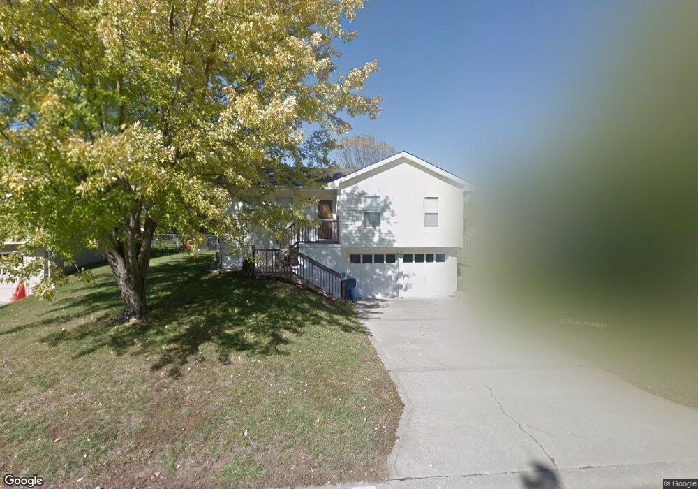
2010 Karlton Way Excelsior Springs, MO 64024
Estimated Value: $223,695 - $251,000
3
Beds
2
Baths
1,066
Sq Ft
$226/Sq Ft
Est. Value
About This Home
This home is located at 2010 Karlton Way, Excelsior Springs, MO 64024 and is currently estimated at $240,424, approximately $225 per square foot. 2010 Karlton Way is a home located in Clay County with nearby schools including Excelsior Springs High School.
Ownership History
Date
Name
Owned For
Owner Type
Purchase Details
Closed on
Nov 22, 2000
Sold by
Knect Marty A and Knecht Robert G
Bought by
Bryant Chris A and Bryant Alisha D
Current Estimated Value
Home Financials for this Owner
Home Financials are based on the most recent Mortgage that was taken out on this home.
Original Mortgage
$64,000
Outstanding Balance
$30,402
Interest Rate
6.87%
Estimated Equity
$210,022
Purchase Details
Closed on
Feb 23, 1998
Sold by
Werle Marty A and Knecht Marty A
Bought by
Knecht Robert G and Knecht Marty A
Home Financials for this Owner
Home Financials are based on the most recent Mortgage that was taken out on this home.
Original Mortgage
$66,400
Interest Rate
6.91%
Create a Home Valuation Report for This Property
The Home Valuation Report is an in-depth analysis detailing your home's value as well as a comparison with similar homes in the area
Home Values in the Area
Average Home Value in this Area
Purchase History
| Date | Buyer | Sale Price | Title Company |
|---|---|---|---|
| Bryant Chris A | -- | County Title Corporation | |
| Knecht Robert G | -- | -- |
Source: Public Records
Mortgage History
| Date | Status | Borrower | Loan Amount |
|---|---|---|---|
| Open | Bryant Chris A | $64,000 | |
| Previous Owner | Knecht Robert G | $66,400 | |
| Closed | Bryant Chris A | $27,500 |
Source: Public Records
Tax History Compared to Growth
Tax History
| Year | Tax Paid | Tax Assessment Tax Assessment Total Assessment is a certain percentage of the fair market value that is determined by local assessors to be the total taxable value of land and additions on the property. | Land | Improvement |
|---|---|---|---|---|
| 2025 | $2,018 | $32,780 | -- | -- |
| 2024 | $2,018 | $28,770 | -- | -- |
| 2023 | $2,005 | $28,770 | $0 | $0 |
| 2022 | $1,811 | $25,560 | $0 | $0 |
| 2021 | $1,818 | $25,555 | $3,800 | $21,755 |
| 2020 | $1,554 | $21,240 | $0 | $0 |
| 2019 | $1,553 | $21,242 | $3,420 | $17,822 |
| 2018 | $1,384 | $18,870 | $0 | $0 |
| 2017 | $1,350 | $18,870 | $3,420 | $15,450 |
| 2016 | $1,350 | $18,870 | $3,420 | $15,450 |
| 2015 | $1,362 | $18,870 | $3,420 | $15,450 |
| 2014 | $1,374 | $18,870 | $3,420 | $15,450 |
Source: Public Records
Map
Nearby Homes
- 2017 Karlton Way
- 1908 Lesa Place
- 1904 Karlton Way
- 617 Lodwick Ln
- 240 Rock Bridge Pkwy
- 2017 Wornall Rd
- Lot 2 Wornall Rd
- 2021 Riverstone Dr
- 2207 Ashford St
- 00000 NE 144th St
- 125 Crown Hill Rd
- 24818 NE 136th St
- 25416 Marel Rd
- 1318 Kristie Cir
- 2210 Piedmont Place
- 2305 Arbor Ln
- 106 Helen St
- 304 Waller Ave
- 332 Woods Ave
- 1101 Williams St
- 2008 Karlton Way
- 2012 Karlton Way
- 2006 Karlton Way
- 2011 Kary Ln
- 2009 Kary Ln
- 2014 Karlton Way
- 2007 Kary Ln
- 2011 Karlton Way
- 2013 Karlton Way
- 2004 Karlton Way
- 2015 Karlton Way
- 2005 Kary Ln
- 2007 Karlton Way
- 602 Kountry Ln
- 2002 Karlton Way
- 2005 Karlton Way
- 604 Kountry Ln
- 2003 Kary Ln
- 2010 Kary Ln
- 2010 Wornall Rd