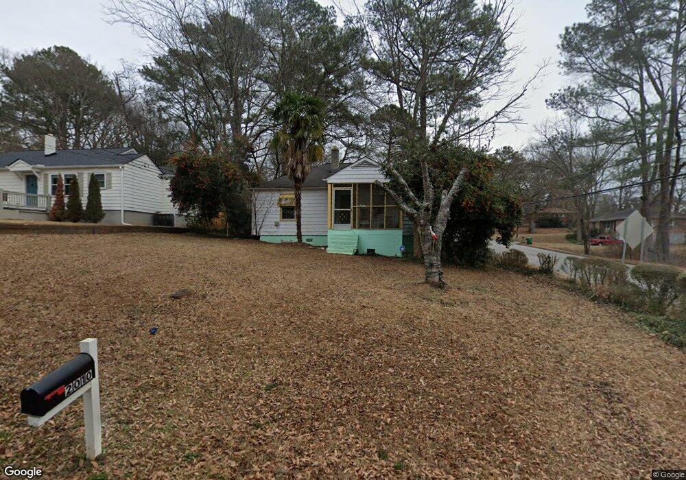
2010 Mcafee Place Decatur, GA 30032
East Lake NeighborhoodEstimated Value: $234,000 - $286,000
2
Beds
1
Bath
912
Sq Ft
$291/Sq Ft
Est. Value
About This Home
This home is located at 2010 Mcafee Place, Decatur, GA 30032 and is currently estimated at $265,268, approximately $290 per square foot. 2010 Mcafee Place is a home located in DeKalb County with nearby schools including McNair Middle School, McNair High School, and Charles Drew Charter School.
Create a Home Valuation Report for This Property
The Home Valuation Report is an in-depth analysis detailing your home's value as well as a comparison with similar homes in the area
Home Values in the Area
Average Home Value in this Area
Tax History Compared to Growth
Tax History
| Year | Tax Paid | Tax Assessment Tax Assessment Total Assessment is a certain percentage of the fair market value that is determined by local assessors to be the total taxable value of land and additions on the property. | Land | Improvement |
|---|---|---|---|---|
| 2025 | $2,508 | $90,800 | $60,440 | $30,360 |
| 2024 | $2,284 | $79,240 | $60,440 | $18,800 |
| 2023 | $2,284 | $82,200 | $60,440 | $21,760 |
| 2022 | $1,901 | $66,200 | $30,400 | $35,800 |
| 2021 | $1,905 | $66,360 | $30,400 | $35,960 |
| 2020 | $1,616 | $53,640 | $30,400 | $23,240 |
| 2019 | $1,440 | $46,480 | $2,920 | $43,560 |
| 2018 | $883 | $36,240 | $2,920 | $33,320 |
| 2017 | $1,135 | $33,320 | $2,920 | $30,400 |
| 2016 | $799 | $24,320 | $2,920 | $21,400 |
| 2014 | $423 | $13,120 | $1,840 | $11,280 |
Source: Public Records
Map
Nearby Homes
- 2006 Mcafee Place
- 2002 Mcafee Place
- 2002 Mcafee Place Unit 2002
- 2167 Mcafee Rd
- 1996 Mcafee Place
- 2149 Mcafee Rd
- 701 Parker Ave
- 693 Parker Ave
- 689 Parker Ave
- 2011 Mcafee Place
- 1990 Mcafee Place
- 2007 Mcafee Place
- 2007 Mcafee Place
- 2031 Rockhaven Dr
- 683 Parker Ave
- 2003 Mcafee Place
- 1997 Mcafee Place
- 1984 Mcafee Place
- 679 Parker Ave
- 2183 Mcafee Rd