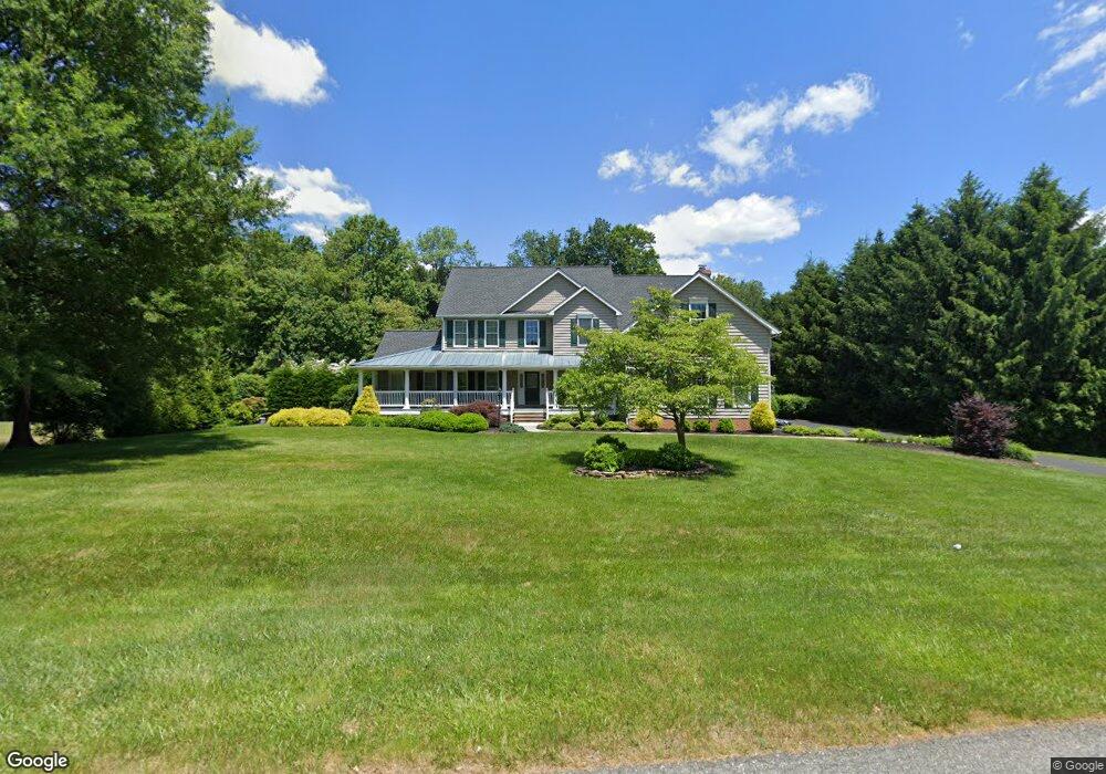
2010 Milldale Ct Fallston, MD 21047
Estimated Value: $801,000 - $1,019,000
--
Bed
4
Baths
4,179
Sq Ft
$224/Sq Ft
Est. Value
About This Home
This home is located at 2010 Milldale Ct, Fallston, MD 21047 and is currently estimated at $937,680, approximately $224 per square foot. 2010 Milldale Ct is a home located in Harford County with nearby schools including Youths Benefit Elementary School, Fallston Middle School, and Fallston High School.
Ownership History
Date
Name
Owned For
Owner Type
Purchase Details
Closed on
Jun 28, 2005
Sold by
Rider Harrison J
Bought by
Gill William N and Gill Bette L
Current Estimated Value
Home Financials for this Owner
Home Financials are based on the most recent Mortgage that was taken out on this home.
Original Mortgage
$150,000
Interest Rate
5.73%
Mortgage Type
New Conventional
Purchase Details
Closed on
Sep 10, 1996
Sold by
Deigert Ingeborg G
Bought by
Rider Harrison J and Rider Nancy J
Purchase Details
Closed on
Mar 5, 1996
Sold by
Deigert Joseph D
Bought by
Deigert Joseph D
Create a Home Valuation Report for This Property
The Home Valuation Report is an in-depth analysis detailing your home's value as well as a comparison with similar homes in the area
Home Values in the Area
Average Home Value in this Area
Purchase History
| Date | Buyer | Sale Price | Title Company |
|---|---|---|---|
| Gill William N | $600,000 | -- | |
| Rider Harrison J | $110,000 | -- | |
| Deigert Joseph D | -- | -- | |
| Deigert Joseph D | -- | -- |
Source: Public Records
Mortgage History
| Date | Status | Borrower | Loan Amount |
|---|---|---|---|
| Closed | Gill William N | $150,000 | |
| Closed | Rider Harrison J | -- |
Source: Public Records
Tax History Compared to Growth
Tax History
| Year | Tax Paid | Tax Assessment Tax Assessment Total Assessment is a certain percentage of the fair market value that is determined by local assessors to be the total taxable value of land and additions on the property. | Land | Improvement |
|---|---|---|---|---|
| 2025 | $8,096 | $791,700 | $177,800 | $613,900 |
| 2024 | $8,096 | $750,267 | $0 | $0 |
| 2023 | $7,334 | $708,833 | $0 | $0 |
| 2022 | $7,274 | $667,400 | $177,800 | $489,600 |
| 2021 | $7,424 | $652,767 | $0 | $0 |
| 2020 | $7,424 | $638,133 | $0 | $0 |
| 2019 | $7,255 | $623,500 | $177,800 | $445,700 |
| 2018 | $7,026 | $609,133 | $0 | $0 |
| 2017 | $6,862 | $623,500 | $0 | $0 |
| 2016 | -- | $580,400 | $0 | $0 |
| 2015 | $7,112 | $580,400 | $0 | $0 |
| 2014 | $7,112 | $580,400 | $0 | $0 |
Source: Public Records
Map
Nearby Homes
- 1105 Wild Orchid Dr
- 2208 Carrs Mill Rd
- 1315 Old Fallston Rd
- 1201 N Tollgate Rd
- 1602 Thornwood Ct
- 1217 Grafton Shop Rd
- 733 Reckord Rd
- 1605 Kiersten Ct
- 1205 Bear Hollow Ct
- 2509 Port Ln
- 2517 Port Ln
- 2511 Port Ln
- 700 Remington Rd
- 1004 Bogart Cir
- 903 Garland Ct
- 817 Peppard Dr
- Lot 5 Arden Dr
- 2208 Arden Dr
- 2011 Fallsgrove Way
- 2204 Arden Dr
- 2008 Milldale Ct
- 2009 Milldale Ct
- 2007 Milldale Ct
- 2011 Milldale Ct
- 2012 Milldale Ct
- 2006 Milldale Ct
- 2005 Milldale Ct
- 2013 Milldale Ct
- 1999 Milldale Ct
- 2004 Milldale Ct
- 2015 Milldale Ct
- 1130 Sturbridge Rd
- 2001 Brickhouse Ln
- 1128 Sturbridge Rd
- 1126 Sturbridge Rd
- 2002 Brickhouse Ln
- 2001 Carrs Mill Rd
- 2016 Milldale Ct
- 2016 Mill Dale Ct
- 1124 Sturbridge Rd