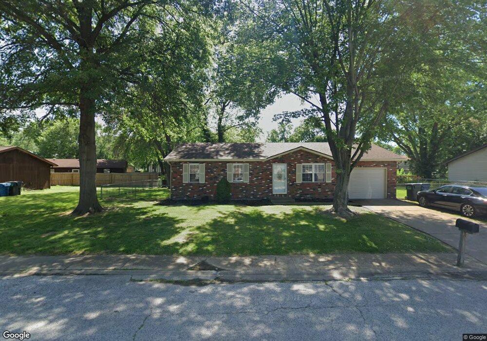
2010 Oak Tree Ln East Saint Louis, IL 62206
Estimated Value: $82,000 - $105,000
--
Bed
--
Bath
1,160
Sq Ft
$80/Sq Ft
Est. Value
About This Home
This home is located at 2010 Oak Tree Ln, East Saint Louis, IL 62206 and is currently estimated at $93,131, approximately $80 per square foot. 2010 Oak Tree Ln is a home located in St. Clair County.
Ownership History
Date
Name
Owned For
Owner Type
Purchase Details
Closed on
Sep 19, 2002
Sold by
Hud
Bought by
Stacks Deandre
Current Estimated Value
Home Financials for this Owner
Home Financials are based on the most recent Mortgage that was taken out on this home.
Original Mortgage
$45,592
Outstanding Balance
$19,268
Interest Rate
6.4%
Mortgage Type
FHA
Estimated Equity
$73,863
Purchase Details
Closed on
Jan 8, 2002
Sold by
Noblin Christopher L and Mortgage Electronic Registract
Bought by
Hud
Create a Home Valuation Report for This Property
The Home Valuation Report is an in-depth analysis detailing your home's value as well as a comparison with similar homes in the area
Home Values in the Area
Average Home Value in this Area
Purchase History
| Date | Buyer | Sale Price | Title Company |
|---|---|---|---|
| Stacks Deandre | $46,000 | -- | |
| Hud | -- | -- |
Source: Public Records
Mortgage History
| Date | Status | Borrower | Loan Amount |
|---|---|---|---|
| Open | Stacks Deandre | $45,592 |
Source: Public Records
Tax History Compared to Growth
Tax History
| Year | Tax Paid | Tax Assessment Tax Assessment Total Assessment is a certain percentage of the fair market value that is determined by local assessors to be the total taxable value of land and additions on the property. | Land | Improvement |
|---|---|---|---|---|
| 2024 | $1,573 | $14,268 | $1,387 | $12,881 |
| 2023 | $1,310 | $12,896 | $1,254 | $11,642 |
| 2022 | $1,052 | $11,302 | $1,099 | $10,203 |
| 2021 | $1,011 | $10,709 | $1,041 | $9,668 |
| 2020 | $1,215 | $11,218 | $1,090 | $10,128 |
| 2019 | $1,218 | $11,218 | $1,090 | $10,128 |
| 2018 | $1,232 | $11,382 | $1,106 | $10,276 |
| 2017 | $1,090 | $11,108 | $1,080 | $10,028 |
| 2016 | $1,096 | $10,969 | $1,076 | $9,893 |
| 2014 | $992 | $10,849 | $1,064 | $9,785 |
| 2013 | $2,158 | $10,176 | $998 | $9,178 |
Source: Public Records
Map
Nearby Homes
- 2013 Maple Tree Ln
- 1997 Oak Tree Ln
- 2014 Florence St
- 2 Margie Dr
- 2025 Sandy Ridge Rd
- 1713 Loretta Ave
- 2274 Carol St
- 2016 Lynn St
- 2005 Louise Ave
- 1505 Camp Jackson Rd
- 34 Marilyn Ln
- 1128 Saint Benedict Dr
- 17 Hanover Ln
- 30 Marilyn Ln
- 10 E Adams Dr
- 16 Helen Ct
- 22 Marilyn Ln
- 1426 Richard Dr
- 1106 Saint Boniface Dr
- 28 Louise Ln
- 2008 Oak Tree Ln
- 2011 Maple Tree Ln
- 2012 Oak Tree Ln
- 2009 Maple Tree Ln
- 2011 Oak Tree Ln
- 2009 Oak Tree Ln
- 2006 Oak Tree Ln
- 2013 Oak Tree Ln
- 2007 Maple Tree Ln
- 2007 Oak Tree Ln
- 2015 Maple Tree Ln
- 2015 Oak Tree Ln
- 2004 Oak Tree Ln
- 2005 Oak Tree Ln
- 2010 Maple Tree Ln
- 2014 Maple Tree Ln
- 2017 Oak Tree Ln
- 2008 Maple Tree Ln
- 2016 Maple Tree Ln