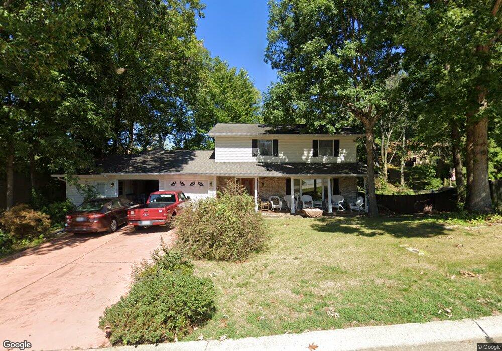
2010 Pamela Dr Cape Girardeau, MO 63701
Estimated Value: $292,000 - $373,000
3
Beds
3
Baths
2,441
Sq Ft
$137/Sq Ft
Est. Value
About This Home
This home is located at 2010 Pamela Dr, Cape Girardeau, MO 63701 and is currently estimated at $334,444, approximately $137 per square foot. 2010 Pamela Dr is a home with nearby schools including Alma Schrader Elementary School, Central Middle School, and Central Junior High School.
Ownership History
Date
Name
Owned For
Owner Type
Purchase Details
Closed on
Apr 25, 2019
Sold by
Fetherston Daniel P and Fetherston Paula Ann
Bought by
Fetherston Daniel P and Fetherston Qualified Spousal Trust
Current Estimated Value
Purchase Details
Closed on
Nov 15, 2013
Sold by
Fetherston Daniel P and Fetherston Paula Ann
Bought by
Fetherston Daniel P and Fetherston Paula Ann
Purchase Details
Closed on
Dec 15, 2006
Sold by
Schlosser Gary V and Schlosser Alice E
Bought by
Fetherston Daniel P and Gresham Paula Ann
Home Financials for this Owner
Home Financials are based on the most recent Mortgage that was taken out on this home.
Original Mortgage
$37,000
Interest Rate
6.27%
Mortgage Type
Stand Alone Second
Create a Home Valuation Report for This Property
The Home Valuation Report is an in-depth analysis detailing your home's value as well as a comparison with similar homes in the area
Home Values in the Area
Average Home Value in this Area
Purchase History
| Date | Buyer | Sale Price | Title Company |
|---|---|---|---|
| Fetherston Daniel P | -- | None Available | |
| Fetherston Daniel P | -- | -- | |
| Fetherston Daniel P | -- | None Available |
Source: Public Records
Mortgage History
| Date | Status | Borrower | Loan Amount |
|---|---|---|---|
| Previous Owner | Fetherston Daniel P | $37,000 | |
| Previous Owner | Fetherston Daniel P | $148,000 |
Source: Public Records
Tax History Compared to Growth
Tax History
| Year | Tax Paid | Tax Assessment Tax Assessment Total Assessment is a certain percentage of the fair market value that is determined by local assessors to be the total taxable value of land and additions on the property. | Land | Improvement |
|---|---|---|---|---|
| 2025 | $20 | $40,320 | $3,670 | $36,650 |
| 2024 | $20 | $38,400 | $3,490 | $34,910 |
| 2023 | $1,996 | $38,400 | $3,490 | $34,910 |
| 2022 | $1,840 | $35,390 | $3,220 | $32,170 |
| 2021 | $1,840 | $35,390 | $3,220 | $32,170 |
| 2020 | $1,845 | $35,390 | $3,220 | $32,170 |
| 2019 | $1,843 | $35,390 | $0 | $0 |
| 2018 | $1,839 | $35,390 | $0 | $0 |
| 2017 | $1,844 | $35,390 | $0 | $0 |
| 2016 | $1,836 | $35,390 | $0 | $0 |
| 2015 | $1,838 | $35,390 | $0 | $0 |
| 2014 | $1,847 | $35,390 | $0 | $0 |
Source: Public Records
Map
Nearby Homes
- 2528 Palomino Dr
- 2520 Horseshoe Ridge
- 2519 Horseshoe Ridge
- 2085 Derbyshire Ln
- 2415 Perryville Rd
- 2206 Derbyshire Ln
- 2137 Wood Hollow Ct
- 1705 Paul Revere Dr
- 2062 Concord Place
- 1960 Briarwood Dr
- 1938 Westwood Dr
- 1623 Lexington Ave
- 1910 Sherwood Dr
- 1608 Lexington Ave
- 2550 Marvin St
- 1912 Perryville Rd
- 2153 Esker Trail
- 2640 Walden Blvd
- 1577 Saratoga St
- 2224 Heywood Meadows