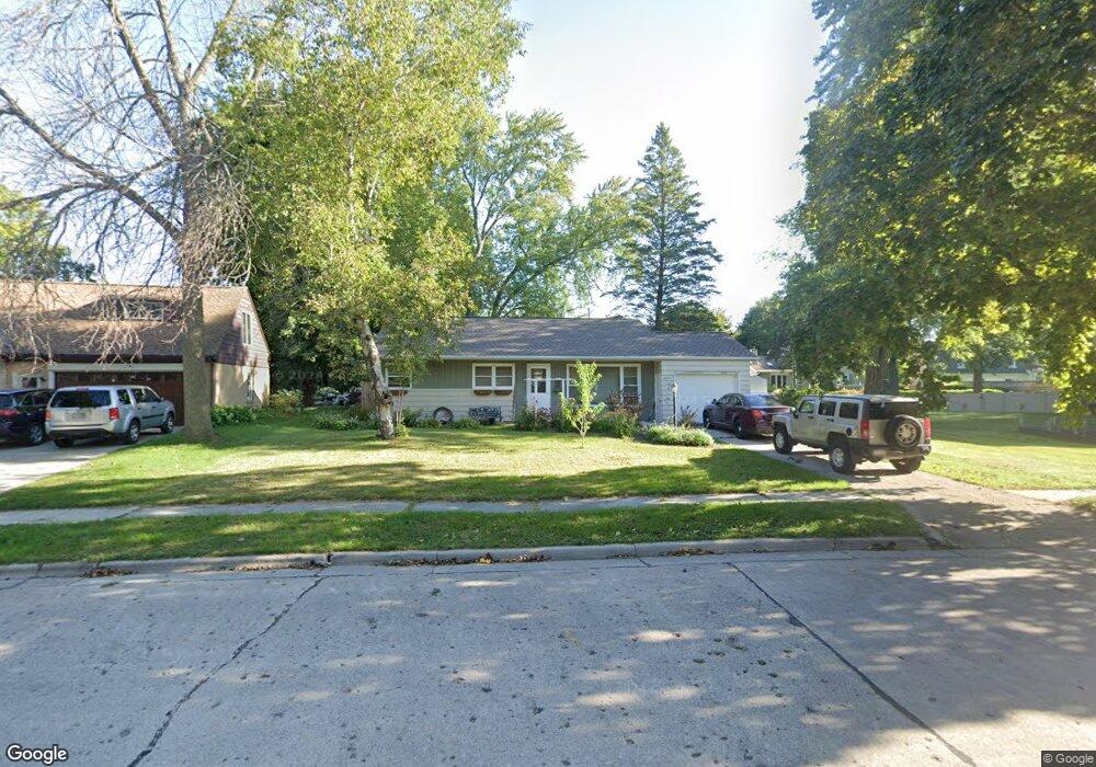
2010 Rheaume Rd Manitowoc, WI 54220
Estimated Value: $191,769 - $220,000
3
Beds
1
Bath
1,064
Sq Ft
$194/Sq Ft
Est. Value
About This Home
This home is located at 2010 Rheaume Rd, Manitowoc, WI 54220 and is currently estimated at $205,885, approximately $193 per square foot. 2010 Rheaume Rd is a home located in Manitowoc County with nearby schools including Jackson Elementary School, Wilson Middle School, and Lincoln High School.
Ownership History
Date
Name
Owned For
Owner Type
Purchase Details
Closed on
Apr 14, 2006
Sold by
Thome Todd C and Decker Sarah B
Bought by
Decker Barbara L and Decker Sarah B
Current Estimated Value
Home Financials for this Owner
Home Financials are based on the most recent Mortgage that was taken out on this home.
Original Mortgage
$5,012,036
Outstanding Balance
$2,900,152
Interest Rate
6.48%
Mortgage Type
New Conventional
Estimated Equity
-$2,694,267
Create a Home Valuation Report for This Property
The Home Valuation Report is an in-depth analysis detailing your home's value as well as a comparison with similar homes in the area
Home Values in the Area
Average Home Value in this Area
Purchase History
| Date | Buyer | Sale Price | Title Company |
|---|---|---|---|
| Decker Barbara L | $210,000 | None Available |
Source: Public Records
Mortgage History
| Date | Status | Borrower | Loan Amount |
|---|---|---|---|
| Open | Decker Barbara L | $5,012,036 |
Source: Public Records
Tax History Compared to Growth
Tax History
| Year | Tax Paid | Tax Assessment Tax Assessment Total Assessment is a certain percentage of the fair market value that is determined by local assessors to be the total taxable value of land and additions on the property. | Land | Improvement |
|---|---|---|---|---|
| 2024 | $2,348 | $135,600 | $20,400 | $115,200 |
| 2023 | $2,179 | $135,600 | $20,400 | $115,200 |
| 2022 | $1,880 | $99,200 | $20,400 | $78,800 |
| 2021 | $1,908 | $99,200 | $20,400 | $78,800 |
| 2020 | $1,961 | $94,700 | $20,400 | $74,300 |
| 2019 | $1,946 | $94,700 | $20,400 | $74,300 |
| 2018 | $1,902 | $94,700 | $20,400 | $74,300 |
| 2017 | $1,855 | $94,700 | $20,400 | $74,300 |
| 2016 | $1,929 | $94,700 | $20,400 | $74,300 |
| 2015 | $1,974 | $94,700 | $20,400 | $74,300 |
| 2014 | $1,924 | $94,700 | $20,400 | $74,300 |
| 2013 | $1,946 | $94,700 | $20,400 | $74,300 |
Source: Public Records
Map
Nearby Homes
- 1316 N 23rd St
- 1825 Waldo Blvd
- 1625 Atlanta Cir
- 1008 N 23rd St
- 1025 N 15th St
- 928 N 16th St
- 1414 Nagle Ave
- 1518 Torrison Dr
- 919 N 14th St
- 1101 Nagle Ave
- 1920 Ravenswood Ln
- 1922 Ravenswood Ln
- 1926 Ravenswood Ln
- 1928 Ravenswood Ln
- 1934 Ravenswood Ln
- 1936 Ravenswood Ln
- 1127 Tanglewood Rd
- 3718 Westwood Ln
- Lt99 N 18th St
- 840 Lincoln Blvd
- 2014 Rheaume Rd
- 2011 Granger Rd
- 2004 Rheaume Rd
- 1919 Granger Rd
- 2003 Granger Rd
- 2009 Rheaume Rd
- 2015 Rheaume Rd
- 2015 Granger Rd
- 1916 Markham St
- 1911 Granger Rd
- 2018 Rheaume Rd
- 2019 Rheaume Rd
- 2010 Markham St
- 2019 Granger Rd
- 1906 Markham St
- 2022 Rheaume Rd
- 2027 Rheaume Rd
- 2023 Rheaume Rd
- 2002 Granger Rd
- 2004 Granger Rd