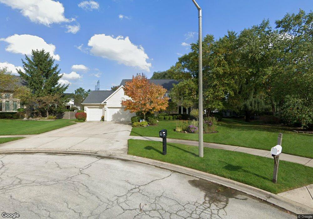
2010 Sheridan Ct Buffalo Grove, IL 60089
Rolling Hills NeighborhoodEstimated Value: $837,094 - $928,000
--
Bed
3
Baths
3,439
Sq Ft
$257/Sq Ft
Est. Value
About This Home
This home is located at 2010 Sheridan Ct, Buffalo Grove, IL 60089 and is currently estimated at $884,774, approximately $257 per square foot. 2010 Sheridan Ct is a home located in Lake County with nearby schools including Ivy Hall Elementary School, Twin Groves Middle School, and Adlai E Stevenson High School.
Ownership History
Date
Name
Owned For
Owner Type
Purchase Details
Closed on
Mar 3, 1995
Sold by
American National Bk & Tr Co Of Chicago
Bought by
Hollander Eugene K and Hollander Caryn J
Current Estimated Value
Home Financials for this Owner
Home Financials are based on the most recent Mortgage that was taken out on this home.
Original Mortgage
$160,000
Interest Rate
8.12%
Create a Home Valuation Report for This Property
The Home Valuation Report is an in-depth analysis detailing your home's value as well as a comparison with similar homes in the area
Home Values in the Area
Average Home Value in this Area
Purchase History
| Date | Buyer | Sale Price | Title Company |
|---|---|---|---|
| Hollander Eugene K | $338,500 | Chicago Title Insurance Co |
Source: Public Records
Mortgage History
| Date | Status | Borrower | Loan Amount |
|---|---|---|---|
| Closed | Hollander Eugene K | $160,000 |
Source: Public Records
Tax History Compared to Growth
Tax History
| Year | Tax Paid | Tax Assessment Tax Assessment Total Assessment is a certain percentage of the fair market value that is determined by local assessors to be the total taxable value of land and additions on the property. | Land | Improvement |
|---|---|---|---|---|
| 2024 | $19,449 | $221,594 | $49,673 | $171,921 |
| 2023 | $19,449 | $199,133 | $44,638 | $154,495 |
| 2022 | $18,317 | $185,383 | $41,556 | $143,827 |
| 2021 | $17,732 | $183,384 | $41,108 | $142,276 |
| 2020 | $19,178 | $202,377 | $41,248 | $161,129 |
| 2019 | $18,714 | $201,631 | $41,096 | $160,535 |
| 2018 | $18,684 | $206,703 | $44,675 | $162,028 |
| 2017 | $18,387 | $201,878 | $43,632 | $158,246 |
| 2016 | $17,734 | $201,744 | $41,781 | $159,963 |
| 2015 | $18,148 | $188,669 | $39,073 | $149,596 |
| 2014 | $18,425 | $188,441 | $41,965 | $146,476 |
| 2012 | $18,334 | $188,819 | $42,049 | $146,770 |
Source: Public Records
Map
Nearby Homes
- 1998 Sheridan Ct
- 1903 Sheridan Rd
- 1901 Brandywyn Ln
- 486 Satinwood Terrace Unit 11
- 5255 Danbury Ct
- 333 Didier Ct
- 5328 Oak Grove Dr
- 268 Hoffmann Dr
- 361 Hoffmann Dr
- 538 Lasalle Ct
- 361 Willow Pkwy Unit 234
- 259 Willow Pkwy Unit 403
- 327 Lasalle Ln
- 890 Knollwood Dr
- 2770 Sandalwood Rd Unit 3
- 2033 Olive Hill Dr
- 2071 Wright Blvd
- 896 Chaucer Way Unit 2
- 1265 Devonshire Rd
- 5107 N Arlington Heights Rd
- 2006 Sheridan Ct
- 2014 Sheridan Ct
- 1944 Beverly Ln
- 1954 Sheridan Rd
- 1948 Beverly Ln
- 1958 Sheridan Rd
- 1940 Beverly Ln
- 2002 Sheridan Ct
- 2018 Sheridan Ct
- 1952 Beverly Ln
- 1962 Sheridan Rd
- 2022 Sheridan Ct
- 790 Edgemere Rd
- 1936 Beverly Ln
- 800 Edgemere Rd
- 1966 Sheridan Rd
- 1949 Beverly Ln
- 2026 Sheridan Ct
- 1970 Sheridan Rd
- 1994 Sheridan Ct