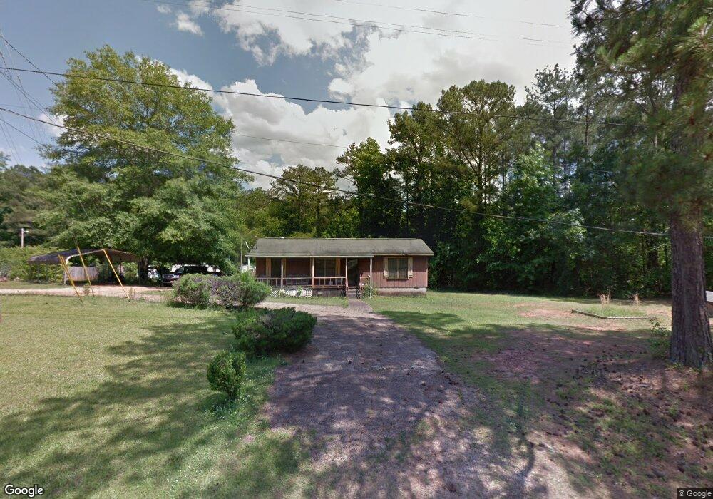
2010 Smokey Rd Newnan, GA 30263
Estimated Value: $158,926 - $245,000
3
Beds
2
Baths
1,104
Sq Ft
$178/Sq Ft
Est. Value
About This Home
This home is located at 2010 Smokey Rd, Newnan, GA 30263 and is currently estimated at $196,232, approximately $177 per square foot. 2010 Smokey Rd is a home located in Coweta County with nearby schools including Ruth Hill Elementary School, Smokey Road Middle School, and Newnan High School.
Ownership History
Date
Name
Owned For
Owner Type
Purchase Details
Closed on
Jan 17, 2019
Sold by
Ransby Daniel
Bought by
Cleveland Randy W
Current Estimated Value
Home Financials for this Owner
Home Financials are based on the most recent Mortgage that was taken out on this home.
Original Mortgage
$60,000
Interest Rate
4.6%
Mortgage Type
Commercial
Purchase Details
Closed on
Aug 7, 1975
Bought by
Ransby Daniel
Create a Home Valuation Report for This Property
The Home Valuation Report is an in-depth analysis detailing your home's value as well as a comparison with similar homes in the area
Home Values in the Area
Average Home Value in this Area
Purchase History
| Date | Buyer | Sale Price | Title Company |
|---|---|---|---|
| Cleveland Randy W | $53,000 | -- | |
| Ransby Daniel | $1,300 | -- |
Source: Public Records
Mortgage History
| Date | Status | Borrower | Loan Amount |
|---|---|---|---|
| Closed | Cleveland Randy W | $60,000 |
Source: Public Records
Tax History Compared to Growth
Tax History
| Year | Tax Paid | Tax Assessment Tax Assessment Total Assessment is a certain percentage of the fair market value that is determined by local assessors to be the total taxable value of land and additions on the property. | Land | Improvement |
|---|---|---|---|---|
| 2025 | $1,033 | $43,729 | $6,970 | $36,759 |
| 2024 | $1,010 | $43,508 | $6,970 | $36,538 |
| 2023 | $1,010 | $46,586 | $9,494 | $37,092 |
| 2022 | $848 | $34,435 | $5,425 | $29,010 |
| 2021 | $789 | $29,958 | $5,167 | $24,791 |
| 2020 | $562 | $21,200 | $3,655 | $17,545 |
| 2019 | $209 | $29,217 | $8,276 | $20,941 |
| 2018 | $211 | $29,217 | $8,276 | $20,941 |
| 2017 | $210 | $29,217 | $8,276 | $20,941 |
| 2016 | $204 | $29,217 | $8,276 | $20,941 |
| 2015 | $700 | $29,217 | $8,276 | $20,941 |
| 2014 | $698 | $29,217 | $8,276 | $20,941 |
Source: Public Records
Map
Nearby Homes
- 0 Old Smokey Rd
- 0 George Arnold Rd Unit 7657652
- 1861 Smokey Rd
- 1845 Smokey Rd
- 15 Forest Place
- 831 Holbrook Rd
- 56 Fox Hollow Run
- 1109 Old Corinth Rd
- 0 Emery Nell Ln Unit 10624673
- 0 Alston Point Unit LOT 410/411
- 15 Dixon Rd
- 191 Hearthstone Dr S
- 21 Sunset Ridge Way
- 130 Mallard Dr
- 50 Hearthstone Dr
- 50 Hearthstone Dr E
- 0 Ga Hwy 34 W Unit 21 10564723
- 140 Beverly Park Ct
- 19 Quimby Jackson Rd
- 83 Derring Cir
- 1986 Smokey Rd
- 2016 Smokey Rd Unit Lot 3
- 1993 Smokey Rd
- 2011 Smokey Rd
- 1970 Smokey Rd
- 2017 Smokey Rd
- 1934 Smokey Rd
- 2066 Smokey Rd
- 2066 Smokey Rd Unit Lot 1
- 17 George Arnold Rd
- 2086 Smokey Rd
- 2086 Smokey Rd Unit Lot 2
- 0 George Arnold Rd Unit 7041348
- 34 George Arnold Rd
- 1906 Smokey Rd
- 136 Wild Boar Way Unit 30
- 43 George Arnold Rd
- 1969 Smokey Rd
- 68 George Arnold Rd
- 1902 Smokey Rd