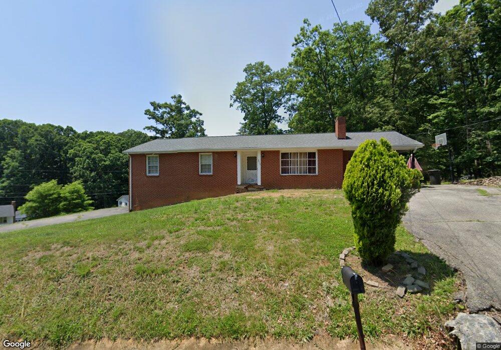
2010 Sourwood St Roanoke, VA 24012
Estimated Value: $300,440 - $341,000
3
Beds
2
Baths
1,258
Sq Ft
$257/Sq Ft
Est. Value
About This Home
This home is located at 2010 Sourwood St, Roanoke, VA 24012 and is currently estimated at $322,860, approximately $256 per square foot. 2010 Sourwood St is a home located in Roanoke County with nearby schools including Bonsack Elementary School, William Byrd Middle School, and William Byrd High School.
Ownership History
Date
Name
Owned For
Owner Type
Purchase Details
Closed on
Aug 31, 2006
Sold by
Frisbie George R
Bought by
Sinani Bari and Sinani Elizabeth
Current Estimated Value
Home Financials for this Owner
Home Financials are based on the most recent Mortgage that was taken out on this home.
Original Mortgage
$131,950
Outstanding Balance
$79,930
Interest Rate
6.83%
Mortgage Type
New Conventional
Estimated Equity
$242,931
Create a Home Valuation Report for This Property
The Home Valuation Report is an in-depth analysis detailing your home's value as well as a comparison with similar homes in the area
Home Values in the Area
Average Home Value in this Area
Purchase History
| Date | Buyer | Sale Price | Title Company |
|---|---|---|---|
| Sinani Bari | $164,950 | None Available |
Source: Public Records
Mortgage History
| Date | Status | Borrower | Loan Amount |
|---|---|---|---|
| Open | Sinani Bari | $131,950 |
Source: Public Records
Tax History Compared to Growth
Tax History
| Year | Tax Paid | Tax Assessment Tax Assessment Total Assessment is a certain percentage of the fair market value that is determined by local assessors to be the total taxable value of land and additions on the property. | Land | Improvement |
|---|---|---|---|---|
| 2025 | $2,551 | $247,700 | $52,000 | $195,700 |
| 2024 | $2,519 | $242,200 | $52,000 | $190,200 |
| 2023 | $2,352 | $221,900 | $52,000 | $169,900 |
| 2022 | $2,074 | $190,300 | $46,000 | $144,300 |
| 2021 | $1,922 | $176,300 | $41,800 | $134,500 |
| 2020 | $1,858 | $170,500 | $37,100 | $133,400 |
| 2019 | $1,846 | $169,400 | $35,200 | $134,200 |
| 2018 | $1,792 | $165,700 | $34,200 | $131,500 |
| 2017 | $1,792 | $164,400 | $34,200 | $130,200 |
| 2016 | $1,793 | $164,500 | $34,200 | $130,300 |
| 2015 | $1,794 | $164,600 | $34,200 | $130,400 |
| 2014 | $1,795 | $164,700 | $34,200 | $130,500 |
Source: Public Records
Map
Nearby Homes
- 2020 Ruritan Rd
- 1971 W Ruritan Rd
- 2054 Ruritan Rd
- 1944 W Ruritan Rd
- 2402 Coachman Dr
- 2206 Coachman Dr
- 1802 W Ruritan Rd
- 4964 Pine Glen Rd NE
- 2826 Greggin Dr
- 2414 Carlsbad Cir
- 0 E Ruritan Rd
- 4751 Player Dr NE
- 1713 Ashbury Ct
- 2912 Golden Ivy Dr
- 6110 Wisteria Place Ct
- 4760 Old Mountain Rd NE
- 4127 Mockingbird Hill Rd
- 4902 Old Mountain Rd NE
- 4015 Mockingbird Hill Rd
- 1525 W Ruritan Rd
- 2049 Denise Cir
- 2036 Denise Cir NE
- 2021 Sourwood St
- 2023 Denise Cir
- 2044 Denise Cir
- 2059 Denise Cir
- 2050 Denise Cir
- 2028 Denise Cir
- 2060 Denise Cir
- 2106 Wesvan Dr
- 2015 Denise Cir
- 2020 Denise Cir
- 2116 Wesvan Dr
- 2068 Wesvan Dr
- 2067 Denise Cir
- 2068 Denise Cir
- 2012 Denise Cir
- 2060 Wesvan Dr
- 2132 Wesvan Dr
- 2005 Denise Cir