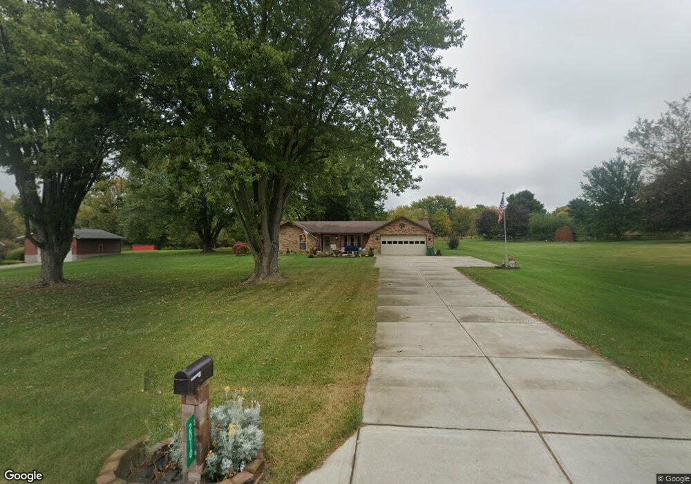
2010 Sundance St Springfield, OH 45502
Estimated Value: $280,000 - $326,000
3
Beds
2
Baths
1,440
Sq Ft
$212/Sq Ft
Est. Value
About This Home
This home is located at 2010 Sundance St, Springfield, OH 45502 and is currently estimated at $305,934, approximately $212 per square foot. 2010 Sundance St is a home located in Clark County with nearby schools including Greenon Elementary School, Greenon Jr. High School, and Greenon High School.
Ownership History
Date
Name
Owned For
Owner Type
Purchase Details
Closed on
Oct 17, 2016
Sold by
Swingle Earl D and Swingle Diane M
Bought by
Gardone Michael G
Current Estimated Value
Home Financials for this Owner
Home Financials are based on the most recent Mortgage that was taken out on this home.
Original Mortgage
$185,940
Outstanding Balance
$149,255
Interest Rate
3.5%
Mortgage Type
VA
Estimated Equity
$156,679
Purchase Details
Closed on
Jun 1, 2007
Sold by
Pierson Oren R and Pierson Deborah A
Bought by
Swingle Earl D and Swingle Diane M
Home Financials for this Owner
Home Financials are based on the most recent Mortgage that was taken out on this home.
Original Mortgage
$78,000
Interest Rate
6.2%
Mortgage Type
Purchase Money Mortgage
Purchase Details
Closed on
Sep 1, 1983
Sold by
Mitchell Robert L and Mitchell Grace L
Bought by
Pierson Oren R and Pierson Deborah A
Create a Home Valuation Report for This Property
The Home Valuation Report is an in-depth analysis detailing your home's value as well as a comparison with similar homes in the area
Home Values in the Area
Average Home Value in this Area
Purchase History
| Date | Buyer | Sale Price | Title Company |
|---|---|---|---|
| Gardone Michael G | $180,000 | Landmark Title Agency South | |
| Swingle Earl D | $175,900 | Signature 1St Title Agency I | |
| Pierson Oren R | $76,900 | -- |
Source: Public Records
Mortgage History
| Date | Status | Borrower | Loan Amount |
|---|---|---|---|
| Open | Gardone Michael G | $185,940 | |
| Previous Owner | Swingle Earl D | $78,000 |
Source: Public Records
Tax History Compared to Growth
Tax History
| Year | Tax Paid | Tax Assessment Tax Assessment Total Assessment is a certain percentage of the fair market value that is determined by local assessors to be the total taxable value of land and additions on the property. | Land | Improvement |
|---|---|---|---|---|
| 2024 | $3,959 | $76,950 | $17,960 | $58,990 |
| 2023 | $3,959 | $75,670 | $17,960 | $57,710 |
| 2022 | $3,955 | $75,670 | $17,960 | $57,710 |
| 2021 | $3,425 | $58,000 | $13,920 | $44,080 |
| 2020 | $3,434 | $58,000 | $13,920 | $44,080 |
| 2019 | $3,481 | $58,000 | $13,920 | $44,080 |
| 2018 | $2,819 | $46,010 | $13,510 | $32,500 |
| 2017 | $2,826 | $49,708 | $13,507 | $36,201 |
| 2016 | $1,994 | $49,708 | $13,507 | $36,201 |
| 2015 | $2,044 | $50,124 | $13,923 | $36,201 |
| 2014 | $2,048 | $50,124 | $13,923 | $36,201 |
| 2013 | $1,802 | $50,124 | $13,923 | $36,201 |
Source: Public Records
Map
Nearby Homes
- 4311 Lone Wolf Ave
- 4341 Lone Wolf Ave
- 1810 Old Mill Rd
- 1616 Crest Dr
- 2600 Brookdale Dr
- 5177 Outerview Dr
- 5520 Old Lower Valley Park
- 3161 Dayton Springfield Rd
- 3161 Dayton Rd
- 3072 Fowler Rd
- 1290 Red Oaks Cir
- 3587 Lower Valley Pike
- 3000 Rebert Pike
- 5095 W National Rd
- 5540 Broadway Rd
- 68 Skyline Dr
- 124 Old Mill Rd
- 3721 W National Rd
- 245 Gordon Rd
- 5822 Broadway Rd
- 2002 Sundance St
- 2018 Sundance St
- 2026 Sundance Dr
- 2026 Sundance St
- 2001 Sundance St
- 2009 Sundance St
- 2015 Sundance St
- 2023 Sundance St
- 2034 Sundance St
- 4303 Dayton Springfield Rd
- 4392 Dayton Springfield Rd
- 4435 Dayton Springfield Rd
- 2039 Sundance St
- 2031 Broken Trail Dr
- 4308 Dayton Springfield Rd
- 4290 Dayton Springfield Rd
- 2042 Sundance St
- 2040 Broken Trail Dr
- 4278 Dayton Springfield Rd Unit 4282
- 2037 Broken Trail Dr