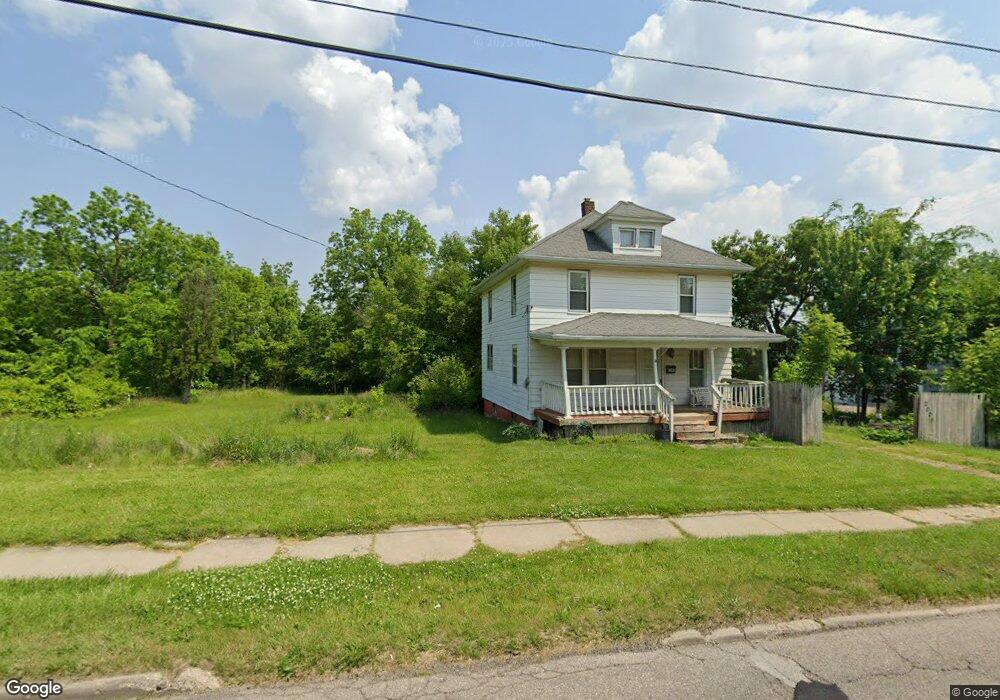
2010 W Court St Flint, MI 48503
Southwest Flint NeighborhoodEstimated Value: $48,000 - $102,000
2
Beds
1
Bath
888
Sq Ft
$84/Sq Ft
Est. Value
About This Home
This home is located at 2010 W Court St, Flint, MI 48503 and is currently estimated at $75,000, approximately $84 per square foot. 2010 W Court St is a home located in Genesee County with nearby schools including Eisenhower School, St. Paul Lutheran School, and St John Vianney Catholic School.
Ownership History
Date
Name
Owned For
Owner Type
Purchase Details
Closed on
Dec 20, 2012
Sold by
Cherry Deborah L
Bought by
Genesee County Land Bank
Current Estimated Value
Purchase Details
Closed on
Jul 8, 2010
Sold by
Arrand Brittany M
Bought by
Vice James R and Arrand Jack D
Purchase Details
Closed on
Sep 12, 2008
Sold by
Arrand Jack and Arrand Jennifer
Bought by
Arrand Brittany M
Home Financials for this Owner
Home Financials are based on the most recent Mortgage that was taken out on this home.
Original Mortgage
$5,000
Interest Rate
6.54%
Mortgage Type
Seller Take Back
Purchase Details
Closed on
Sep 21, 2007
Sold by
Webb Jeffrey P
Bought by
Mortgage Electronic Registration Systems
Purchase Details
Closed on
Jul 11, 2007
Sold by
Mortgage Electronic Registration Systems
Bought by
Bank Of New York and Cwabs 2005-06
Create a Home Valuation Report for This Property
The Home Valuation Report is an in-depth analysis detailing your home's value as well as a comparison with similar homes in the area
Home Values in the Area
Average Home Value in this Area
Purchase History
| Date | Buyer | Sale Price | Title Company |
|---|---|---|---|
| Genesee County Land Bank | -- | None Available | |
| Vice James R | $3,400 | Cislo Title Company | |
| Arrand Brittany M | $5,000 | Sargents Title Company | |
| Mortgage Electronic Registration Systems | $20,982 | None Available | |
| Bank Of New York | -- | None Available |
Source: Public Records
Mortgage History
| Date | Status | Borrower | Loan Amount |
|---|---|---|---|
| Previous Owner | Arrand Brittany M | $5,000 |
Source: Public Records
Tax History Compared to Growth
Tax History
| Year | Tax Paid | Tax Assessment Tax Assessment Total Assessment is a certain percentage of the fair market value that is determined by local assessors to be the total taxable value of land and additions on the property. | Land | Improvement |
|---|---|---|---|---|
| 2025 | -- | $0 | $0 | $0 |
| 2024 | -- | $0 | $0 | $0 |
| 2023 | -- | $0 | $0 | $0 |
| 2022 | $0 | $0 | $0 | $0 |
| 2021 | $0 | $0 | $0 | $0 |
| 2020 | $0 | $0 | $0 | $0 |
| 2019 | $0 | $0 | $0 | $0 |
| 2018 | $0 | $0 | $0 | $0 |
| 2017 | $0 | $0 | $0 | $0 |
| 2016 | $0 | $0 | $0 | $0 |
| 2015 | -- | $0 | $0 | $0 |
| 2014 | -- | $0 | $0 | $0 |
| 2012 | -- | $7,400 | $0 | $0 |
Source: Public Records
Map
Nearby Homes
- 1926 W Court St
- 2124 Swayze St
- 1202 Pershing St
- 2437 Zimmerman St
- 1412 Durand St
- 1402 Woodcroft Ave
- 2464 Gibson St
- 2008 University Ave
- 2429 Brown St
- 2509 Corunna Rd
- 2433 Brown St
- 1505 Downey St
- 1506 Downey St
- 2537 Swayze St
- 1810 Chelsea Cir
- 1820 Chelsea Cir
- 1006 Hammond Ave
- 2663 W Court St
- 2618 Brown St
- 2608 Cumings Ave
- 2006 W Court St
- 2020 W Court St
- 2009 Beckwith Ct
- 2005 Beckwith Ct
- 2001 Beckwith Ct
- 1936 W Court St
- 2011 W Court St
- 2015 W Court St
- 2014 Beckwith Ct
- 2018 Beckwith Ct
- 2006 Beckwith Ct
- 2022 Beckwith Ct
- 2002 Beckwith Ct
- 2026 Beckwith Ct
- 2101 W Court St
- 1926 Corunna Rd
- 1933 W Court St
- 917 Durand St
- 2118 W Court St
- 908 Durand St