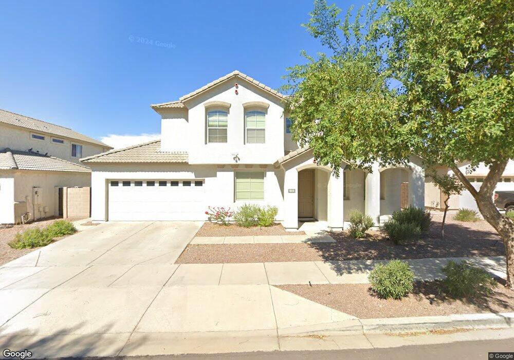
2010 W Darrel Rd Phoenix, AZ 85041
South Mountain NeighborhoodEstimated Value: $440,918 - $541,000
Studio
3
Baths
2,864
Sq Ft
$168/Sq Ft
Est. Value
About This Home
This home is located at 2010 W Darrel Rd, Phoenix, AZ 85041 and is currently estimated at $479,980, approximately $167 per square foot. 2010 W Darrel Rd is a home located in Maricopa County with nearby schools including Ed & Verma Pastor Elementary School, Cesar Chavez High School, and Phoenix Coding Academy.
Ownership History
Date
Name
Owned For
Owner Type
Purchase Details
Closed on
May 30, 2006
Sold by
Noor Hafiz
Bought by
Sarsour Ismail and Sarsour Iman
Current Estimated Value
Purchase Details
Closed on
Dec 8, 2005
Sold by
Noor Sharifa
Bought by
Noor Hafiz
Home Financials for this Owner
Home Financials are based on the most recent Mortgage that was taken out on this home.
Original Mortgage
$268,544
Interest Rate
7.25%
Mortgage Type
Fannie Mae Freddie Mac
Create a Home Valuation Report for This Property
The Home Valuation Report is an in-depth analysis detailing your home's value as well as a comparison with similar homes in the area
Home Values in the Area
Average Home Value in this Area
Purchase History
| Date | Buyer | Sale Price | Title Company |
|---|---|---|---|
| Sarsour Ismail | $333,000 | Title Partners Of Phoenix Ll | |
| Noor Hafiz | -- | Lawyers Title Ins | |
| Noor Hafiz | $268,544 | Lawyers Title Ins | |
| K Hovnanian Great Western Homes Llc | $119,827 | Lawyers Title Ins |
Source: Public Records
Mortgage History
| Date | Status | Borrower | Loan Amount |
|---|---|---|---|
| Previous Owner | K Hovnanian Great Western Homes Llc | $268,544 |
Source: Public Records
Tax History
| Year | Tax Paid | Tax Assessment Tax Assessment Total Assessment is a certain percentage of the fair market value that is determined by local assessors to be the total taxable value of land and additions on the property. | Land | Improvement |
|---|---|---|---|---|
| 2025 | $2,393 | $17,704 | -- | -- |
| 2024 | $2,261 | $16,861 | -- | -- |
| 2023 | $2,261 | $33,600 | $6,720 | $26,880 |
| 2022 | $2,214 | $25,420 | $5,080 | $20,340 |
| 2021 | $2,283 | $24,070 | $4,810 | $19,260 |
| 2020 | $2,254 | $21,970 | $4,390 | $17,580 |
| 2019 | $2,178 | $20,250 | $4,050 | $16,200 |
| 2018 | $2,116 | $19,510 | $3,900 | $15,610 |
| 2017 | $1,972 | $17,130 | $3,420 | $13,710 |
| 2016 | $1,871 | $15,920 | $3,180 | $12,740 |
| 2015 | $1,738 | $15,170 | $3,030 | $12,140 |
Source: Public Records
Map
Nearby Homes
- 2202 W Carter Rd
- 1802 W Carter Rd
- 2224 W Minton St
- 6610 S 22nd Dr
- 1824 W Lydia Ln
- 6409 S 22nd Ave
- 1925 W Burgess Ln
- 7413 S 22nd Ave
- 1917 W Burgess Ln
- 7014 S 17th Ave
- 2323 W Carson Rd
- 6611 S 17th Ave
- 1838 W Alta Vista Rd
- 7331 S 23rd Dr
- 1550 W Saint Kateri Dr
- 1635 W Dunbar Dr
- 6216 S 16th Ln
- 1822 W Lynne Ln
- 2421 W Ellis St
- 2521 W Darrel Rd
- 2006 W Darrel Rd
- 2014 W Darrel Rd
- 2011 W Vineyard Rd
- 2002 W Darrel Rd
- 2015 W Vineyard Rd
- 2007 W Vineyard Rd
- 2009 W Darrel Rd
- 2013 W Darrel Rd
- 2005 W Darrel Rd
- 2003 W Vineyard Rd
- 2020 W Darrel Rd
- 6818 S 19th Ln
- 6822 S 19th Ln
- 6814 S 19th Ln
- 2019 W Darrel Rd
- 6904 S 19th Ln
- 2008 W Maldonado Rd
- 2012 W Maldonado Rd
- 2004 W Maldonado Rd
- 2023 W Darrel Rd
Your Personal Tour Guide
Ask me questions while you tour the home.