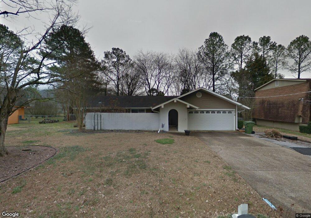
2010 Woodmore Dr SE Huntsville, AL 35803
Weatherly Heights NeighborhoodEstimated Value: $259,998 - $306,000
--
Bed
--
Bath
1,588
Sq Ft
$182/Sq Ft
Est. Value
About This Home
This home is located at 2010 Woodmore Dr SE, Huntsville, AL 35803 and is currently estimated at $289,000, approximately $181 per square foot. 2010 Woodmore Dr SE is a home located in Madison County with nearby schools including Weatherly Heights Elementary School, Mt. Gap Middle School, and Virgil Grissom High School.
Ownership History
Date
Name
Owned For
Owner Type
Purchase Details
Closed on
Jul 1, 2023
Sold by
Terrell Wesley Eugene and Terrell Sonyia Nicole
Bought by
Terrell Sonyia Nicole
Current Estimated Value
Purchase Details
Closed on
Jun 1, 2010
Sold by
Davis Keith E and Terrell Sonyia N
Bought by
Terrell Wesley E and Terrell Sonyia N
Home Financials for this Owner
Home Financials are based on the most recent Mortgage that was taken out on this home.
Original Mortgage
$117,600
Interest Rate
4.61%
Mortgage Type
New Conventional
Create a Home Valuation Report for This Property
The Home Valuation Report is an in-depth analysis detailing your home's value as well as a comparison with similar homes in the area
Home Values in the Area
Average Home Value in this Area
Purchase History
| Date | Buyer | Sale Price | Title Company |
|---|---|---|---|
| Terrell Sonyia Nicole | -- | None Listed On Document | |
| Terrell Sonyia Nicole | -- | None Listed On Document | |
| Terrell Wesley E | -- | -- |
Source: Public Records
Mortgage History
| Date | Status | Borrower | Loan Amount |
|---|---|---|---|
| Previous Owner | Terrell Wesley E | $117,600 |
Source: Public Records
Tax History Compared to Growth
Tax History
| Year | Tax Paid | Tax Assessment Tax Assessment Total Assessment is a certain percentage of the fair market value that is determined by local assessors to be the total taxable value of land and additions on the property. | Land | Improvement |
|---|---|---|---|---|
| 2024 | $1,052 | $18,360 | $2,780 | $15,580 |
| 2023 | $1,017 | $17,200 | $2,780 | $14,420 |
| 2022 | $939 | $17,020 | $2,780 | $14,240 |
| 2021 | $742 | $13,620 | $1,580 | $12,040 |
| 2020 | $727 | $13,350 | $1,580 | $11,770 |
| 2019 | $706 | $12,990 | $1,580 | $11,410 |
| 2018 | $700 | $12,900 | $0 | $0 |
| 2017 | $700 | $12,900 | $0 | $0 |
| 2016 | $700 | $12,900 | $0 | $0 |
| 2015 | $700 | $12,900 | $0 | $0 |
| 2014 | $701 | $12,920 | $0 | $0 |
Source: Public Records
Map
Nearby Homes
- 10012 Allison Dr SE
- 1904 Willow Park Ct SE
- 9410 Valley Ln SE
- 2011 Weatherly Rd SE
- 10141 Dunbarton Dr SE
- 10202 Melanie Dr SE
- 2509 Box Canyon Rd SE
- 9408 Danese Ln SE
- 10209 Plantation Dr SE
- 9628 Waldrop Dr SE
- 1901 Waxleaf Green SE
- 8035 Navios Dr SE
- 1506 Ravenwood Cir SE
- 8021 Navios Dr SE
- 9046 Sugar Tree Trail SE
- 10003 Meredith Ln SE
- 9608 Waldrop Dr SE
- 9408 Ojay Dr SE
- 8833 Tacoma Trail SE
- 1905 W Tuliptree Dr SE
- 2008 Woodmore Dr SE
- 2012 Woodmore Dr SE
- 2011 Wrenwood Dr SE
- 2014 Woodmore Dr SE
- 2013 Wrenwood Dr SE
- 2011 Woodmore Dr SE
- 2009 Wrenwood Dr SE
- 2006 Woodmore Dr SE
- 2009 Woodmore Dr SE
- 2015 Wrenwood Dr SE
- 2007 Wrenwood Dr SE
- 2015 Woodmore Dr SE
- 2007 Woodmore Dr SE
- 2004 Woodmore Dr SE
- 2016 Woodmore Dr SE
- 2017 Wrenwood Dr SE
- 2017 Woodmore Dr SE
- 2005 Wrenwood Dr SE
- 2005 Woodmore Dr SE
- 2010 Aftonbrae Dr SE