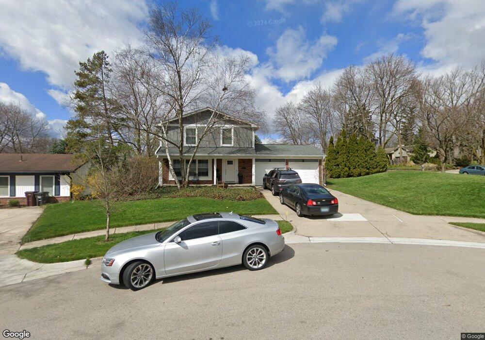
2010 Yeoman Ct Ann Arbor, MI 48103
Estimated Value: $484,000 - $563,000
--
Bed
1
Bath
1,728
Sq Ft
$304/Sq Ft
Est. Value
About This Home
This home is located at 2010 Yeoman Ct, Ann Arbor, MI 48103 and is currently estimated at $524,476, approximately $303 per square foot. 2010 Yeoman Ct is a home located in Washtenaw County with nearby schools including Lawton Elementary School, Slauson Middle School, and Pioneer High School.
Ownership History
Date
Name
Owned For
Owner Type
Purchase Details
Closed on
Nov 2, 1999
Sold by
Glasser Daniel A
Bought by
Churchill Brett
Current Estimated Value
Purchase Details
Closed on
Mar 27, 1996
Sold by
Bery Susheel
Bought by
Glasser Daniel A
Home Financials for this Owner
Home Financials are based on the most recent Mortgage that was taken out on this home.
Original Mortgage
$120,000
Interest Rate
7.36%
Mortgage Type
New Conventional
Create a Home Valuation Report for This Property
The Home Valuation Report is an in-depth analysis detailing your home's value as well as a comparison with similar homes in the area
Home Values in the Area
Average Home Value in this Area
Purchase History
| Date | Buyer | Sale Price | Title Company |
|---|---|---|---|
| Churchill Brett | $179,900 | -- | |
| Glasser Daniel A | $150,000 | -- |
Source: Public Records
Mortgage History
| Date | Status | Borrower | Loan Amount |
|---|---|---|---|
| Previous Owner | Glasser Daniel A | $120,000 |
Source: Public Records
Tax History Compared to Growth
Tax History
| Year | Tax Paid | Tax Assessment Tax Assessment Total Assessment is a certain percentage of the fair market value that is determined by local assessors to be the total taxable value of land and additions on the property. | Land | Improvement |
|---|---|---|---|---|
| 2025 | $6,318 | $229,800 | $0 | $0 |
| 2024 | $6,162 | $208,500 | $0 | $0 |
| 2023 | $5,682 | $207,900 | $0 | $0 |
| 2022 | $6,192 | $192,500 | $0 | $0 |
| 2021 | $6,046 | $182,800 | $0 | $0 |
| 2020 | $5,924 | $170,000 | $0 | $0 |
| 2019 | $5,637 | $156,100 | $156,100 | $0 |
| 2018 | $5,558 | $148,600 | $0 | $0 |
| 2017 | $5,407 | $144,200 | $0 | $0 |
| 2016 | $4,605 | $108,118 | $0 | $0 |
| 2015 | $4,968 | $107,795 | $0 | $0 |
| 2014 | $4,968 | $104,428 | $0 | $0 |
| 2013 | -- | $104,428 | $0 | $0 |
Source: Public Records
Map
Nearby Homes
- 2225 Steeplechase Dr
- 1720 Avondale Ave
- 2460 Mershon Dr
- 1540 Westfield Ave
- 1524 Marian Ave
- 2127 Pauline Ct
- 2155 Pauline Ct
- 1929 Harley Dr
- 1599 Scio Ridge Rd
- 2126 Pauline Blvd Unit 104
- 2124 Pauline Blvd Unit 307
- 2120 Pauline Blvd Unit 305
- 2225 Chaucer Dr
- 1265 S Maple Rd Unit 207
- 1225 S Maple Rd Unit 307
- 1235 S Maple Rd Unit 101
- 1235 S Maple Rd Unit 302
- 2130 Park Dr Unit 1
- Lincoln Plan at Townes on the Green
- Willow Plan at Townes on the Green
- 2020 Yeoman Ct
- 2030 Yeoman Ct
- 2005 Rugby Ct
- 2015 Yeoman Ct
- 1912 Old Pear Tree Ct
- 2025 Rugby Ct
- 2005 Yeoman Ct
- 1913 Old Pear Tree Ct
- 1900 Scio Church Rd
- 2040 Yeoman Ct
- 2025 Yeoman Ct
- 1950 Scio Church Rd
- 2020 Rugby Ct
- 2035 Rugby Ct
- 1909 Old Pear Tree Ct
- 2020 Scio Church Rd
- 1906 Dogwood Ct
- 2035 Yeoman Ct
- 2010 Rugby Ct
- 1902 Dogwood Ct