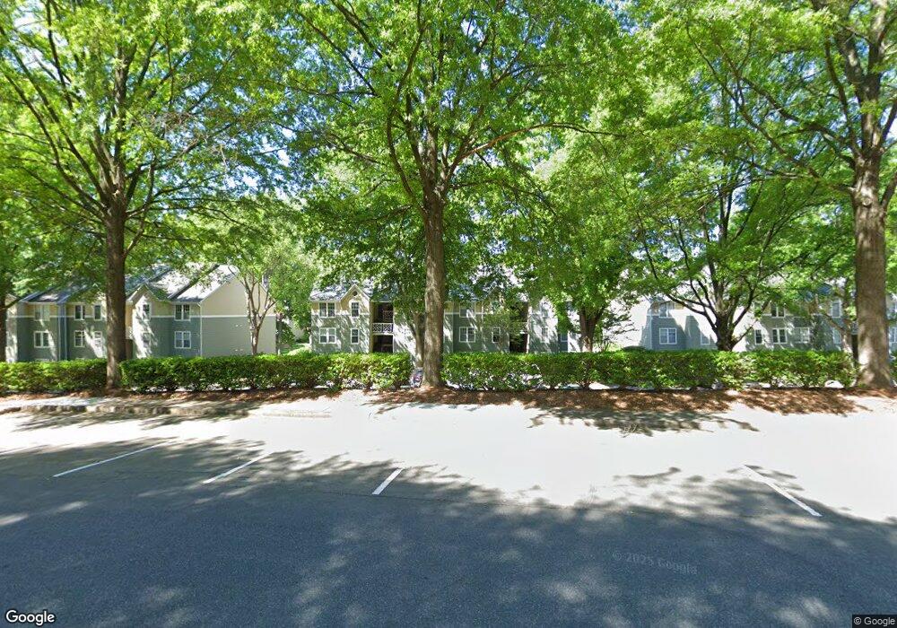
20105 Henderson Rd Unit G Cornelius, NC 28031
Estimated Value: $292,476 - $328,000
2
Beds
2
Baths
1,026
Sq Ft
$300/Sq Ft
Est. Value
About This Home
This home is located at 20105 Henderson Rd Unit G, Cornelius, NC 28031 and is currently estimated at $308,119, approximately $300 per square foot. 20105 Henderson Rd Unit G is a home located in Mecklenburg County with nearby schools including Cornelius Elementary School, Bailey Middle School, and William Amos Hough High School.
Ownership History
Date
Name
Owned For
Owner Type
Purchase Details
Closed on
Apr 29, 2005
Sold by
Adcock David L and Adcock Heather
Bought by
Mcgown Eric R
Current Estimated Value
Home Financials for this Owner
Home Financials are based on the most recent Mortgage that was taken out on this home.
Original Mortgage
$96,800
Outstanding Balance
$50,602
Interest Rate
5.88%
Mortgage Type
Fannie Mae Freddie Mac
Estimated Equity
$257,517
Purchase Details
Closed on
Aug 5, 2003
Sold by
Adcook Melanie J
Bought by
Adcook David L
Home Financials for this Owner
Home Financials are based on the most recent Mortgage that was taken out on this home.
Original Mortgage
$116,800
Interest Rate
6.28%
Mortgage Type
Purchase Money Mortgage
Create a Home Valuation Report for This Property
The Home Valuation Report is an in-depth analysis detailing your home's value as well as a comparison with similar homes in the area
Home Values in the Area
Average Home Value in this Area
Purchase History
| Date | Buyer | Sale Price | Title Company |
|---|---|---|---|
| Mcgown Eric R | $121,000 | -- | |
| Adcook David L | -- | -- |
Source: Public Records
Mortgage History
| Date | Status | Borrower | Loan Amount |
|---|---|---|---|
| Open | Mcgown Eric R | $96,800 | |
| Previous Owner | Adcook David L | $116,800 | |
| Closed | Mcgown Eric R | $11,979 |
Source: Public Records
Tax History Compared to Growth
Tax History
| Year | Tax Paid | Tax Assessment Tax Assessment Total Assessment is a certain percentage of the fair market value that is determined by local assessors to be the total taxable value of land and additions on the property. | Land | Improvement |
|---|---|---|---|---|
| 2025 | $1,901 | $282,166 | -- | $282,166 |
| 2024 | $1,901 | $282,166 | -- | $282,166 |
| 2023 | $1,868 | $282,166 | $0 | $282,166 |
| 2022 | $1,371 | $156,800 | $0 | $156,800 |
| 2021 | $1,355 | $156,800 | $0 | $156,800 |
| 2020 | $1,355 | $156,800 | $0 | $156,800 |
| 2019 | $1,349 | $156,800 | $0 | $156,800 |
| 2018 | $1,443 | $131,300 | $35,000 | $96,300 |
| 2017 | $1,430 | $131,300 | $35,000 | $96,300 |
| 2016 | $1,426 | $131,300 | $35,000 | $96,300 |
| 2015 | $1,403 | $131,300 | $35,000 | $96,300 |
| 2014 | $1,401 | $131,300 | $35,000 | $96,300 |
Source: Public Records
Map
Nearby Homes
- 20115 Henderson Rd Unit D
- 20115 Henderson Rd Unit H
- 20105 Chapel Point Ln
- 19329 Watermark Dr Unit 551/ 552
- 19329 Watermark Dr Unit 551
- 19901 Henderson Rd Unit C
- 20114 Norman Colony Rd
- 20314 Colony Point Ln
- 20332 Colony Point Ln
- 21311 Baltic Dr
- 20028 Northport Dr
- 19739 Valiant Way
- 19711 Bethel Church Rd
- 19934 Walter Henderson Rd
- 21300 Sandy Cove Rd
- 20305 Queensdale Dr
- 21520 Rio Oro Dr
- 21617 Rio Oro Dr
- 20517 Queensdale Dr
- 20237 Harroway Dr
- 20105 Henderson Rd Unit H
- 20105 Henderson Rd Unit M
- 20105 Henderson Rd Unit L
- 20105 Henderson Rd Unit K
- 20105 Henderson Rd Unit F
- 20105 Henderson Rd Unit E
- 20105 Henderson Rd Unit D
- 20105 Henderson Rd Unit C
- 20105 Henderson Rd Unit B
- 20105 Henderson Rd Unit A
- 20105 Henderson Rd
- 20109 Henderson Rd Unit 4D
- 20109 Henderson Rd Unit K
- 20109 Henderson Rd Unit M
- 20109 Henderson Rd Unit L
- 20109 Henderson Rd Unit J
- 20109 Henderson Rd Unit H
- 20109 Henderson Rd Unit G
- 20109 Henderson Rd Unit F
- 20109 Henderson Rd Unit E