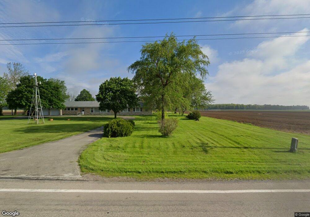
20107 State Route 117 Spencerville, OH 45887
Estimated Value: $219,000 - $262,000
3
Beds
2
Baths
2,276
Sq Ft
$104/Sq Ft
Est. Value
About This Home
This home is located at 20107 State Route 117, Spencerville, OH 45887 and is currently estimated at $237,609, approximately $104 per square foot. 20107 State Route 117 is a home located in Van Wert County with nearby schools including Spencerville Elementary School, Spencerville Middle School, and Spencerville High School.
Ownership History
Date
Name
Owned For
Owner Type
Purchase Details
Closed on
Apr 20, 2023
Sold by
Seibert Richard L and Seibert Patricia A
Bought by
Richard L Seibert Living Trust
Current Estimated Value
Purchase Details
Closed on
Jul 16, 2020
Sold by
Street Linda L and Miller Family Trust
Bought by
Street Harold S and Street Linda L
Purchase Details
Closed on
Jun 22, 2017
Sold by
Street Linda L and Miller Family Trust
Bought by
Seibert Richard L and Seibert Patricia A
Home Financials for this Owner
Home Financials are based on the most recent Mortgage that was taken out on this home.
Original Mortgage
$1,042,718
Interest Rate
4.05%
Mortgage Type
Future Advance Clause Open End Mortgage
Purchase Details
Closed on
Dec 19, 2007
Sold by
Miller Lowell B and Miller Ruth L
Bought by
Miller Lowell B and Miller Ruth L
Create a Home Valuation Report for This Property
The Home Valuation Report is an in-depth analysis detailing your home's value as well as a comparison with similar homes in the area
Home Values in the Area
Average Home Value in this Area
Purchase History
| Date | Buyer | Sale Price | Title Company |
|---|---|---|---|
| Richard L Seibert Living Trust | -- | None Listed On Document | |
| Richard L Seibert Living Trust | -- | None Listed On Document | |
| Street Harold S | $120,000 | None Available | |
| Seibert Richard L | $1,368,000 | Attorney | |
| Miller Lowell B | -- | Attorney |
Source: Public Records
Mortgage History
| Date | Status | Borrower | Loan Amount |
|---|---|---|---|
| Previous Owner | Seibert Richard L | $1,042,718 |
Source: Public Records
Tax History Compared to Growth
Tax History
| Year | Tax Paid | Tax Assessment Tax Assessment Total Assessment is a certain percentage of the fair market value that is determined by local assessors to be the total taxable value of land and additions on the property. | Land | Improvement |
|---|---|---|---|---|
| 2024 | $1,835 | $61,930 | $10,290 | $51,640 |
| 2023 | $1,835 | $61,930 | $10,290 | $51,640 |
| 2022 | $1,576 | $46,270 | $8,790 | $37,480 |
| 2021 | $1,572 | $46,270 | $8,790 | $37,480 |
| 2020 | $1,632 | $46,270 | $8,790 | $37,480 |
| 2019 | $1,441 | $42,070 | $7,810 | $34,260 |
| 2018 | $1,447 | $40,860 | $7,810 | $33,050 |
| 2017 | $4,272 | $112,970 | $79,920 | $33,050 |
| 2016 | $4,353 | $135,120 | $101,550 | $33,570 |
| 2015 | $4,409 | $135,120 | $101,550 | $33,570 |
| 2014 | $4,192 | $135,370 | $101,550 | $33,820 |
| 2013 | $2,610 | $81,770 | $47,950 | $33,820 |
Source: Public Records
Map
Nearby Homes
- 21183 Ohio 116
- 21197 Ohio 116
- 21302 Masters Rd
- 14101 Allentown Rd
- 440 W 4th St
- 409 W 4th St
- 336 W 4th St
- 406 S Mulberry St
- 00 Kleinoeder Rd
- 521 S Broadway St
- 408 N Mulberry St
- 425 N Main St
- 213 N Pearl St
- 316 E 4th St
- 123 Oakland Ave
- 714 Briggs Ave Unit 1
- 8323 Deep Cut Rd
- 19059 Wittington St
- 15044 Main St
- 19083 Venedocia Eastern Rd
- 19953 State Route 117
- 19881 State Route 117
- 19840 State Route 117
- 19819 State Route 117
- 20418 State Route 117
- 19784 State Route 117
- 19968 Louth Rd
- 19878 Louth Rd
- 19910 Louth Rd
- 20165 State Route 116
- 20205 State Route 116
- 19610 Louth Rd
- 20613 State Route 117
- 19572 Louth Rd
- 19550 Louth Rd
- 20347 State Route 116
- 20487 State Route 116
- 20570 State Route 116