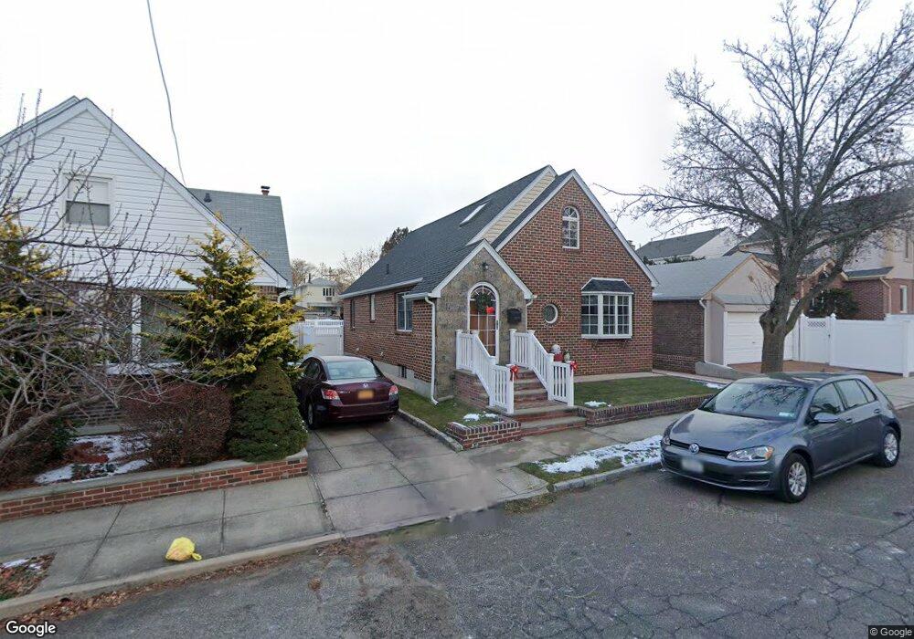
20109 27th Ave Bayside, NY 11360
Auburndale NeighborhoodEstimated Value: $1,185,806 - $1,400,000
--
Bed
--
Bath
1,988
Sq Ft
$647/Sq Ft
Est. Value
About This Home
This home is located at 20109 27th Ave, Bayside, NY 11360 and is currently estimated at $1,285,452, approximately $646 per square foot. 20109 27th Ave is a home located in Queens County with nearby schools including P.S. 159 Queens, I.S. 25 Adrien Block, and Bayside High School.
Ownership History
Date
Name
Owned For
Owner Type
Purchase Details
Closed on
Nov 14, 1996
Sold by
Koenig Walter and Koenig Carol Ann
Bought by
Poje John A and Risichella Poje Debra
Current Estimated Value
Home Financials for this Owner
Home Financials are based on the most recent Mortgage that was taken out on this home.
Original Mortgage
$200,000
Interest Rate
7.48%
Create a Home Valuation Report for This Property
The Home Valuation Report is an in-depth analysis detailing your home's value as well as a comparison with similar homes in the area
Home Values in the Area
Average Home Value in this Area
Purchase History
| Date | Buyer | Sale Price | Title Company |
|---|---|---|---|
| Poje John A | $293,000 | First American Title Ins Co |
Source: Public Records
Mortgage History
| Date | Status | Borrower | Loan Amount |
|---|---|---|---|
| Previous Owner | Poje John A | $200,000 |
Source: Public Records
Tax History Compared to Growth
Tax History
| Year | Tax Paid | Tax Assessment Tax Assessment Total Assessment is a certain percentage of the fair market value that is determined by local assessors to be the total taxable value of land and additions on the property. | Land | Improvement |
|---|---|---|---|---|
| 2025 | $9,553 | $50,074 | $10,159 | $39,915 |
| 2024 | $2,225 | $48,962 | $10,329 | $38,633 |
| 2023 | $9,121 | $46,812 | $9,539 | $37,273 |
| 2022 | $8,774 | $86,940 | $16,860 | $70,080 |
| 2021 | $8,741 | $75,480 | $16,860 | $58,620 |
| 2020 | $8,537 | $67,380 | $16,860 | $50,520 |
| 2019 | $8,243 | $62,400 | $16,860 | $45,540 |
| 2018 | $7,655 | $39,010 | $9,709 | $29,301 |
| 2017 | $7,287 | $37,218 | $11,698 | $25,520 |
| 2016 | $6,844 | $37,218 | $11,698 | $25,520 |
| 2015 | $4,015 | $34,773 | $13,411 | $21,362 |
| 2014 | $4,015 | $34,002 | $12,921 | $21,081 |
Source: Public Records
Map
Nearby Homes
- 201-05 28th Ave
- 19929 26th Ave
- 199-27 26th Ave
- 26-23 Utopia Pkwy
- 20124 24th Ave
- 28-07 172nd St
- 23-14 205th St
- 2801 206th St
- 21-38 202nd St Unit 1-207
- 21-38 202nd St Unit 2
- 199-05 32nd Ave
- 21-29 Utopia Pkwy Unit UPSTAIRS
- 2533 Francis Lewis Blvd
- 32-28 202nd St
- 3211 204th St
- 19916 21st Ave Unit 1336
- 199-08 21st Ave Unit 1-327
- 29-31 170th St
- 25-31 Bayside Ln
- 199-05 21st Ave Unit 1st Floor