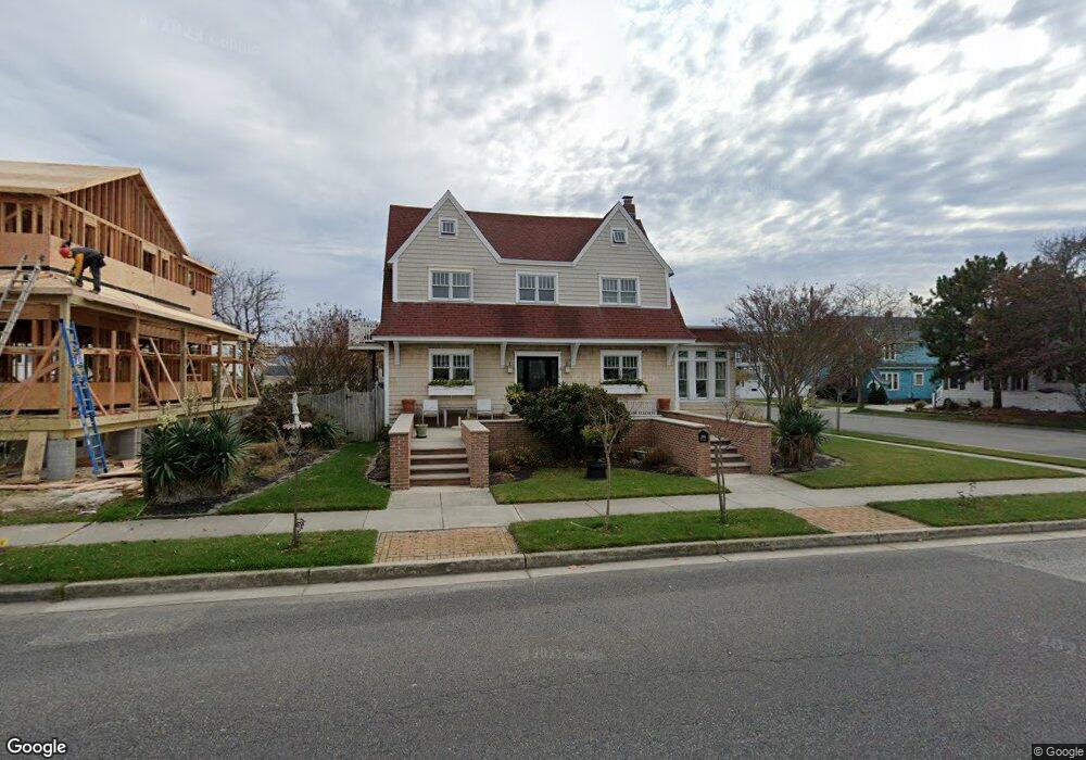
2011 Atlantic Ave Wildwood, NJ 08260
The Wildwoods NeighborhoodEstimated Value: $1,012,687 - $1,665,000
--
Bed
--
Bath
2,016
Sq Ft
$610/Sq Ft
Est. Value
About This Home
This home is located at 2011 Atlantic Ave, Wildwood, NJ 08260 and is currently estimated at $1,230,422, approximately $610 per square foot. 2011 Atlantic Ave is a home located in Cape May County with nearby schools including Margaret Mace Elementary School, Wildwood Catholic Academy, and Wildwood Catholic High School.
Ownership History
Date
Name
Owned For
Owner Type
Purchase Details
Closed on
Jun 3, 2002
Sold by
Lanczinger Bert
Bought by
Bucolo Cora and Bucolo Anthony
Current Estimated Value
Home Financials for this Owner
Home Financials are based on the most recent Mortgage that was taken out on this home.
Original Mortgage
$140,000
Outstanding Balance
$59,571
Interest Rate
6.9%
Estimated Equity
$1,170,851
Purchase Details
Closed on
Oct 4, 2001
Sold by
Cade Helen
Bought by
Lanczinger Bert and Lanczinger Eva
Create a Home Valuation Report for This Property
The Home Valuation Report is an in-depth analysis detailing your home's value as well as a comparison with similar homes in the area
Home Values in the Area
Average Home Value in this Area
Purchase History
| Date | Buyer | Sale Price | Title Company |
|---|---|---|---|
| Bucolo Cora | $175,000 | -- | |
| Lanczinger Bert | $111,100 | -- |
Source: Public Records
Mortgage History
| Date | Status | Borrower | Loan Amount |
|---|---|---|---|
| Open | Bucolo Cora | $140,000 |
Source: Public Records
Tax History Compared to Growth
Tax History
| Year | Tax Paid | Tax Assessment Tax Assessment Total Assessment is a certain percentage of the fair market value that is determined by local assessors to be the total taxable value of land and additions on the property. | Land | Improvement |
|---|---|---|---|---|
| 2025 | $7,481 | $498,100 | $299,000 | $199,100 |
| 2024 | $7,481 | $498,100 | $299,000 | $199,100 |
| 2023 | $7,316 | $498,100 | $299,000 | $199,100 |
| 2022 | $7,012 | $498,100 | $299,000 | $199,100 |
| 2021 | $6,578 | $498,100 | $299,000 | $199,100 |
| 2020 | $6,479 | $498,100 | $299,000 | $199,100 |
| 2019 | $6,255 | $498,100 | $299,000 | $199,100 |
| 2018 | $6,071 | $498,100 | $299,000 | $199,100 |
| 2017 | $5,936 | $498,100 | $299,000 | $199,100 |
| 2016 | $5,817 | $498,100 | $299,000 | $199,100 |
| 2015 | $5,483 | $508,200 | $360,000 | $148,200 |
| 2014 | $5,345 | $508,200 | $360,000 | $148,200 |
Source: Public Records
Map
Nearby Homes
- 317 E 21st Ave Unit 3
- 420 E 21st Ave
- 1904 Atlantic Ave
- 221 E 21st Ave
- 220 E 21st Ave Unit B
- 220 E 21st Ave Unit A
- 220 E 21st Ave
- 1800 Atlantic Ave Unit 101
- 2200 Atlantic Ave Unit 104
- 2001 Surf Ave Unit 6
- 2001 Surf Ave Unit 7
- 2001 Surf Ave Unit 5
- 2001 Surf Ave Unit 1
- 217 E 19th Ave Unit 200
- 422 E 21st Ave
- 1800 Ocean Ave Unit 318
- 2207 Surf Ave Unit 302
- 324 E 23rd Ave Unit A
- 214 E 23rd Ave Unit West
- 226 E 16th Ave
- 2009 Atlantic Ave
- 305 E 21st Ave
- 313 E 21st Ave
- 2001 Atlantic Ave
- 2101 Atlantic Ave
- 347 E 21st Ave Unit 201
- 347 E 21st Ave Unit 200
- 347 E 21st Ave Unit 100
- 306 E 20th Ave
- 2010 Atlantic Ave
- 315 E 21st Ave
- 302 E 21st Ave
- 312 E 20th Ave Unit C
- 2000 Atlantic Ave
- 2103 Atlantic Ave
- 304 E 21st Ave
- 317 E 21st Ave Unit 3
- 2100 Atlantic Ave
- 334 E 20th Ave Unit B
- 334 E 20th Ave Unit A