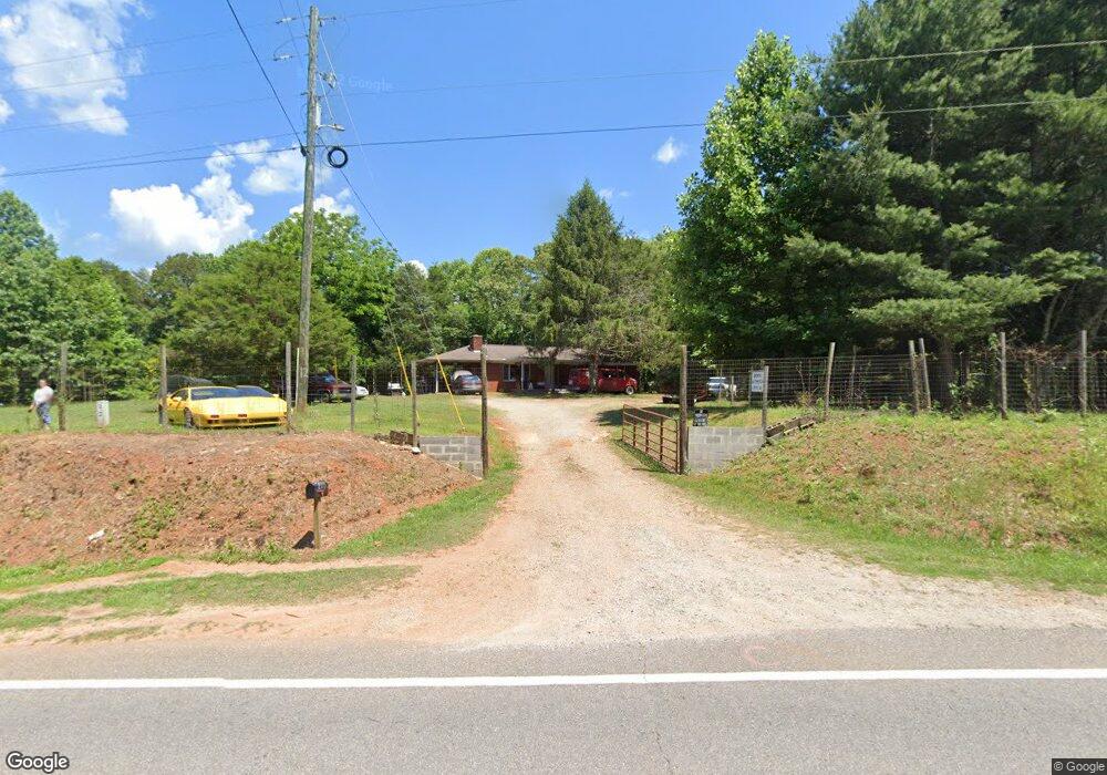
2011 Auraria Rd Dahlonega, GA 30533
Estimated Value: $369,000 - $474,000
--
Bed
1
Bath
2,040
Sq Ft
$211/Sq Ft
Est. Value
About This Home
This home is located at 2011 Auraria Rd, Dahlonega, GA 30533 and is currently estimated at $430,773, approximately $211 per square foot. 2011 Auraria Rd is a home located in Lumpkin County with nearby schools including Clay County Middle School and Lumpkin County High School.
Ownership History
Date
Name
Owned For
Owner Type
Purchase Details
Closed on
May 5, 2023
Sold by
Satterfield Michael James
Bought by
Dinsmore Nathan and Dinsmore Kim
Current Estimated Value
Purchase Details
Closed on
Jun 27, 2022
Sold by
Satterfield Michael James
Bought by
Minor Kevin and Minor Tracy
Purchase Details
Closed on
May 13, 2022
Sold by
Satterfield Michael James
Bought by
Dinsmore Nathan
Purchase Details
Closed on
Mar 28, 2022
Sold by
Satterfield Michael James
Bought by
Brown Nathan and Brown Melanie
Purchase Details
Closed on
Dec 29, 1998
Sold by
Satterfield Ruby A
Bought by
Satterfield Michael
Purchase Details
Closed on
Mar 1, 1982
Sold by
Satterfield Ruby A
Bought by
Satterfield Ruby A
Purchase Details
Closed on
May 18, 1973
Bought by
Satterfield Ruby A
Create a Home Valuation Report for This Property
The Home Valuation Report is an in-depth analysis detailing your home's value as well as a comparison with similar homes in the area
Home Values in the Area
Average Home Value in this Area
Purchase History
| Date | Buyer | Sale Price | Title Company |
|---|---|---|---|
| Dinsmore Nathan | $23,000 | -- | |
| Minor Kevin | $60,000 | -- | |
| Dinsmore Nathan | $25,000 | -- | |
| Brown Nathan | $248,125 | -- | |
| Satterfield Michael | -- | -- | |
| Satterfield Ruby A | -- | -- | |
| Satterfield Ruby A | -- | -- |
Source: Public Records
Tax History Compared to Growth
Tax History
| Year | Tax Paid | Tax Assessment Tax Assessment Total Assessment is a certain percentage of the fair market value that is determined by local assessors to be the total taxable value of land and additions on the property. | Land | Improvement |
|---|---|---|---|---|
| 2024 | $3,743 | $161,125 | $24,000 | $137,125 |
| 2023 | $1,498 | $63,694 | $24,000 | $39,694 |
| 2022 | $2,414 | $97,507 | $56,448 | $41,059 |
| 2021 | $1,010 | $90,960 | $56,448 | $34,512 |
| 2020 | $1,013 | $87,689 | $54,091 | $33,598 |
| 2019 | $1,019 | $87,689 | $54,091 | $33,598 |
| 2018 | $1,045 | $86,385 | $54,091 | $32,294 |
| 2017 | $1,062 | $86,391 | $54,091 | $32,300 |
| 2016 | $980 | $82,574 | $54,091 | $28,483 |
| 2015 | $882 | $82,574 | $54,091 | $28,483 |
| 2014 | $882 | $83,487 | $54,091 | $29,396 |
| 2013 | -- | $84,400 | $54,090 | $30,309 |
Source: Public Records
Map
Nearby Homes
- 0 Honey Tree Terrace Unit 10448792
- 0 Honey Tree Terrace Unit 7516071
- 775 Crooked Creek Dr
- 1047 Nugget Ct
- 3149 Auraria Rd
- 251 Bearslide Hollow
- Lot 5 Still Rd
- 191 Sleepy Hollow Rd
- 114 Funaro Ln
- 190 Grand Oak Ln
- 1170 Calhoun Rd
- 0 Falling Pines Rd Unit 10643861
- 0 Falling Pines Rd Unit 7681028
- 1415 Calhoun Rd
- 735 Calhoun Rd
- 120 Rivermont Ln
- 0 Dawsonville Hwy Unit 10631159
- 00 Dawsonville Hwy
- 99 Madeline Anthony Road Lots 44 and 45
- 99 Madeline Anthony Rd
- 2008 Auraria Rd
- 2010 Auraria Rd
- 2161 Auraria Rd
- 0 John Walker Rd Unit 8382568
- 0 John Walker Rd
- 0 John Walker Rd Unit 8147424
- 0 John Walker Rd Unit 7245728
- 0 John Walker Rd Unit 7441833
- 0 John Walker Rd Unit 8639773
- 62 John Walker Rd
- 2199 Auraria Rd
- 185 Walnut Rd
- 61 John Walker Rd
- 1823 Auraria Rd
- 2205 Auraria Rd
- 67 John Walker Rd
- 184 Walnut Rd
- 1797 Auraria Rd
- 127 John Walker Rd
- 127 John Walker Rd Unit 1