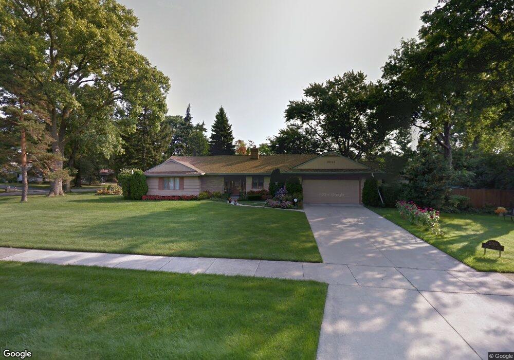
2011 Briar Hill Rd Flint, MI 48503
Woodcroft Estates NeighborhoodEstimated Value: $218,395 - $322,000
2
Beds
4
Baths
2,119
Sq Ft
$122/Sq Ft
Est. Value
About This Home
This home is located at 2011 Briar Hill Rd, Flint, MI 48503 and is currently estimated at $259,099, approximately $122 per square foot. 2011 Briar Hill Rd is a home located in Genesee County with nearby schools including Durant-Tuuri-Mott Elementary School, Flint Southwestern Classical Academy, and St. Paul Lutheran School.
Ownership History
Date
Name
Owned For
Owner Type
Purchase Details
Closed on
Dec 16, 1999
Sold by
M M Shaheen Trust
Bought by
Finley Willie D and Finley Oreatha
Current Estimated Value
Home Financials for this Owner
Home Financials are based on the most recent Mortgage that was taken out on this home.
Original Mortgage
$130,000
Outstanding Balance
$40,205
Interest Rate
7.7%
Mortgage Type
Purchase Money Mortgage
Estimated Equity
$218,894
Create a Home Valuation Report for This Property
The Home Valuation Report is an in-depth analysis detailing your home's value as well as a comparison with similar homes in the area
Home Values in the Area
Average Home Value in this Area
Purchase History
| Date | Buyer | Sale Price | Title Company |
|---|---|---|---|
| Finley Willie D | $185,000 | Metropolitan Title Company |
Source: Public Records
Mortgage History
| Date | Status | Borrower | Loan Amount |
|---|---|---|---|
| Open | Finley Willie D | $130,000 |
Source: Public Records
Tax History Compared to Growth
Tax History
| Year | Tax Paid | Tax Assessment Tax Assessment Total Assessment is a certain percentage of the fair market value that is determined by local assessors to be the total taxable value of land and additions on the property. | Land | Improvement |
|---|---|---|---|---|
| 2025 | $2,659 | $96,900 | $0 | $0 |
| 2024 | $2,350 | $103,500 | $0 | $0 |
| 2023 | $2,275 | $97,400 | $0 | $0 |
| 2022 | $0 | $87,500 | $0 | $0 |
| 2021 | $2,404 | $80,700 | $0 | $0 |
| 2020 | $2,109 | $73,200 | $0 | $0 |
| 2019 | $2,018 | $74,400 | $0 | $0 |
| 2018 | $2,145 | $67,800 | $0 | $0 |
| 2017 | $2,071 | $0 | $0 | $0 |
| 2016 | $2,055 | $0 | $0 | $0 |
| 2015 | -- | $0 | $0 | $0 |
| 2014 | -- | $0 | $0 | $0 |
| 2012 | -- | $43,000 | $0 | $0 |
Source: Public Records
Map
Nearby Homes
- 3401 Westwood Pkwy
- 3102 Westwood Pkwy
- 3402 Brandon St
- 3001 Yale St
- 3506 Chicago Blvd
- 3305 Larchmont St
- 2926 Yale St
- 3214 Clairmont St
- 3217 Arlene Ave
- 1414 Knapp Ave
- 3813 Larchmont St
- 1326 Hughes Ave
- 1318 Knapp Ave
- 1412 S Ballenger Hwy
- 3918 Larchmont St
- 1308 Barney Ave
- 1217 Barney Ave
- 1202 Knapp Ave
- 3413 Augusta St
- 1122 Stocker Ave
- 3311 Hawthorne Dr
- 3321 Hawthorne Dr
- 2021 Briar Hill Rd
- 3401 Hawthorne Dr
- 2010 Briar Hill Rd
- 3322 Hawthorne Dr
- 3330 Hawthorne Dr
- 2041 Briar Hill Rd
- 3301 Hawthorne Dr
- 3411 Hawthorne Dr
- 3402 Hawthorne Dr
- 2038 Crooked Ln
- 3412 Hawthorne Dr Unit Bldg-Unit
- 3412 Hawthorne Dr
- 3302 Westwood Pkwy
- 2046 Crooked Ln
- 3302 Hawthorne Dr
- 3421 Hawthorne Dr
- 3211 Hawthorne Dr
- 2054 Crooked Ln