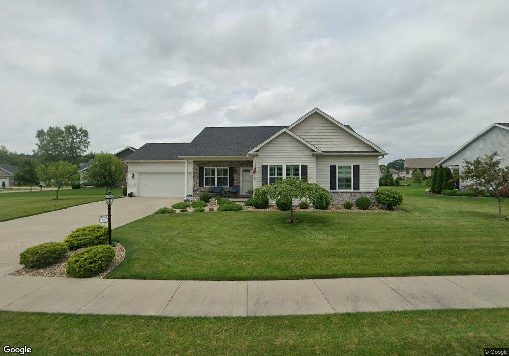
2011 Brookside Dr NE New Philadelphia, OH 44663
Estimated Value: $355,000 - $396,000
3
Beds
2
Baths
1,954
Sq Ft
$193/Sq Ft
Est. Value
About This Home
This home is located at 2011 Brookside Dr NE, New Philadelphia, OH 44663 and is currently estimated at $377,414, approximately $193 per square foot. 2011 Brookside Dr NE is a home with nearby schools including New Philadelphia High School, Quaker Preparatory Academy, and Quaker Digital Academy.
Ownership History
Date
Name
Owned For
Owner Type
Purchase Details
Closed on
Dec 14, 2024
Sold by
Norman Gary Gene and Norman Marianne
Bought by
Norman Family Gene Declaration Of Trust and Norman
Current Estimated Value
Purchase Details
Closed on
Jul 27, 2017
Sold by
Tci Ltd Llc
Bought by
Norman Gary Gene and Norman Marianne
Home Financials for this Owner
Home Financials are based on the most recent Mortgage that was taken out on this home.
Original Mortgage
$220,000
Interest Rate
3.91%
Mortgage Type
Construction
Create a Home Valuation Report for This Property
The Home Valuation Report is an in-depth analysis detailing your home's value as well as a comparison with similar homes in the area
Home Values in the Area
Average Home Value in this Area
Purchase History
| Date | Buyer | Sale Price | Title Company |
|---|---|---|---|
| Norman Family Gene Declaration Of Trust | -- | None Listed On Document | |
| Norman Family Gene Declaration Of Trust | -- | None Listed On Document | |
| Norman Gary Gene | $35,900 | Alban Title |
Source: Public Records
Mortgage History
| Date | Status | Borrower | Loan Amount |
|---|---|---|---|
| Previous Owner | Norman Gary Gene | $220,000 |
Source: Public Records
Tax History Compared to Growth
Tax History
| Year | Tax Paid | Tax Assessment Tax Assessment Total Assessment is a certain percentage of the fair market value that is determined by local assessors to be the total taxable value of land and additions on the property. | Land | Improvement |
|---|---|---|---|---|
| 2024 | $3,595 | $103,222 | $13,853 | $89,369 |
| 2023 | $3,595 | $294,920 | $39,580 | $255,340 |
| 2022 | $3,657 | $103,222 | $13,853 | $89,369 |
| 2021 | $3,370 | $90,647 | $11,897 | $78,750 |
| 2020 | $3,387 | $90,647 | $11,897 | $78,750 |
| 2019 | $3,384 | $90,647 | $11,897 | $78,750 |
| 2018 | $3,074 | $7,790 | $7,790 | $0 |
| 2017 | $347 | $7,790 | $7,790 | $0 |
| 2016 | $72 | $1,600 | $1,600 | $0 |
Source: Public Records
Map
Nearby Homes
- 2006 Buckeye St NE
- 268 Schoenbrunn Dr NE
- 247 Kent Cir NE
- 221 Sea Gull Dr SE
- 0 Goshen Hill Rd SE
- 1224 Goshen Ave SE
- 1892 Roxford St
- 1273 Concord Cir SE
- 641 Crider Ave NE
- 2709 Backwater Rd SE
- 231 4th St SE
- 451 Mill Ave SE
- 1354 Independence Cir SE
- 1451 Ridge Rd NE
- 1734 Barnhill Rd
- 1149 Jefferson St SE
- 1577 State Route 39 NE
- 428 Kaserman Ave NE
- 1166 S Broadway St
- 4711 Broadway
- 1983 Brookside Dr NE
- 2021 Brookside Dr NE
- 2008 Brookside Dr NE
- 1973 Brookside Dr NE
- 1994 Brookside Dr NE
- 543 Easy St NE
- 533 Easy St NE
- 521 Correl Dr NE
- 535 Corral Dr NE
- 1980 Brookside Dr NE
- 551 Easy St NE
- 0 Brookside Dr NE Unit 3850698
- 545 Corral Dr NE
- 563 Easy St NE
- 511 Corral Dr NE
- 1972 Brookside Dr NE
- 122 Coral
- 2047 Brookside Dr NE
- 519 Easy St NE
- 11 Corral Dr NE