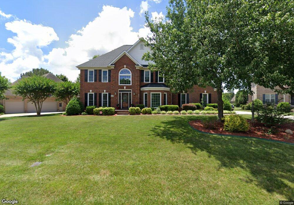
2011 Bunker Ct Matthews, NC 28104
Estimated Value: $749,000 - $775,813
4
Beds
3
Baths
3,122
Sq Ft
$244/Sq Ft
Est. Value
About This Home
This home is located at 2011 Bunker Ct, Matthews, NC 28104 and is currently estimated at $761,453, approximately $243 per square foot. 2011 Bunker Ct is a home located in Union County with nearby schools including Stallings Elementary School, Porter Ridge Middle School, and Porter Ridge High School.
Ownership History
Date
Name
Owned For
Owner Type
Purchase Details
Closed on
Oct 11, 2016
Sold by
Bass Jeff K and Bass Kimberly A
Bought by
Dillon Patrick and Dillon Renae
Current Estimated Value
Purchase Details
Closed on
Mar 3, 1999
Sold by
D Ballard Construction Inc
Bought by
Bass Jeff K and Bass Kimberly A
Home Financials for this Owner
Home Financials are based on the most recent Mortgage that was taken out on this home.
Original Mortgage
$239,500
Interest Rate
6.79%
Create a Home Valuation Report for This Property
The Home Valuation Report is an in-depth analysis detailing your home's value as well as a comparison with similar homes in the area
Purchase History
| Date | Buyer | Sale Price | Title Company |
|---|---|---|---|
| Dillon Patrick | $424,000 | None Available | |
| Bass Jeff K | $300,000 | -- |
Source: Public Records
Mortgage History
| Date | Status | Borrower | Loan Amount |
|---|---|---|---|
| Previous Owner | Bass Jeff K | $239,500 |
Source: Public Records
Tax History
| Year | Tax Paid | Tax Assessment Tax Assessment Total Assessment is a certain percentage of the fair market value that is determined by local assessors to be the total taxable value of land and additions on the property. | Land | Improvement |
|---|---|---|---|---|
| 2025 | $4,859 | $719,700 | $0 | $0 |
| 2024 | $3,970 | $456,400 | $90,000 | $366,400 |
| 2023 | $3,801 | $456,400 | $90,000 | $366,400 |
| 2022 | $3,780 | $456,400 | $90,000 | $366,400 |
| 2021 | $3,780 | $456,400 | $90,000 | $366,400 |
| 2020 | $3,585 | $355,800 | $72,500 | $283,300 |
| 2019 | $3,585 | $355,800 | $72,500 | $283,300 |
| 2018 | $3,585 | $355,800 | $72,500 | $283,300 |
| 2017 | $3,568 | $336,600 | $72,500 | $264,100 |
| 2016 | $3,513 | $336,600 | $72,500 | $264,100 |
| 2015 | $3,556 | $336,600 | $72,500 | $264,100 |
| 2014 | $2,422 | $339,140 | $75,000 | $264,140 |
Source: Public Records
Map
Nearby Homes
- 1151 Avalon Place
- 1344 Garden Vista Dr
- 9008 Birch Ct
- 1318 Poppy Way
- 1915 Millbrook Ln
- 1330 Millview Ln
- 8106 Castlemaine Dr
- 5518 Two Iron Dr
- 607 Southstone Dr
- 1022 Galloway Dr
- 1026 Galloway Dr
- 0 Union Rd Unit CAR4114099
- 5020 Scaleybark Ct
- 14404 Lawyers Rd
- 8056 Hunley Ridge Rd
- 650 Union Rd
- 15927 Lawyers Rd
- 6111 Dovetail Ct
- 6300 Allen Black Rd
- 1715 Union Rd
- 2011 Bunker Ct Unit 22
- 2003 Bunker Ct
- 2019 Bunker Ct
- 2010 Bunker Ct
- 2026 Bunker Ct
- 2002 Bunker Ct
- 2018 Bunker Ct
- 1422 Emerald Lake Dr
- 1428 Emerald Lake Dr
- 1416 Emerald Lake Dr
- 1500 Emerald Lake Dr
- 1506 Emerald Lake Dr
- 1924 Links Ln
- 1916 Links Ln
- 1601 Emerald Lake Dr
- 1613 Emerald Lake Dr
- 1410 Emerald Lake Dr
- 1908 Links Ln
- 1932 Links Ln
- 1900 Links Ln
Your Personal Tour Guide
Ask me questions while you tour the home.