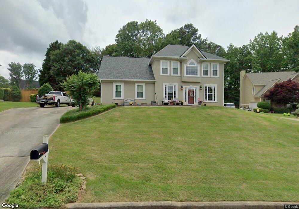
2011 Cambridge Dr Woodstock, GA 30188
Estimated Value: $441,425 - $447,000
3
Beds
3
Baths
2,240
Sq Ft
$198/Sq Ft
Est. Value
About This Home
This home is located at 2011 Cambridge Dr, Woodstock, GA 30188 and is currently estimated at $444,213, approximately $198 per square foot. 2011 Cambridge Dr is a home located in Cherokee County with nearby schools including Little River Elementary, Mill Creek Middle School, and River Ridge High School.
Ownership History
Date
Name
Owned For
Owner Type
Purchase Details
Closed on
Feb 23, 2005
Sold by
Hosea William F and Hosea Sharon
Bought by
Fraser R Scott
Current Estimated Value
Home Financials for this Owner
Home Financials are based on the most recent Mortgage that was taken out on this home.
Original Mortgage
$153,600
Outstanding Balance
$76,831
Interest Rate
5.61%
Mortgage Type
New Conventional
Estimated Equity
$367,382
Purchase Details
Closed on
Jan 24, 2003
Sold by
Hosea William F
Bought by
Hosea William F and Hosea Sharon
Purchase Details
Closed on
Jul 2, 1997
Sold by
Barrington Homes Inc
Bought by
Hosea William F and Hosea Sharon S
Home Financials for this Owner
Home Financials are based on the most recent Mortgage that was taken out on this home.
Original Mortgage
$108,300
Interest Rate
7.98%
Mortgage Type
New Conventional
Create a Home Valuation Report for This Property
The Home Valuation Report is an in-depth analysis detailing your home's value as well as a comparison with similar homes in the area
Home Values in the Area
Average Home Value in this Area
Purchase History
| Date | Buyer | Sale Price | Title Company |
|---|---|---|---|
| Fraser R Scott | $192,000 | -- | |
| Hosea William F | -- | -- | |
| Hosea William F | $144,500 | -- |
Source: Public Records
Mortgage History
| Date | Status | Borrower | Loan Amount |
|---|---|---|---|
| Open | Fraser R Scott | $153,600 | |
| Previous Owner | Hosea William F | $108,300 |
Source: Public Records
Tax History Compared to Growth
Tax History
| Year | Tax Paid | Tax Assessment Tax Assessment Total Assessment is a certain percentage of the fair market value that is determined by local assessors to be the total taxable value of land and additions on the property. | Land | Improvement |
|---|---|---|---|---|
| 2025 | $4,170 | $158,788 | $32,800 | $125,988 |
| 2024 | $4,081 | $157,032 | $32,800 | $124,232 |
| 2023 | $4,145 | $159,516 | $32,800 | $126,716 |
| 2022 | $3,480 | $132,400 | $30,000 | $102,400 |
| 2021 | $3,182 | $112,080 | $24,000 | $88,080 |
| 2020 | $2,757 | $97,040 | $18,400 | $78,640 |
| 2019 | $2,464 | $86,720 | $18,400 | $68,320 |
| 2018 | $2,447 | $85,600 | $18,400 | $67,200 |
| 2017 | $2,401 | $208,300 | $18,400 | $64,920 |
| 2016 | $2,313 | $198,600 | $18,400 | $61,040 |
| 2015 | $2,123 | $180,500 | $16,800 | $55,400 |
| 2014 | $1,976 | $167,700 | $16,800 | $50,280 |
Source: Public Records
Map
Nearby Homes
- 156 W Oaks Place
- 4941 Willow Ln
- 226 Hames Rd Unit 405
- 226 Hames Rd Unit 225
- 1877 Falcon Wood Dr NE
- 5009 Kingsley Manor Ct
- 4924 Locklear Way
- 205 Leland Way
- 4813 Highpoint Dr NE
- 205 Trickum Hills Ln
- 5100 Ravenwood Dr
- 2899 Treeside Terrace
- 615 Bedford Ct
- 11511 Highway 92
- 204 Magnolia Creek Way
- 4791 Jamerson Forest Cir
- 2013 Cambridge Dr
- 2009 Cambridge Dr Unit 2
- 1016 Cambridge Ct
- 2015 Cambridge Dr
- 1017 Cambridge Ct Unit 1
- 2007 Cambridge Dr
- 2012 Cambridge Dr Unit II
- 2014 Cambridge Dr Unit 2
- 5114 Old Chestnut Ct
- 5112 Old Chestnut Ct
- 1014 Cambridge Ct Unit 1
- 2017 Cambridge Dr
- 5116 Old Chestnut Ct
- 103 Cornwall Ct
- 5110 Old Chestnut Ct
- 2005 Cambridge Dr Unit 2
- 2016 Cambridge Dr
- 105 Cornwall Ct Unit 2
- 0 Cambridge Dr Unit 3209449
- 5118 Old Chestnut Ct