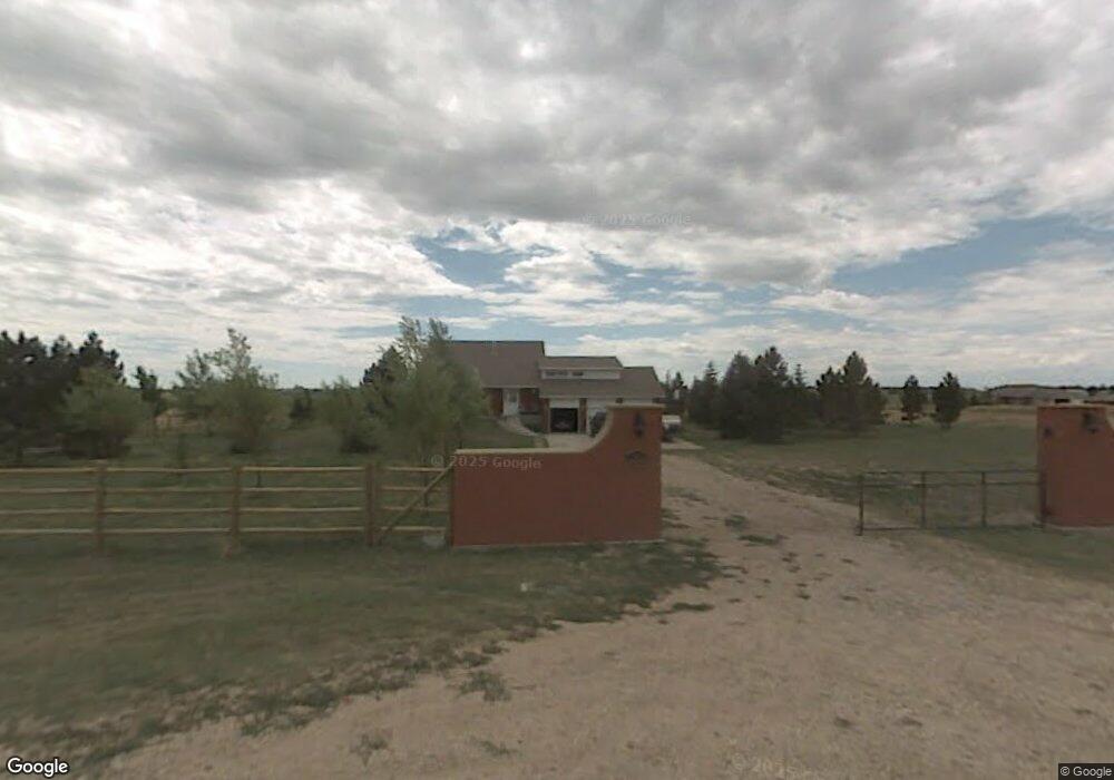
2011 Chaparral Rd Cheyenne, WY 82009
Ranchettes NeighborhoodEstimated Value: $550,000 - $611,565
--
Bed
--
Bath
2,040
Sq Ft
$283/Sq Ft
Est. Value
About This Home
This home is located at 2011 Chaparral Rd, Cheyenne, WY 82009 and is currently estimated at $577,855, approximately $283 per square foot. 2011 Chaparral Rd is a home located in Laramie County with nearby schools including Prairie Wind Elementary School, McCormick Junior High School, and Central High School.
Ownership History
Date
Name
Owned For
Owner Type
Purchase Details
Closed on
Feb 8, 2010
Sold by
Pacheco Ronnie L and Pacheco Oralia C
Bought by
Pacheco Ronnie L
Current Estimated Value
Home Financials for this Owner
Home Financials are based on the most recent Mortgage that was taken out on this home.
Original Mortgage
$209,500
Interest Rate
4.97%
Mortgage Type
New Conventional
Purchase Details
Closed on
Jul 16, 2002
Sold by
Pacheco Ronnie L
Bought by
Pacheco Ronnie L and Pacheco Oralia C
Purchase Details
Closed on
Feb 23, 2001
Sold by
Pacheco Gail E
Bought by
Pacheco Ronnie L
Home Financials for this Owner
Home Financials are based on the most recent Mortgage that was taken out on this home.
Original Mortgage
$158,000
Interest Rate
7.19%
Create a Home Valuation Report for This Property
The Home Valuation Report is an in-depth analysis detailing your home's value as well as a comparison with similar homes in the area
Home Values in the Area
Average Home Value in this Area
Purchase History
| Date | Buyer | Sale Price | Title Company |
|---|---|---|---|
| Pacheco Ronnie L | -- | None Available | |
| Pacheco Ronnie L | -- | -- | |
| Pacheco Ronnie L | -- | -- |
Source: Public Records
Mortgage History
| Date | Status | Borrower | Loan Amount |
|---|---|---|---|
| Closed | Pacheco Ronnie L | $209,500 | |
| Closed | Pacheco Ronnie L | $158,000 |
Source: Public Records
Tax History Compared to Growth
Tax History
| Year | Tax Paid | Tax Assessment Tax Assessment Total Assessment is a certain percentage of the fair market value that is determined by local assessors to be the total taxable value of land and additions on the property. | Land | Improvement |
|---|---|---|---|---|
| 2025 | $3,362 | $25,779 | $5,811 | $19,968 |
| 2024 | $3,362 | $50,021 | $11,621 | $38,400 |
| 2023 | $3,190 | $48,545 | $11,621 | $36,924 |
| 2022 | $2,874 | $42,784 | $11,621 | $31,163 |
| 2021 | $2,562 | $38,046 | $9,164 | $28,882 |
| 2020 | $2,521 | $37,548 | $9,164 | $28,384 |
| 2019 | $2,147 | $31,948 | $9,164 | $22,784 |
| 2018 | $1,893 | $28,459 | $6,635 | $21,824 |
| 2017 | $1,913 | $28,482 | $6,438 | $22,044 |
| 2016 | $1,883 | $28,014 | $6,242 | $21,772 |
| 2015 | $1,830 | $27,225 | $6,242 | $20,983 |
| 2014 | $1,847 | $27,290 | $6,242 | $21,048 |
Source: Public Records
Map
Nearby Homes
- 9404 Wayne Rd
- 1745 Silver Spur Rd
- 8704 Cowpoke Rd
- 8007 Kepler Dr
- TBD Kepler Dr
- 714 E Ole Maverick Rd
- 1218 Wendy Ln
- 1348 Jessi Dr
- 724 E Powell Rd
- 1348 Jack Ln
- 1336 Jessi Dr
- 8012 Bobcat Rd
- 7612 Danni Marie Cir
- 808 E Laughlin Rd
- 1316 Jessi Dr
- 2918 Sitting Bull Rd
- 1236 Jessi Dr
- 5124 Sullivan St
- 7353 Huntz Dr
- 1213 Alyssa Way
- 2023 Chaparral Rd
- 2014 Chaparral Rd
- 9636 Branding Iron Dr
- 2026 Chaparral Rd
- 9509 Branding Iron Dr
- 9542 Branding Iron Dr
- 2117 Chaparral Rd
- 9728 Branding Iron Dr
- 9506 Branding Iron Dr
- 10019 Branding Iron Dr
- 9520 Powderhouse Rd
- 2130 Chaparral Rd
- 9920 Branding Iron Dr
- 9514 Powderhouse Rd
- 9803 Powderhouse Rd
- 9617 Powderhouse Rd
- 9615 Wayne Rd
- 10115 Branding Iron D
- 9511 Powderhouse Rd
- 9915 Powderhouse Rd