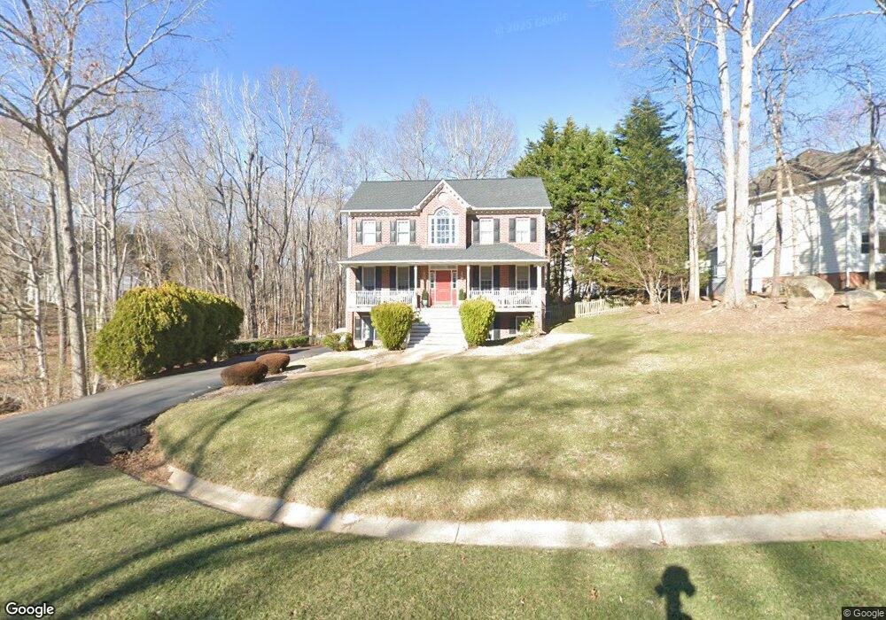
2011 Chartstone Dr Midlothian, VA 23113
Roxshire NeighborhoodEstimated Value: $683,079 - $727,000
4
Beds
4
Baths
3,045
Sq Ft
$230/Sq Ft
Est. Value
About This Home
This home is located at 2011 Chartstone Dr, Midlothian, VA 23113 and is currently estimated at $699,270, approximately $229 per square foot. 2011 Chartstone Dr is a home located in Chesterfield County with nearby schools including Robious Elementary School, Robious Middle School, and James River High School.
Ownership History
Date
Name
Owned For
Owner Type
Purchase Details
Closed on
Feb 16, 2001
Bought by
Price Jerrold K
Current Estimated Value
Home Financials for this Owner
Home Financials are based on the most recent Mortgage that was taken out on this home.
Original Mortgage
$191,500
Outstanding Balance
$69,172
Interest Rate
7.08%
Mortgage Type
New Conventional
Estimated Equity
$630,098
Purchase Details
Closed on
Feb 13, 1996
Sold by
Delegge Donald T and Delegge Laurie A
Bought by
Mclellan Construction Corporation
Home Financials for this Owner
Home Financials are based on the most recent Mortgage that was taken out on this home.
Original Mortgage
$26,000
Interest Rate
7.1%
Mortgage Type
New Conventional
Create a Home Valuation Report for This Property
The Home Valuation Report is an in-depth analysis detailing your home's value as well as a comparison with similar homes in the area
Home Values in the Area
Average Home Value in this Area
Purchase History
| Date | Buyer | Sale Price | Title Company |
|---|---|---|---|
| Price Jerrold K | -- | -- | |
| Mclellan Construction Corporation | $26,000 | -- |
Source: Public Records
Mortgage History
| Date | Status | Borrower | Loan Amount |
|---|---|---|---|
| Open | Mclellan Construction Corporation | $191,500 | |
| Previous Owner | Mclellan Construction Corporation | $26,000 |
Source: Public Records
Tax History
| Year | Tax Paid | Tax Assessment Tax Assessment Total Assessment is a certain percentage of the fair market value that is determined by local assessors to be the total taxable value of land and additions on the property. | Land | Improvement |
|---|---|---|---|---|
| 2025 | $5,389 | $602,700 | $137,800 | $464,900 |
| 2024 | $5,389 | $578,200 | $128,300 | $449,900 |
| 2023 | $4,574 | $502,600 | $118,800 | $383,800 |
| 2022 | $4,412 | $479,600 | $109,300 | $370,300 |
| 2021 | $4,174 | $432,400 | $98,800 | $333,600 |
| 2020 | $3,947 | $415,500 | $98,800 | $316,700 |
| 2019 | $3,921 | $412,700 | $96,000 | $316,700 |
| 2018 | $3,772 | $397,100 | $94,100 | $303,000 |
| 2017 | $3,794 | $395,200 | $92,200 | $303,000 |
| 2016 | $3,777 | $393,400 | $92,200 | $301,200 |
| 2015 | $3,729 | $385,800 | $84,600 | $301,200 |
| 2014 | $3,614 | $373,900 | $77,900 | $296,000 |
Source: Public Records
Map
Nearby Homes
- 2210 Corner Rock Rd
- 2321 Olde Stone Rd
- 1860 Glamorgan Ln
- 12505 Mandolin Dr
- 12407 Sandbag Cir
- 11800 Heathmere Crescent
- 11911 Kilrenny Rd
- 2560 Chartstone Dr
- 1318 Unison Dr
- 2711 Salisbury Rd
- 11719 Heathmere Crescent
- 13311 Glendower Rd
- 11915 W Briar Patch Dr
- 11801 Wiesinger Ln
- 13607 Danwoods Rd
- 12605 Mill Lock Terrace
- 1522 Sycamore Square Dr
- 11611 E Briar Patch Dr
- 2501 Wildercroft Rd
- 1301 Salisbury Dr
- 2001 Chartstone Dr
- 2020 Thornleigh Rd
- 2031 Chartstone Dr
- 2000 Chartstone Dr
- 2010 Chartstone Dr
- 2001 Thornleigh Rd
- 1910 Thornleigh Rd
- 1931 Thornleigh Rd
- 2030 Chartstone Dr
- 2021 Thornleigh Rd
- 2020 Chartstone Dr
- 1921 Thornleigh Rd
- 2041 Chartstone Dr
- 1900 Thornleigh Rd
- 2040 Chartstone Dr
- 1911 Thornleigh Rd
- 2000 Normandstone Dr
- 2010 Normandstone Dr
- 1940 Normandstone Dr
- 2020 Normandstone Dr
Your Personal Tour Guide
Ask me questions while you tour the home.