C
Seller's Agent in 2025
Christina Hawkins
Era All In One Realty
133 Total Sales
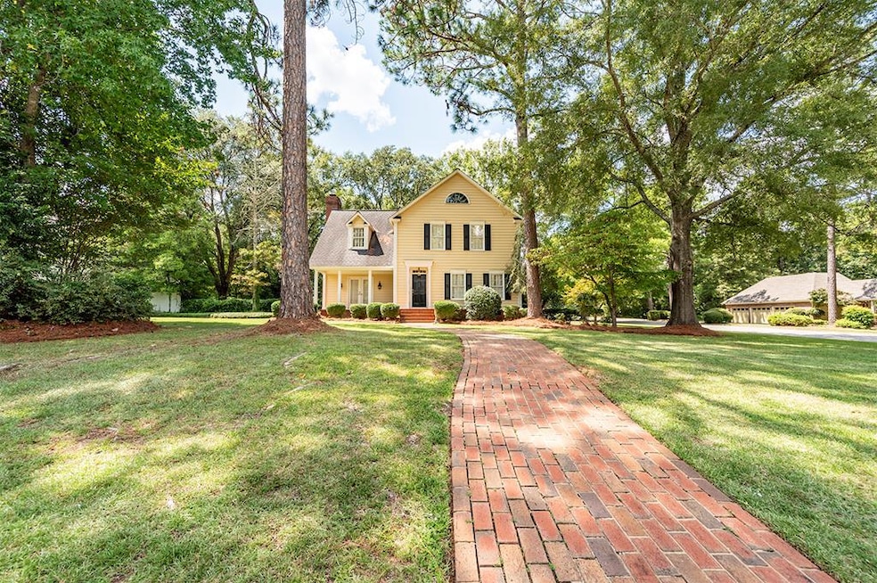

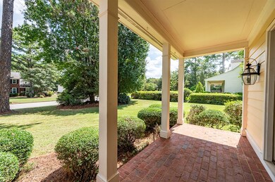
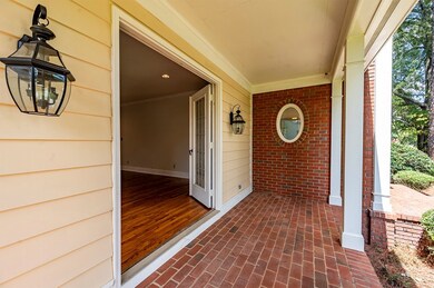
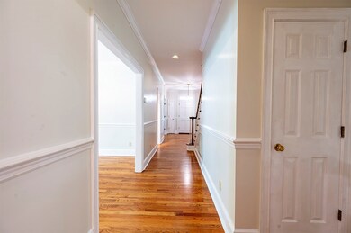
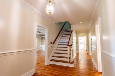

Stunning 5-Bedroom Home in Merry Acres West with New Interior Paint – A Must-See! Welcome to this charming 3600+ sq ft home, nestled on a desirable corner lot in the sought-after Merry Acres West neighborhood. With 5 spacious bedrooms and 4.5 bathrooms, this home offers a perfect blend of comfort and elegance. As you enter through the foyer, you're greeted by beautiful hardwood floors that flow seamlessly into the expansive den and beautiful staircase. Featuring a wood-burning fireplace with gas logs and custom built-ins, this cozy living space is perfect for both relaxation and entertaining. Two sets of French doors lead to both the front and back porches, allowing natural light to flood the space. The main level also includes a private bedroom and bath, as well as a formal dining room with built-ins for buffet and china storage. The updated kitchen is a chef's dream, with sleek stainless steel appliances, double wall oven, upgraded granite countertops, under-counter lighting, a spacious pantry, and a center island. Just off the kitchen, you'll find convenient access to both the backyard and the den, ideal for easy indoor-outdoor living. Upstairs, the expansive master suite features a luxurious en-suite bath with a whirlpool tub, double sinks, and plenty of storage. The four additional bedrooms are generously sized and offer ample closet space, perfect for growing families. A large bonus room, currently used as a billiards space, is a great flex area. This bonus room is accessed by a private staircase that leads directly to the garage, complete with its own air conditioning unit for ultimate comfort. Plus, the pool table stays with the home! Enjoy the outdoors in your fully fenced backyard, complete with a sprinkler system for easy lawn maintenance. The corner lot adds extra privacy and curb appeal, making this home an absolute standout. With its spacious floor plan, fantastic amenities, and prime location, this home is a rare find. Don't miss out on the opportunity to make it yours!
Last Agent to Sell the Property
Era All In One Realty Brokerage Phone: 2298886670 License #305773 Listed on: 09/05/2025

| Date | Type | Sale Price | Title Company |
|---|---|---|---|
| Warranty Deed | $306,500 | -- | |
| Warranty Deed | $263,500 | -- | |
| Warranty Deed | $227,200 | -- | |
| Warranty Deed | $22,400 | -- |
| Date | Status | Loan Amount | Loan Type |
|---|---|---|---|
| Open | $300,948 | FHA |
| Date | Event | Price | List to Sale | Price per Sq Ft | Prior Sale |
|---|---|---|---|---|---|
| 10/24/2025 10/24/25 | Sold | $350,000 | -12.5% | $96 / Sq Ft | |
| 10/04/2025 10/04/25 | Pending | -- | -- | -- | |
| 09/29/2025 09/29/25 | Price Changed | $399,900 | -2.2% | $110 / Sq Ft | |
| 09/05/2025 09/05/25 | For Sale | $409,000 | +33.4% | $112 / Sq Ft | |
| 12/04/2020 12/04/20 | Sold | $306,500 | -- | $84 / Sq Ft | View Prior Sale |
| 10/25/2020 10/25/20 | Pending | -- | -- | -- |
| Year | Tax Paid | Tax Assessment Tax Assessment Total Assessment is a certain percentage of the fair market value that is determined by local assessors to be the total taxable value of land and additions on the property. | Land | Improvement |
|---|---|---|---|---|
| 2024 | $4,511 | $94,560 | $16,000 | $78,560 |
| 2023 | $4,406 | $94,560 | $16,000 | $78,560 |
| 2022 | $4,422 | $94,560 | $16,000 | $78,560 |
| 2021 | $4,100 | $94,560 | $16,000 | $78,560 |
| 2020 | $3,826 | $94,560 | $16,000 | $78,560 |
| 2019 | $4,038 | $94,560 | $16,000 | $78,560 |
| 2018 | $4,055 | $94,560 | $16,000 | $78,560 |
| 2017 | $3,777 | $94,560 | $16,000 | $78,560 |
| 2016 | $3,779 | $94,560 | $16,000 | $78,560 |
| 2015 | $3,790 | $94,560 | $16,000 | $78,560 |
| 2014 | $3,755 | $94,880 | $16,320 | $78,560 |
C
Seller's Agent in 2025
Christina Hawkins
Era All In One Realty
133 Total Sales
Buyer's Agent in 2025
Tee Reed
Tee Reed Realty LLC
(229) 234-7870
49 Total Sales
Seller's Agent in 2020
Linda Turpin
Re/Max Of Albany
(229) 881-1529
105 Total Sales
Source: Albany Board of REALTORS®
MLS Number: 166648
APN: 00350-00006-001