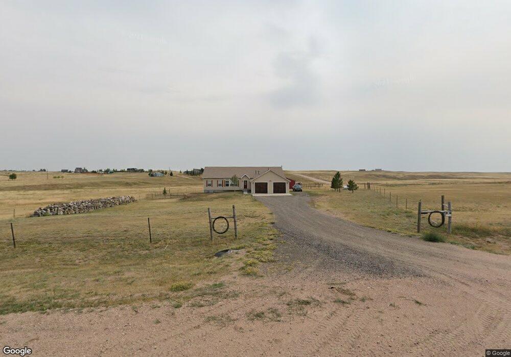
2011 Draw Dr Cheyenne, WY 82009
Estimated Value: $530,000 - $657,458
3
Beds
2
Baths
1,869
Sq Ft
$316/Sq Ft
Est. Value
About This Home
This home is located at 2011 Draw Dr, Cheyenne, WY 82009 and is currently estimated at $590,486, approximately $315 per square foot. 2011 Draw Dr is a home located in Laramie County with nearby schools including Prairie Wind Elementary School, McCormick Junior High School, and Central High School.
Ownership History
Date
Name
Owned For
Owner Type
Purchase Details
Closed on
Jun 12, 2009
Sold by
Kenyon Craig R and Kenyon Kelli F
Bought by
Eckmann David R and Eckmann Dorothy J
Current Estimated Value
Home Financials for this Owner
Home Financials are based on the most recent Mortgage that was taken out on this home.
Original Mortgage
$242,755
Outstanding Balance
$153,872
Interest Rate
4.83%
Mortgage Type
VA
Estimated Equity
$436,614
Purchase Details
Closed on
May 30, 2007
Sold by
Stone Wendy L
Bought by
Kenyon Craig R and Kenyon Kelli F
Home Financials for this Owner
Home Financials are based on the most recent Mortgage that was taken out on this home.
Original Mortgage
$46,094
Interest Rate
6.17%
Mortgage Type
Purchase Money Mortgage
Create a Home Valuation Report for This Property
The Home Valuation Report is an in-depth analysis detailing your home's value as well as a comparison with similar homes in the area
Home Values in the Area
Average Home Value in this Area
Purchase History
| Date | Buyer | Sale Price | Title Company |
|---|---|---|---|
| Eckmann David R | -- | None Available | |
| Kenyon Craig R | -- | None Available |
Source: Public Records
Mortgage History
| Date | Status | Borrower | Loan Amount |
|---|---|---|---|
| Open | Eckmann David R | $242,755 | |
| Previous Owner | Kenyon Craig R | $46,094 |
Source: Public Records
Tax History Compared to Growth
Tax History
| Year | Tax Paid | Tax Assessment Tax Assessment Total Assessment is a certain percentage of the fair market value that is determined by local assessors to be the total taxable value of land and additions on the property. | Land | Improvement |
|---|---|---|---|---|
| 2025 | $3,474 | $42,785 | $7,766 | $35,019 |
| 2024 | $3,474 | $54,685 | $10,354 | $44,331 |
| 2023 | $3,640 | $58,396 | $9,643 | $48,753 |
| 2022 | $3,268 | $51,641 | $9,643 | $41,998 |
| 2021 | $2,813 | $44,775 | $5,710 | $39,065 |
| 2020 | $2,136 | $34,815 | $5,571 | $29,244 |
| 2019 | $2,052 | $33,542 | $5,571 | $27,971 |
| 2018 | $1,592 | $26,935 | $5,194 | $21,741 |
| 2017 | $1,582 | $26,545 | $5,194 | $21,351 |
| 2016 | $1,573 | $26,408 | $5,016 | $21,392 |
| 2015 | $1,522 | $25,638 | $5,016 | $20,622 |
| 2014 | $1,537 | $25,702 | $5,016 | $20,686 |
Source: Public Records
Map
Nearby Homes
- Tract 10 Klipstein Rd
- TBD Klipstein Rd
- Tract 11 Klipstein Rd
- Lot 17 Foxhill Rd
- Lot 18 Foxhill Rd
- 1875 Lauver Ln
- Tract 22 Rich Strike Rd
- Tract 112 Rich Strike Rd
- Tract 116 Rich Strike Rd
- Tract 106 Rich Strike Rd
- Tract 19 Rich Strike Rd
- Tract 110 Rich Strike Rd
- Tract 107 Rich Strike Rd
- Tract 23 Rich Strike Rd
- Tract 113 Rich Strike Rd
- Tract 115 Rich Strike Rd
- Tract 114 Rich Strike Rd
- 7407 Rich Strike Ct
- Tract 103 Charles Jake Ct
- Tract 104 Charles Jake Ct
- 2012 Draw Dr
- 1669 Road 120
- 2020 Draw Dr
- 1660 Ninemile Blvd
- 1668 Ninemile Blvd
- 1645 Road 120
- 1673 Ninemile Blvd
- 2032 Draw Dr
- 1652 Ninemile Blvd
- 1665 Ninemile Blvd
- 2010 Carls Rd
- 2026 Carls Rd
- 2003 Carls Rd
- 2019 Carls Rd
- 1630 Road 120
- 2032 Carls Rd
- 2031 Carls Rd
- 2040 Carls Rd
- 1615 Road 120
- 2035 Carls Rd