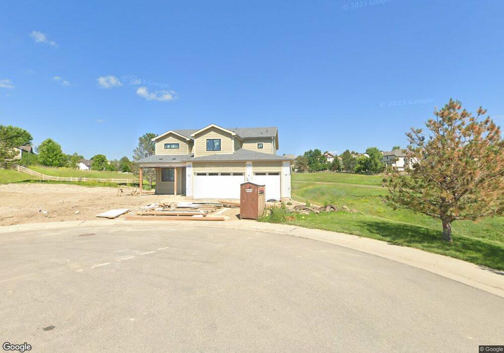
2011 Emerson Ln Superior, CO 80027
Estimated Value: $1,155,207 - $1,323,000
5
Beds
4
Baths
2,759
Sq Ft
$448/Sq Ft
Est. Value
About This Home
This home is located at 2011 Emerson Ln, Superior, CO 80027 and is currently estimated at $1,237,052, approximately $448 per square foot. 2011 Emerson Ln is a home located in Boulder County with nearby schools including Eldorado K-8 School, Superior Elementary School, and Monarch High School.
Ownership History
Date
Name
Owned For
Owner Type
Purchase Details
Closed on
Sep 18, 1998
Sold by
Mcdowell Casey P and Mcdowell Jill K
Bought by
Glaab Richard R and Glaab Catherine A
Current Estimated Value
Home Financials for this Owner
Home Financials are based on the most recent Mortgage that was taken out on this home.
Original Mortgage
$227,150
Outstanding Balance
$48,606
Interest Rate
6.92%
Estimated Equity
$1,188,446
Purchase Details
Closed on
Jan 30, 1998
Sold by
Richmond American Homes Of Colorado Inc
Bought by
Mcdowell Casey P
Home Financials for this Owner
Home Financials are based on the most recent Mortgage that was taken out on this home.
Original Mortgage
$194,800
Interest Rate
6.98%
Mortgage Type
Balloon
Purchase Details
Closed on
Jul 28, 1993
Bought by
Glaab Richard R and Glaab Catherine A
Create a Home Valuation Report for This Property
The Home Valuation Report is an in-depth analysis detailing your home's value as well as a comparison with similar homes in the area
Home Values in the Area
Average Home Value in this Area
Purchase History
| Date | Buyer | Sale Price | Title Company |
|---|---|---|---|
| Glaab Richard R | $303,500 | -- | |
| Mcdowell Casey P | $254,560 | Land Title | |
| Glaab Richard R | -- | -- |
Source: Public Records
Mortgage History
| Date | Status | Borrower | Loan Amount |
|---|---|---|---|
| Open | Glaab Richard R | $227,150 | |
| Previous Owner | Mcdowell Casey P | $194,800 |
Source: Public Records
Tax History Compared to Growth
Tax History
| Year | Tax Paid | Tax Assessment Tax Assessment Total Assessment is a certain percentage of the fair market value that is determined by local assessors to be the total taxable value of land and additions on the property. | Land | Improvement |
|---|---|---|---|---|
| 2025 | $7,992 | $82,919 | $25,325 | $57,594 |
| 2024 | $7,992 | $82,919 | $25,325 | $57,594 |
| 2023 | $1,223 | $87,924 | $22,351 | $69,258 |
| 2022 | $990 | $9,466 | $9,466 | $0 |
| 2021 | $4,922 | $56,092 | $19,477 | $36,615 |
| 2020 | $4,588 | $50,815 | $20,592 | $30,223 |
| 2019 | $4,524 | $50,815 | $20,592 | $30,223 |
| 2018 | $5,009 | $47,887 | $14,256 | $33,631 |
| 2017 | $5,119 | $52,942 | $15,761 | $37,181 |
| 2016 | $4,845 | $43,780 | $14,567 | $29,213 |
| 2015 | $4,604 | $38,566 | $15,442 | $23,124 |
| 2014 | $4,095 | $38,566 | $15,442 | $23,124 |
Source: Public Records
Map
Nearby Homes
- 2007 Erie Ln
- 2225 Clayton Cir
- 2813 Plan at 80027 - Louisville-Superior
- 2788 Plan at 80027 - Louisville-Superior
- 2376 Plan at 80027 - Louisville-Superior
- 2303 Plan at 80027 - Louisville-Superior
- 2040 Plan at 80027 - Louisville-Superior
- 2093 Plan at 80027 - Louisville-Superior
- 2106 Plan at 80027 - Louisville-Superior
- 1579 Plan at 80027 - Louisville-Superior
- 1823 Plan at 80027 - Louisville-Superior
- 1640 Plan at 80027 - Louisville-Superior
- 520 Campo Way
- 2387 Bristol St
- 2417 Bristol St
- 1820 Vernon Ln
- 2515 Andrew Dr
- 888 Northern Way
- 882 Eldorado Dr
- 1757 High Plains Ct
- 2021 Emerson Ln
- 2031 Emerson Ln
- 2016 Emerson Ln
- 2041 Emerson Ln
- 435 Andrew Way
- 2036 Emerson Ln
- 425 Andrew Way
- 2056 Emerson Ln
- 2051 Emerson Ln
- 2061 Emerson Ln
- 593 Eaton Cir
- 415 Andrew Way
- 2076 Emerson Ln
- 430 Andrew Way
- 1950 Eldorado Cir
- 1950 Eldorado Dr
- 2071 Emerson Ln
- 603 Eaton Cir
- 1940 Eldorado Dr
- 405 Andrew Way