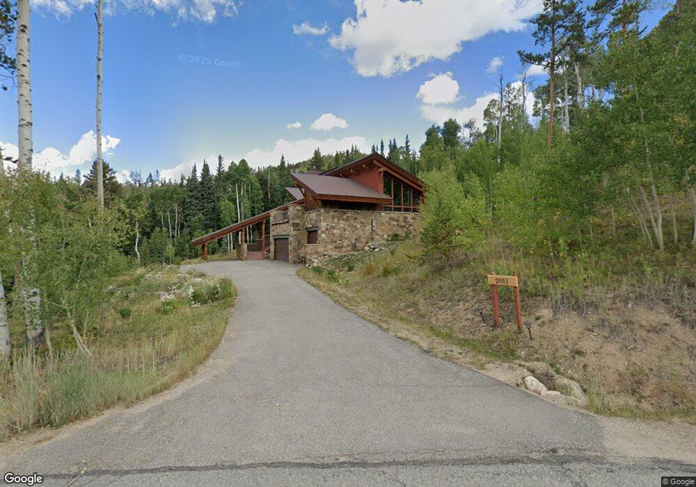
2011 Hamilton Creek Rd Silverthorne, CO 80498
Estimated Value: $2,700,000 - $3,704,000
4
Beds
2
Baths
3,112
Sq Ft
$1,090/Sq Ft
Est. Value
About This Home
This home is located at 2011 Hamilton Creek Rd, Silverthorne, CO 80498 and is currently estimated at $3,390,722, approximately $1,089 per square foot. 2011 Hamilton Creek Rd is a home located in Summit County with nearby schools including Silverthorne Elementary School, Summit Middle School, and Summit High School.
Ownership History
Date
Name
Owned For
Owner Type
Purchase Details
Closed on
Feb 26, 2020
Sold by
Worrell Rowland H
Bought by
Worrell Rowland H and Worrell Judy Bergner
Current Estimated Value
Home Financials for this Owner
Home Financials are based on the most recent Mortgage that was taken out on this home.
Original Mortgage
$705,800
Outstanding Balance
$623,895
Interest Rate
3.4%
Mortgage Type
VA
Estimated Equity
$2,766,827
Purchase Details
Closed on
Jun 26, 2013
Sold by
Hamilton Creek Association
Bought by
Worrell Rowland H
Home Financials for this Owner
Home Financials are based on the most recent Mortgage that was taken out on this home.
Original Mortgage
$460,000
Interest Rate
4%
Mortgage Type
Construction
Purchase Details
Closed on
Oct 30, 2007
Sold by
Worrell Celia Elizabeth
Bought by
Worrell Roland Hill
Create a Home Valuation Report for This Property
The Home Valuation Report is an in-depth analysis detailing your home's value as well as a comparison with similar homes in the area
Home Values in the Area
Average Home Value in this Area
Purchase History
| Date | Buyer | Sale Price | Title Company |
|---|---|---|---|
| Worrell Rowland H | -- | Servicelink | |
| Worrell Rowland H | -- | Land Title Guarantee Company | |
| Worrell Roland Hill | -- | None Available |
Source: Public Records
Mortgage History
| Date | Status | Borrower | Loan Amount |
|---|---|---|---|
| Open | Worrell Rowland H | $705,800 | |
| Previous Owner | Worrell Rowland H | $460,000 |
Source: Public Records
Tax History Compared to Growth
Tax History
| Year | Tax Paid | Tax Assessment Tax Assessment Total Assessment is a certain percentage of the fair market value that is determined by local assessors to be the total taxable value of land and additions on the property. | Land | Improvement |
|---|---|---|---|---|
| 2024 | $19,274 | $215,378 | -- | -- |
| 2023 | $19,274 | $204,993 | $0 | $0 |
| 2022 | $13,270 | $136,609 | $0 | $0 |
| 2021 | $13,495 | $140,540 | $0 | $0 |
| 2020 | $11,859 | $128,279 | $0 | $0 |
| 2019 | $11,766 | $128,279 | $0 | $0 |
| 2018 | $10,545 | $112,936 | $0 | $0 |
| 2017 | $10,031 | $112,936 | $0 | $0 |
| 2016 | $9,757 | $108,934 | $0 | $0 |
| 2015 | $9,587 | $108,934 | $0 | $0 |
| 2014 | $3,437 | $38,782 | $0 | $0 |
| 2013 | -- | $53,657 | $0 | $0 |
Source: Public Records
Map
Nearby Homes
- 530 Lakeview Cir
- 990 Lakeview Cir Unit 3
- 990 Lakeview Cir
- 2206 Hamilton Creek Rd
- 2210 Hamilton Creek Rd
- 690 Lakeview Cir
- 2331 Hamilton Creek Rd
- 18 Heather's Way Trail
- 901 Lakeview Cir
- 50 Spinning Leaf Trail
- 801 Lakeview Cir
- 731 Lakeview Cir
- 65 Aerie Dr
- 52 Buckskin Ln
- 85 Pheasant Tail Ln
- 71 Pheasant Tail Ln
- 468 Fly Line Dr
- 84 Mayfly Dr
- 70 Mayfly Dr Unit 3
- 1961 Hamilton Creek Rd
- 1974 Hamilton Creek Rd
- 1972 Hamilton Creek Rd
- 1978 Hamilton Creek Rd
- 1976 Hamilton Creek Rd
- 1980 Hamilton Creek Rd
- 1861 Hamilton Creek Rd
- 230 Lakeview Cir
- 90 Nordic Trail
- 115 Lakeview Dr
- 291 Lakeview Cir
- 411 Lakeview Cir
- 40 Nordic Trail
- 1792 Hamilton Creek Rd
- 89 Lakeview Cir
- 30 Nordic Trail
- 461 Lakeview Cir
- 470 Lakeview Cir
- 50 Nordic Trail
- 321 Lakeview Cir