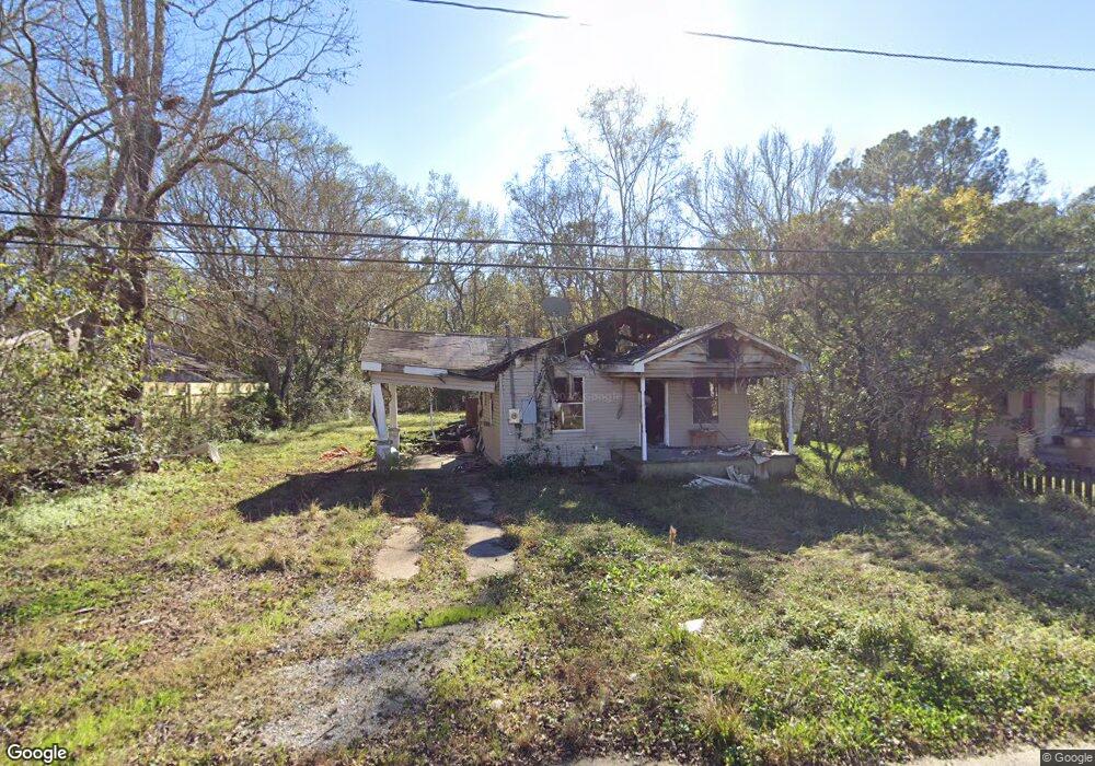
2011 Height St Mobile, AL 36605
Riviera NeighborhoodEstimated Value: $64,000
Studio
1
Bath
953
Sq Ft
$67/Sq Ft
Est. Value
About This Home
This home is located at 2011 Height St, Mobile, AL 36605 and is currently estimated at $64,000, approximately $67 per square foot. 2011 Height St is a home located in Mobile County with nearby schools including Maryvale Elementary School, Williamson High School, and Revelation Christian School.
Ownership History
Date
Name
Owned For
Owner Type
Purchase Details
Closed on
Jan 3, 2020
Sold by
Consumer Mortgage Co Inc
Bought by
Dixon Austin B
Current Estimated Value
Home Financials for this Owner
Home Financials are based on the most recent Mortgage that was taken out on this home.
Original Mortgage
$20,000
Outstanding Balance
$19,412
Interest Rate
12%
Mortgage Type
Unknown
Estimated Equity
$44,588
Purchase Details
Closed on
May 14, 2007
Sold by
Spradlin Julie
Bought by
Consumer Mortgage Co Inc
Purchase Details
Closed on
Mar 21, 2007
Sold by
Poellnitz Johnny W and Poellnitz Maria R
Bought by
Consumer Mortgage Co Inc
Purchase Details
Closed on
May 27, 2005
Sold by
Poellnitz Johnny W and Poellnitz Maria A
Bought by
Spradlin Julie
Create a Home Valuation Report for This Property
The Home Valuation Report is an in-depth analysis detailing your home's value as well as a comparison with similar homes in the area
Home Values in the Area
Average Home Value in this Area
Purchase History
| Date | Buyer | Sale Price | Title Company |
|---|---|---|---|
| Dixon Austin B | $20,000 | None Available | |
| Consumer Mortgage Co Inc | -- | None Available | |
| Consumer Mortgage Co Inc | -- | None Available | |
| Spradlin Julie | $2,424 | -- |
Source: Public Records
Mortgage History
| Date | Status | Borrower | Loan Amount |
|---|---|---|---|
| Open | Dixon Austin B | $20,000 |
Source: Public Records
Tax History
| Year | Tax Paid | Tax Assessment Tax Assessment Total Assessment is a certain percentage of the fair market value that is determined by local assessors to be the total taxable value of land and additions on the property. | Land | Improvement |
|---|---|---|---|---|
| 2025 | $112 | $1,600 | $1,600 | $0 |
| 2024 | $112 | $1,600 | $1,600 | $0 |
| 2023 | $112 | $6,420 | $1,600 | $4,820 |
| 2022 | $391 | $6,160 | $1,600 | $4,560 |
| 2021 | $391 | $6,160 | $1,600 | $4,560 |
| 2020 | $391 | $6,160 | $1,600 | $4,560 |
| 2019 | $431 | $6,780 | $1,600 | $5,180 |
| 2018 | $479 | $7,540 | $0 | $0 |
| 2017 | $516 | $8,120 | $0 | $0 |
| 2016 | $612 | $9,640 | $0 | $0 |
| 2013 | $537 | $8,300 | $0 | $0 |
Source: Public Records
Map
Nearby Homes
- 1353 Brooke Ave
- 1411 Brooke Ave
- 1301 Willow Ln
- 1303 Greenwood Ave
- 1300 Willow Ln
- 1255 Horton Dr
- 2073 Foster Ln
- 1620 W Martin Dr
- 2375 S Buena Dr
- 2450 Odette Ave
- 2450 Odette Ave Unit 19 & 20
- 1055 Bishop Wilmer Dr
- 1500 Navco Rd
- 2103 E Victory Dr
- 1706 Bass Dr
- 1611 Forrest St
- 1455 Houston St
- 1564 Forrest St
- 2001 Ostrom Dr
- 2007 Halls Mill Rd
- 2009 Height St
- 2053 Height St
- 2012 Height St
- 1310 Dauphin Island Pkwy
- 2050 Height St
- 2055 Height St Unit 9
- 2052 Height St
- 2010 Robinson Dr
- 1318 Dauphin Island Pkwy
- 2054 Height St
- 2056 Height St
- 2059 Height St E Unit 9&10
- 2059 Height St Unit 10
- 2059 Height St Unit 9&10
- 1300 Dauphin Island Pkwy
- 2058 Height St
- 2061 Height St
- 2050 Robinson Dr
- 2060 Height St
- 2101 Height St
Your Personal Tour Guide
Ask me questions while you tour the home.