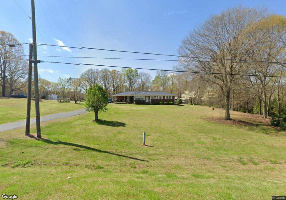
2011 Highway 98 W Danielsville, GA 30633
Estimated Value: $255,000 - $289,000
--
Bed
2
Baths
1,601
Sq Ft
$168/Sq Ft
Est. Value
About This Home
This home is located at 2011 Highway 98 W, Danielsville, GA 30633 and is currently estimated at $269,075, approximately $168 per square foot. 2011 Highway 98 W is a home located in Madison County with nearby schools including Madison County High School and Union Christian Academy.
Ownership History
Date
Name
Owned For
Owner Type
Purchase Details
Closed on
Jul 16, 2021
Sold by
Hardman Inez Hill Estate
Bought by
Hardman David Jackson
Current Estimated Value
Home Financials for this Owner
Home Financials are based on the most recent Mortgage that was taken out on this home.
Original Mortgage
$89,200
Outstanding Balance
$67,160
Interest Rate
2.93%
Mortgage Type
New Conventional
Estimated Equity
$201,915
Purchase Details
Closed on
Jan 1, 1988
Bought by
Hardman Henry Jackso
Create a Home Valuation Report for This Property
The Home Valuation Report is an in-depth analysis detailing your home's value as well as a comparison with similar homes in the area
Home Values in the Area
Average Home Value in this Area
Purchase History
| Date | Buyer | Sale Price | Title Company |
|---|---|---|---|
| Hardman David Jackson | -- | -- | |
| Hardman David Jackson | $175,000 | -- | |
| Hardman Henry Jackso | -- | -- |
Source: Public Records
Mortgage History
| Date | Status | Borrower | Loan Amount |
|---|---|---|---|
| Open | Hardman David Jackson | $89,200 | |
| Closed | Hardman David Jackson | $89,200 |
Source: Public Records
Tax History Compared to Growth
Tax History
| Year | Tax Paid | Tax Assessment Tax Assessment Total Assessment is a certain percentage of the fair market value that is determined by local assessors to be the total taxable value of land and additions on the property. | Land | Improvement |
|---|---|---|---|---|
| 2024 | $1,867 | $71,728 | $20,958 | $50,770 |
| 2023 | $1,988 | $65,118 | $17,465 | $47,653 |
| 2022 | $1,500 | $54,369 | $12,008 | $42,361 |
| 2021 | $1,047 | $44,295 | $12,008 | $32,287 |
| 2020 | $1,001 | $42,548 | $10,261 | $32,287 |
| 2019 | $992 | $41,901 | $10,261 | $31,640 |
| 2018 | $934 | $39,940 | $9,388 | $30,552 |
| 2017 | $1,172 | $40,704 | $8,732 | $31,972 |
| 2016 | $762 | $36,531 | $8,732 | $27,799 |
| 2015 | $761 | $36,531 | $8,732 | $27,799 |
| 2014 | $766 | $36,620 | $8,733 | $27,887 |
| 2013 | -- | $36,620 | $8,733 | $27,887 |
Source: Public Records
Map
Nearby Homes
- 135 Woodpecker Point
- 135 Woodpecker Pte
- 0 Brewer Phillips Rd Unit 10462348
- 0 New Haven Church Rd Unit CL334534
- 0 New Haven Church Rd Unit 10566118
- 0 New Haven Church Rd Unit CL334526
- 0 New Haven Church Rd Unit 10566119
- 28 Acres Irvin Kirk Rd
- 0 Highway 29 N Unit 10525658
- 155 Mulberry Ln
- 170 Northridge Dr
- 150 Northridge Dr Unit 3
- 150 Northridge Dr
- 140 Northridge Dr
- 140 Northridge Dr Unit 6
- 112 Northridge Dr Unit 8
- 112 Northridge Dr
- 96 Northridge Dr Unit 10
- 96 Northridge Dr
- 49 Ridgeway Dr
- 1951 Highway 98 W
- 107 Lakeview Cir
- 31 Ingram Rd
- 71 Bond Rd
- 1919 Highway 98 W
- 14 Ingram Rd
- 36 Ingram Rd
- 121 Bond Rd
- 160 Lakeview Cir
- 160 Lakeview Cir Unit 11
- 145 Bond Rd
- 122 Brewer Phillips Rd
- Lot 1 Lakeview Circle Rd
- 699 Lakeview Circle Rd
- 0 Lakeview Circle Rd Unit 8104425
- 2165 Highway 98 W
- 0 Bond Rd Unit 8243488
- 194 Brewer Phillips Rd
- Lot 19 the Reserve at Roger's Mill
- Lot 17 the Reserve at Roger's Mill