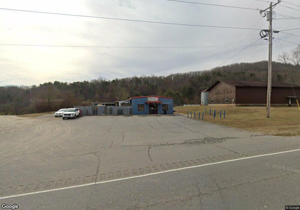
2011 Hwy 64 W Hayesville, NC 28904
Estimated Value: $334,000 - $450,000
--
Bed
2
Baths
2,440
Sq Ft
$158/Sq Ft
Est. Value
About This Home
This home is located at 2011 Hwy 64 W, Hayesville, NC 28904 and is currently estimated at $385,584, approximately $158 per square foot. 2011 Hwy 64 W is a home with nearby schools including Hayesville Elementary School, Hayesville Middle School, and Hayesville High School.
Ownership History
Date
Name
Owned For
Owner Type
Purchase Details
Closed on
Jul 7, 2023
Sold by
Fleming Keith and Fleming Linda
Bought by
Simpson Scott Duncan and Banuelos Lorena Rodarte
Current Estimated Value
Home Financials for this Owner
Home Financials are based on the most recent Mortgage that was taken out on this home.
Original Mortgage
$225,600
Outstanding Balance
$133,156
Interest Rate
6.57%
Mortgage Type
Construction
Estimated Equity
$252,428
Purchase Details
Closed on
Sep 1, 2016
Sold by
Blankenship Andrew and Blankenship Dianne Crone
Bought by
Fleming Keith and Fleming Linda
Home Financials for this Owner
Home Financials are based on the most recent Mortgage that was taken out on this home.
Original Mortgage
$190,000
Interest Rate
3.45%
Mortgage Type
Seller Take Back
Create a Home Valuation Report for This Property
The Home Valuation Report is an in-depth analysis detailing your home's value as well as a comparison with similar homes in the area
Home Values in the Area
Average Home Value in this Area
Purchase History
| Date | Buyer | Sale Price | Title Company |
|---|---|---|---|
| Simpson Scott Duncan | $282,000 | None Listed On Document | |
| Fleming Keith | $200,000 | None Available |
Source: Public Records
Mortgage History
| Date | Status | Borrower | Loan Amount |
|---|---|---|---|
| Open | Simpson Scott Duncan | $225,600 | |
| Previous Owner | Fleming Keith | $190,000 |
Source: Public Records
Tax History Compared to Growth
Tax History
| Year | Tax Paid | Tax Assessment Tax Assessment Total Assessment is a certain percentage of the fair market value that is determined by local assessors to be the total taxable value of land and additions on the property. | Land | Improvement |
|---|---|---|---|---|
| 2025 | $1,053 | $224,000 | $72,000 | $152,000 |
| 2024 | $1,053 | $206,200 | $72,000 | $134,200 |
| 2023 | $955 | $206,200 | $72,000 | $134,200 |
| 2022 | $0 | $206,200 | $72,000 | $134,200 |
| 2021 | $949 | $206,200 | $72,000 | $134,200 |
| 2020 | $949 | $206,200 | $72,000 | $134,200 |
| 2019 | $945 | $205,400 | $72,000 | $133,400 |
| 2018 | $931 | $202,300 | $72,000 | $130,300 |
| 2016 | -- | $258,278 | $99,840 | $158,438 |
| 2015 | -- | $258,278 | $99,840 | $158,438 |
| 2014 | -- | $258,278 | $99,840 | $158,438 |
Source: Public Records
Map
Nearby Homes
- TBD Us Hwy 64 W
- 311 Blair Creek Ridge
- 1045 Old Highway 64 W
- na Old Highway 64 W
- B&D W Cherry Rd
- 488 W Cherry Rd
- 215 Hickory Ridge Cir
- Lot 6 Hickory Ridge Cir
- Lot 4 Hickory Ridge Cir
- Lot 5 Hickory Ridge Cir
- Lot 8 Hickory Ridge Cir
- Lot 3 Hickory Ridge Cir
- Lot 10 Hickory Ridge Cir
- Lot 7 Hickory Ridge Cir
- Lot 9 Hickory Ridge Cir
- Lot 2 Hickory Ridge Cir
- Lot 1 Hickory Ridge Cir
- 3282 Qualla Rd
- Lot 2A Wildwood
- 2053 Hwy 64 W
- 2069 Highwy 64 W
- 2055 Hwy 64 W
- 4 Dairy Way
- 4 Dairy Way Unit Lot 4
- 2 Dairy Way
- 2 Dairy Way Unit Lot 2
- 34 Sunrise Place
- 130 Dairy Way
- 130 Dairy Way
- 1 Dairy Way
- 131 Dairy Way
- 207 Blankenship Ln
- 1887 Hwy 64 W
- 226 Blankenship Ln
- 212 Dairy Way
- 4 Dairy Way
- #1 Sunrise Place
- 10 Sunrise Place
- 1 Sunrise Place
