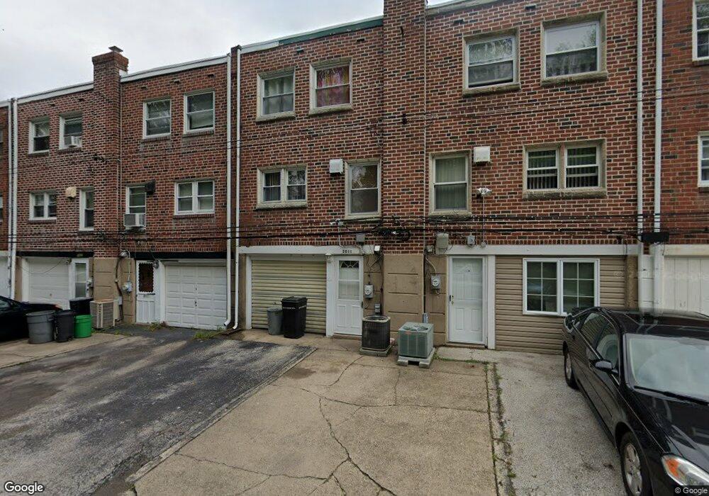
2011 Kent Rd Folcroft, PA 19032
Estimated Value: $177,000 - $218,000
3
Beds
1
Bath
1,152
Sq Ft
$170/Sq Ft
Est. Value
About This Home
This home is located at 2011 Kent Rd, Folcroft, PA 19032 and is currently estimated at $195,749, approximately $169 per square foot. 2011 Kent Rd is a home located in Delaware County with nearby schools including Delcroft School, Academy Park High School, and Liberty Baptist Academy.
Ownership History
Date
Name
Owned For
Owner Type
Purchase Details
Closed on
Dec 28, 2021
Sold by
Lisamarie Verdi
Bought by
Strand Lavonne
Current Estimated Value
Home Financials for this Owner
Home Financials are based on the most recent Mortgage that was taken out on this home.
Original Mortgage
$128,000
Outstanding Balance
$118,646
Interest Rate
3.56%
Mortgage Type
New Conventional
Estimated Equity
$77,103
Purchase Details
Closed on
Jun 24, 2010
Sold by
Strand Lavonne and Strand Lisa
Bought by
Verdi Lisamarie and Strand Lisa
Purchase Details
Closed on
Feb 28, 2003
Sold by
Burns Michael B and Burns Catherine M
Bought by
Strand Lavonne and Strand Lisa
Purchase Details
Closed on
Oct 30, 1996
Sold by
Rinehart Christopher and Rinehart Marie A
Bought by
Burns Michael B and Burns Catherine M
Home Financials for this Owner
Home Financials are based on the most recent Mortgage that was taken out on this home.
Original Mortgage
$64,928
Interest Rate
8.1%
Mortgage Type
FHA
Create a Home Valuation Report for This Property
The Home Valuation Report is an in-depth analysis detailing your home's value as well as a comparison with similar homes in the area
Home Values in the Area
Average Home Value in this Area
Purchase History
| Date | Buyer | Sale Price | Title Company |
|---|---|---|---|
| Strand Lavonne | $160,000 | Land Services Usa | |
| Verdi Lisamarie | -- | None Available | |
| Strand Lavonne | $81,600 | -- | |
| Burns Michael B | $65,000 | -- |
Source: Public Records
Mortgage History
| Date | Status | Borrower | Loan Amount |
|---|---|---|---|
| Open | Strand Lavonne | $128,000 | |
| Previous Owner | Burns Michael B | $64,928 |
Source: Public Records
Tax History
| Year | Tax Paid | Tax Assessment Tax Assessment Total Assessment is a certain percentage of the fair market value that is determined by local assessors to be the total taxable value of land and additions on the property. | Land | Improvement |
|---|---|---|---|---|
| 2025 | $4,169 | $100,620 | $23,690 | $76,930 |
| 2024 | $4,169 | $100,620 | $23,690 | $76,930 |
| 2023 | $4,053 | $100,620 | $23,690 | $76,930 |
| 2022 | $3,834 | $100,620 | $23,690 | $76,930 |
| 2021 | $5,444 | $100,620 | $23,690 | $76,930 |
| 2020 | $3,446 | $60,000 | $18,140 | $41,860 |
| 2019 | $3,368 | $60,000 | $18,140 | $41,860 |
| 2018 | $3,287 | $60,000 | $0 | $0 |
| 2017 | $3,130 | $60,000 | $0 | $0 |
| 2016 | $329 | $60,000 | $0 | $0 |
| 2015 | $329 | $60,000 | $0 | $0 |
| 2014 | $329 | $60,000 | $0 | $0 |
Source: Public Records
Map
Nearby Homes
- 2038 Kent Rd
- 1053 Taylor Dr
- 992 Taylor Dr
- 1062 Taylor Dr
- 2098 Kent Rd
- 1088 Taylor Dr
- 1984 Carter Rd
- 948 Grant Rd
- 753 Bennington Rd
- 842 School Ln
- 1196 Taylor Dr
- 340-342A South Ave
- 336 338 S South Ave
- 334 South Ave
- 328 330 S South Ave
- 551 Delaware Ave
- 215 Chippewa St
- 1821 Shallcross Ave
- 100 E Glenolden Ave Unit B6
- 100 E Glenolden Ave Unit D17
Your Personal Tour Guide
Ask me questions while you tour the home.