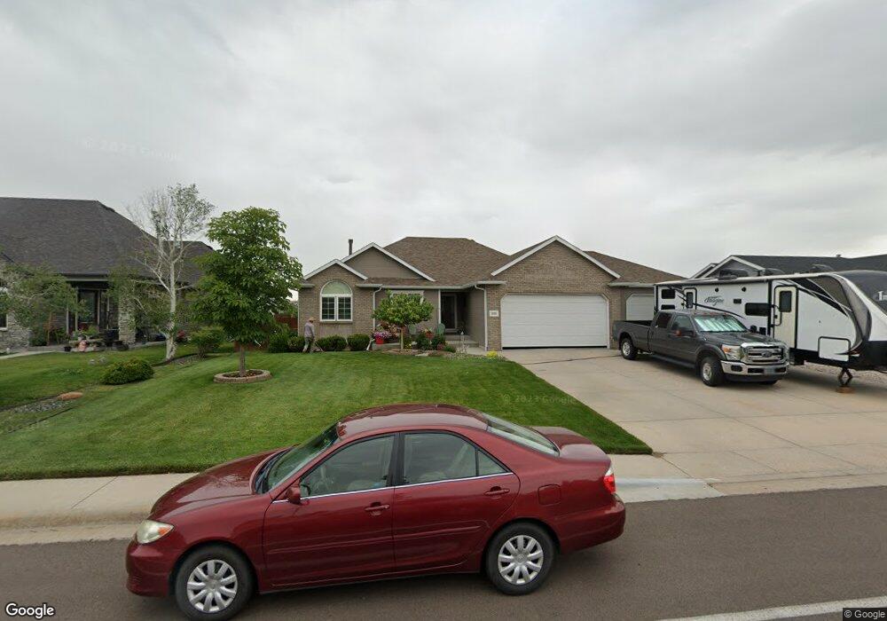
2011 Meadow Dr Cheyenne, WY 82001
Estimated Value: $432,000 - $461,000
Studio
--
Bath
1,420
Sq Ft
$317/Sq Ft
Est. Value
About This Home
This home is located at 2011 Meadow Dr, Cheyenne, WY 82001 and is currently estimated at $450,383, approximately $317 per square foot. 2011 Meadow Dr is a home located in Laramie County with nearby schools including Sunrise Elementary School, Johnson Junior High School, and South High School.
Ownership History
Date
Name
Owned For
Owner Type
Purchase Details
Closed on
Apr 22, 2005
Sold by
Dan Gregg Construction Llc
Bought by
Sherman Robert R and Sherman Kathy A
Current Estimated Value
Home Financials for this Owner
Home Financials are based on the most recent Mortgage that was taken out on this home.
Original Mortgage
$24,686
Interest Rate
6.06%
Mortgage Type
Stand Alone Second
Purchase Details
Closed on
Dec 21, 2004
Sold by
Hess Kenneth E and Hess Phyllis
Bought by
Dan Gregg Construction Llc
Home Financials for this Owner
Home Financials are based on the most recent Mortgage that was taken out on this home.
Original Mortgage
$183,000
Interest Rate
5.78%
Mortgage Type
Purchase Money Mortgage
Create a Home Valuation Report for This Property
The Home Valuation Report is an in-depth analysis detailing your home's value as well as a comparison with similar homes in the area
Purchase History
| Date | Buyer | Sale Price | Title Company |
|---|---|---|---|
| Sherman Robert R | -- | -- | |
| Dan Gregg Construction Llc | -- | -- |
Source: Public Records
Mortgage History
| Date | Status | Borrower | Loan Amount |
|---|---|---|---|
| Closed | Sherman Robert R | $24,686 | |
| Open | Sherman Robert R | $197,492 | |
| Previous Owner | Dan Gregg Construction Llc | $183,000 |
Source: Public Records
Tax History
| Year | Tax Paid | Tax Assessment Tax Assessment Total Assessment is a certain percentage of the fair market value that is determined by local assessors to be the total taxable value of land and additions on the property. | Land | Improvement |
|---|---|---|---|---|
| 2025 | $2,565 | $20,230 | $2,917 | $17,313 |
| 2024 | $2,565 | $39,272 | $5,833 | $33,439 |
| 2023 | $2,592 | $39,657 | $5,833 | $33,824 |
| 2022 | $2,464 | $37,141 | $5,833 | $31,308 |
| 2021 | $2,258 | $34,209 | $5,833 | $28,376 |
| 2020 | $2,152 | $32,837 | $5,833 | $27,004 |
| 2019 | $1,940 | $29,873 | $5,833 | $24,040 |
| 2018 | $1,857 | $28,966 | $5,777 | $23,189 |
| 2017 | $1,812 | $28,111 | $4,490 | $23,621 |
| 2016 | $1,799 | $27,919 | $4,480 | $23,439 |
| 2015 | $1,700 | $26,541 | $4,480 | $22,061 |
| 2014 | $1,707 | $26,484 | $4,480 | $22,004 |
Source: Public Records
Map
Nearby Homes
- 2010 Meadow Dr
- 1609 Maroon Dr
- 4904 E Pershing Blvd
- 4800 Ranch House Way
- 4716 Saddleback Dr
- 4709 Spur Dr
- TBD Tract 3 E Pershing Blvd
- TBD Taft Ave
- 5805 Kennedy Dr
- 1218 Phipps Ave
- 4714 Wright Ct
- 3537 Pierce Ave
- 1202 Phipps Ave
- 100 Tampa Ct
- 4415 Springer Ct
- 5826 Calumet Dr
- 4306 Cheyenne St
- 4400 E 13th St
- 6119 Atlantic Dr
- 5908 Kenosha St
- 2003 Meadow Dr
- 2019 Meadow Dr
- 2027 Meadow Dr
- 1927 Meadow Dr
- 2018 Meadow Dr
- 2002 Meadow Dr
- 1919 Meadow Dr
- 2103 Meadow Dr
- 1926 Meadow Dr
- 2024 Meadow Dr
- 2019 Gettysburg Dr
- 2015 Gettysburg Dr
- 1911 Meadow Dr
- 1918 Meadow Dr
- 2111 Meadow Dr
- 2009 Gettysburg Dr
- 2106 Meadow Dr
- 2003 Gettysburg Dr
- 2023 Gettysburg Dr
- 1910 Meadow Dr
Your Personal Tour Guide
Ask me questions while you tour the home.