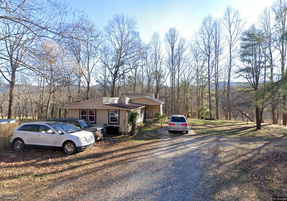
2011 Mulky Gap Rd Blairsville, GA 30512
Estimated Value: $187,000 - $318,000
2
Beds
2
Baths
1,504
Sq Ft
$170/Sq Ft
Est. Value
About This Home
This home is located at 2011 Mulky Gap Rd, Blairsville, GA 30512 and is currently estimated at $255,644, approximately $169 per square foot. 2011 Mulky Gap Rd is a home located in Union County with nearby schools including Union County Primary School, Union County Elementary School, and Union County Middle School.
Ownership History
Date
Name
Owned For
Owner Type
Purchase Details
Closed on
Aug 1, 2022
Sold by
Payne Billy
Bought by
Webb Amy L
Current Estimated Value
Purchase Details
Closed on
Dec 12, 2011
Sold by
Dixon Martha G
Bought by
Payne Billy and Payne Ashly
Purchase Details
Closed on
May 7, 2001
Sold by
Seymour Inc
Bought by
Dixon Martha G
Purchase Details
Closed on
Aug 16, 1977
Bought by
Seymour Inc
Create a Home Valuation Report for This Property
The Home Valuation Report is an in-depth analysis detailing your home's value as well as a comparison with similar homes in the area
Home Values in the Area
Average Home Value in this Area
Purchase History
| Date | Buyer | Sale Price | Title Company |
|---|---|---|---|
| Webb Amy L | $90,000 | -- | |
| Payne Billy | $38,000 | -- | |
| Dixon Martha G | $46,000 | -- | |
| Seymour Inc | $3,300 | -- |
Source: Public Records
Tax History Compared to Growth
Tax History
| Year | Tax Paid | Tax Assessment Tax Assessment Total Assessment is a certain percentage of the fair market value that is determined by local assessors to be the total taxable value of land and additions on the property. | Land | Improvement |
|---|---|---|---|---|
| 2024 | $668 | $56,556 | $7,200 | $49,356 |
| 2023 | $479 | $55,580 | $7,200 | $48,380 |
| 2022 | $616 | $46,284 | $6,680 | $39,604 |
| 2021 | $562 | $35,656 | $3,800 | $31,856 |
| 2020 | $424 | $22,418 | $8,031 | $14,387 |
| 2019 | $401 | $22,418 | $8,031 | $14,387 |
| 2018 | $394 | $22,418 | $8,031 | $14,387 |
| 2017 | $394 | $22,418 | $8,031 | $14,387 |
| 2016 | $394 | $22,418 | $8,031 | $14,387 |
| 2015 | $397 | $22,418 | $8,031 | $14,387 |
| 2013 | -- | $22,418 | $8,030 | $14,387 |
Source: Public Records
Map
Nearby Homes
- 392 Poplar Ridge Dr
- 78 Enotah Ln
- 718 Hidden Lake Rd
- 330 Coosa Run
- 273 Coosa Valley Rd
- 823 Hidden Lake Rd
- 497 Hidden Lake Rd
- 50 Henry Young Ln
- 10 ACRES Mount Pleasant Church Rd
- 18.6Acre Mount Pleasant Church Rd
- 20 ACRES Mount Pleasant Church Rd
- 20 Acr Mount Pleasant Church Rd
- 13.94AC Mount Pleasant Church Rd
- 10 Acres Mount Pleasant Church Dr
- Lot 10 Lower Fox Trail
- #4 Lower Fox Trail
- #3 Lower Fox Trail
- 210 Mt Pleasant Ridge
- 371 Coosa Way
- 277 Hamilton Rd
- 7 Ashbee Overlook
- 2057 Mulky Gap Rd
- 0 Mulkey Gap Rd Unit 106741
- 0 Mulkey Gap Rd
- 2056 Mulkey Gap Rd
- 85 Ashbee
- 1937 Mulkey Gap Rd
- 359 Poplar Ridge Dr
- 373 Poplar Ridge Dr
- 2154 Mulky Gap Rd
- 2154 Mulky Gap Rd
- 2126 Mulky Gap Rd
- 1838 Mulky Gap Rd
- 403 Poplar Ridge Dr
- 2235 Mulky Gap Rd
- 2235 Mulky Gap Rd
- 404 Poplar Ridge Dr
- 2889 Poplar Ridge Dr
- 682 Robertson Cir
- 427 Poplar Ridge Dr