Estimated Value: $173,000 - $271,000
3
Beds
2
Baths
1,375
Sq Ft
$166/Sq Ft
Est. Value
About This Home
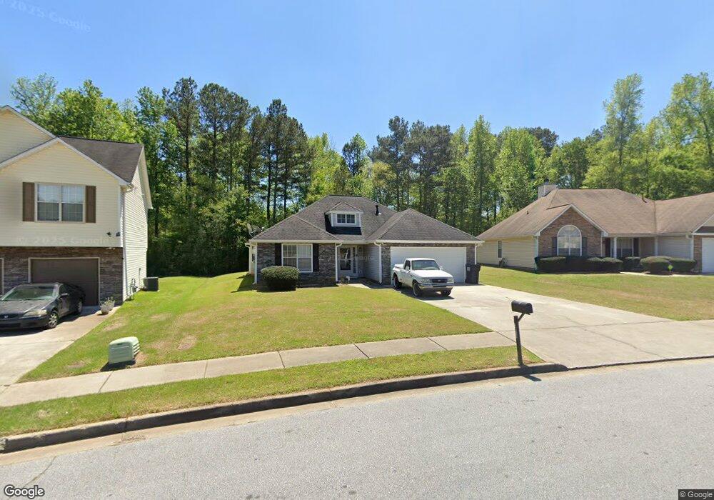
This home is located at 2011 Owens Trail, Rex, GA 30273 and is currently estimated at $227,841, approximately $165 per square foot. 2011 Owens Trail is a home located in Clayton County with nearby schools including Thurgood Marshall Elementary School, Adamson Middle School, and Morrow High School.
Ownership History
Date
Name
Owned For
Owner Type
Purchase Details
Closed on
Mar 30, 2010
Sold by
Us Bk National Assn
Bought by
Coleman Debra F
Current Estimated Value
Purchase Details
Closed on
Jan 5, 2010
Sold by
Sothsavath Anousath D
Bought by
Us Bk National Assn
Purchase Details
Closed on
Sep 29, 2000
Sold by
Tim Jones Communities Inc
Bought by
Sothsavath Anousath D
Home Financials for this Owner
Home Financials are based on the most recent Mortgage that was taken out on this home.
Original Mortgage
$103,450
Interest Rate
7.97%
Mortgage Type
New Conventional
Create a Home Valuation Report for This Property
The Home Valuation Report is an in-depth analysis detailing your home's value as well as a comparison with similar homes in the area
Home Values in the Area
Average Home Value in this Area
Purchase History
| Date | Buyer | Sale Price | Title Company |
|---|---|---|---|
| Coleman Debra F | $58,000 | -- | |
| Us Bk National Assn | $80,000 | -- | |
| Us Bk National Assn | $80,000 | -- | |
| Sothsavath Anousath D | $108,900 | -- |
Source: Public Records
Mortgage History
| Date | Status | Borrower | Loan Amount |
|---|---|---|---|
| Previous Owner | Sothsavath Anousath D | $103,450 |
Source: Public Records
Tax History
| Year | Tax Paid | Tax Assessment Tax Assessment Total Assessment is a certain percentage of the fair market value that is determined by local assessors to be the total taxable value of land and additions on the property. | Land | Improvement |
|---|---|---|---|---|
| 2025 | $3,102 | $80,000 | $8,800 | $71,200 |
| 2024 | $3,159 | $80,000 | $8,800 | $71,200 |
| 2023 | $2,888 | $80,000 | $8,800 | $71,200 |
| 2022 | $2,462 | $61,760 | $8,800 | $52,960 |
| 2021 | $2,146 | $53,360 | $8,800 | $44,560 |
| 2020 | $2,067 | $50,733 | $8,800 | $41,933 |
| 2019 | $1,697 | $40,857 | $6,000 | $34,857 |
| 2018 | $1,617 | $38,892 | $6,000 | $32,892 |
| 2017 | $1,674 | $40,208 | $6,000 | $34,208 |
| 2016 | $1,448 | $34,649 | $6,000 | $28,649 |
| 2015 | $1,436 | $0 | $0 | $0 |
| 2014 | $1,348 | $32,926 | $6,000 | $26,926 |
Source: Public Records
Map
Nearby Homes
- 6135 Stone Creek Ln
- 6050 Randy Ln
- 2815 Teal Landing Dr
- 2835 Randy Ct Unit 4
- 2756 Kathie Ln
- 3099 Chippewa Dr
- 6266 Culver Dr
- 6082 Kathie Ct
- 5640 Laney Dr
- 5652 Laney Dr
- 2731 Lynn Ct
- 2717 Shelley Ln
- 6068 Mount Zion Blvd
- 2280 Santa fe St Unit 17
- 2306 Santa fe St Unit 9
- 6343 Towhee Way
- 6354 Towhee Way
- 5838 Highway 42
- 6389 Warbler Ct
- 6379 Warbler Ct
- 2017 Owens Trail
- 2005 Owens Trail
- 2023 Owens Trail
- 1999 Owens Trail
- 6127 Stone Creek Ln
- 2029 Owens Trail
- 2000 Owens Trail
- 1993 Owens Trail
- 2037 Owens Trail
- 6121 Stone Creek Ln
- 1988 Owens Trail
- 6072 W Creekview Ct
- 1987 Owens Trail
- 2045 Owens Trail
- 6122 Stone Creek Ln
- 6071 W Creekview Ct
- 1981 Owens Trail
- W W Creekview Ct
- 2051 Owens Trail
- 6143 Stone Creek Ln
Your Personal Tour Guide
Ask me questions while you tour the home.