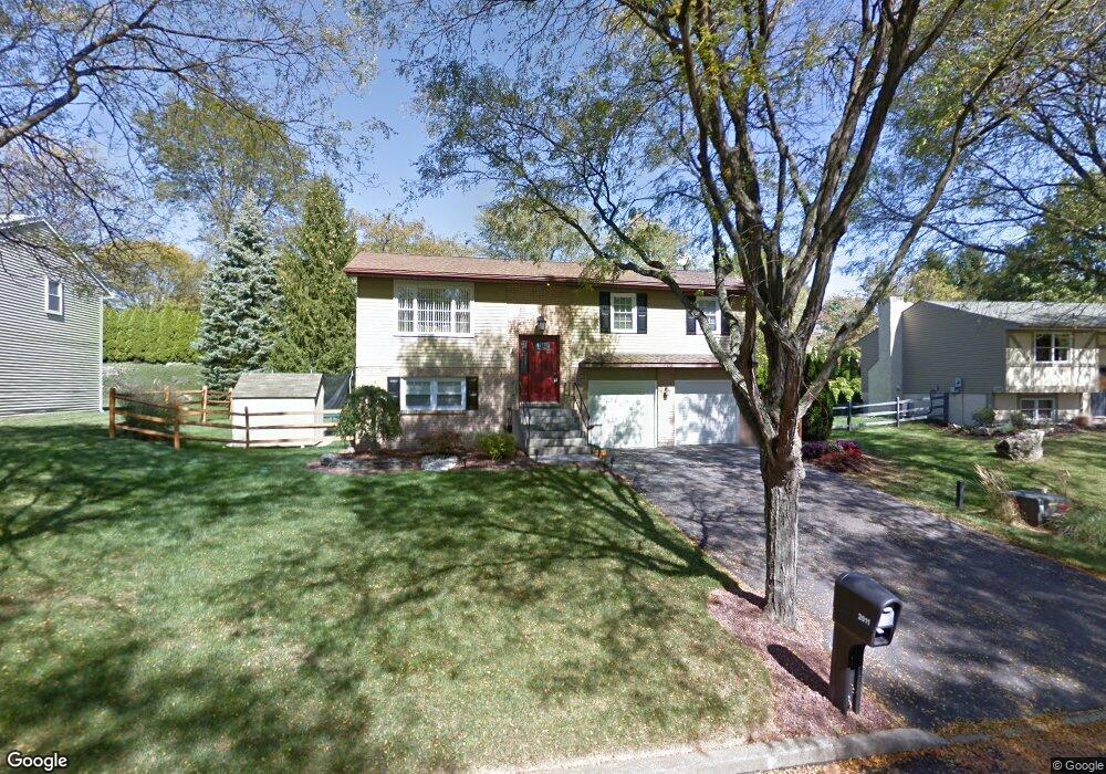
2011 Pierce Dr Whitehall, PA 18052
Fullerton NeighborhoodEstimated Value: $359,000 - $419,000
4
Beds
2
Baths
1,900
Sq Ft
$206/Sq Ft
Est. Value
About This Home
This home is located at 2011 Pierce Dr, Whitehall, PA 18052 and is currently estimated at $391,329, approximately $205 per square foot. 2011 Pierce Dr is a home located in Lehigh County with nearby schools including Tussing Elementary School, Kratzer Elementary School, and Cavelero Mid High School.
Ownership History
Date
Name
Owned For
Owner Type
Purchase Details
Closed on
Mar 21, 2003
Sold by
Brantley Willie B and Brantley Joyce J
Bought by
Rawski Thomas G and Rawski Constance M
Current Estimated Value
Home Financials for this Owner
Home Financials are based on the most recent Mortgage that was taken out on this home.
Original Mortgage
$117,500
Outstanding Balance
$50,587
Interest Rate
5.9%
Mortgage Type
Purchase Money Mortgage
Estimated Equity
$340,742
Purchase Details
Closed on
May 18, 1987
Bought by
Williams Joyce J
Create a Home Valuation Report for This Property
The Home Valuation Report is an in-depth analysis detailing your home's value as well as a comparison with similar homes in the area
Home Values in the Area
Average Home Value in this Area
Purchase History
| Date | Buyer | Sale Price | Title Company |
|---|---|---|---|
| Rawski Thomas G | $150,000 | -- | |
| Williams Joyce J | -- | -- |
Source: Public Records
Mortgage History
| Date | Status | Borrower | Loan Amount |
|---|---|---|---|
| Open | Rawski Thomas G | $117,500 | |
| Closed | Rawski Thomas G | $25,000 |
Source: Public Records
Tax History Compared to Growth
Tax History
| Year | Tax Paid | Tax Assessment Tax Assessment Total Assessment is a certain percentage of the fair market value that is determined by local assessors to be the total taxable value of land and additions on the property. | Land | Improvement |
|---|---|---|---|---|
| 2025 | $4,331 | $178,100 | $33,400 | $144,700 |
| 2024 | $4,185 | $178,100 | $33,400 | $144,700 |
| 2023 | $4,096 | $178,100 | $33,400 | $144,700 |
| 2022 | $4,080 | $178,100 | $144,700 | $33,400 |
| 2021 | $4,080 | $178,100 | $33,400 | $144,700 |
| 2020 | $4,080 | $178,100 | $33,400 | $144,700 |
| 2019 | $4,004 | $178,100 | $33,400 | $144,700 |
| 2018 | $3,872 | $178,100 | $33,400 | $144,700 |
| 2017 | $3,738 | $178,100 | $33,400 | $144,700 |
| 2016 | -- | $178,100 | $33,400 | $144,700 |
| 2015 | -- | $178,100 | $33,400 | $144,700 |
| 2014 | -- | $178,100 | $33,400 | $144,700 |
Source: Public Records
Map
Nearby Homes
- 2101 Van Buren Dr
- 1924 Alberta Dr
- 1733 Elmhurst Dr
- 1590 Abigail Ln Unit LOT 59
- 1573 Abigail Ln
- 2020 Whitehall Ave
- 109 Johnson Ct
- 1739 N 21st St
- 1818 W Jane St
- 1718 W Stanley St Unit 1722
- 195 Shiloh Ct
- 36 Peachtree Cir
- 1844 Schadt Ave
- 2 Grantarthur #Franklin Ct
- 1 Grantartur #Taylor Ct
- 4 Grantarthur #Morris Ct
- 3 Grantarthur #Liberty Ct
- 1640 Alta Dr
- 1553 Creekside Rd Unit B23
- 1 Grantarthur #Taylor Ct
- 2019 Pierce Dr
- 2041 Van Buren Dr
- 2010 Pierce Dr
- 1989 Presidential Dr
- 1995 Presidential Dr
- 2018 Pierce Dr
- 1998 Pierce Dr
- 1992 Presidential Dr
- 2026 Pierce Dr
- 1993 Presidential Dr
- 1989 Pierce Dr
- 1988 Pierce Dr
- 1929 Breckinridge Ct
- 1606 Sunset Dr
- 2109 Van Buren Dr
- 1990 Presidential Dr
- 2040 Van Buren Dr
- 1596 Sunset Dr
- 1997 Van Buren Dr