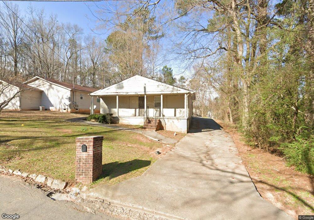
2011 Ruth St NW Atlanta, GA 30318
Grove Park NeighborhoodEstimated Value: $254,000 - $362,000
3
Beds
1
Bath
1,386
Sq Ft
$211/Sq Ft
Est. Value
About This Home
This home is located at 2011 Ruth St NW, Atlanta, GA 30318 and is currently estimated at $293,093, approximately $211 per square foot. 2011 Ruth St NW is a home located in Fulton County with nearby schools including Boyd Elementary School, John Lewis Invictus Academy, and Frederick Douglass High School.
Ownership History
Date
Name
Owned For
Owner Type
Purchase Details
Closed on
Dec 9, 2005
Sold by
Laaron Walter
Bought by
Zachery Rebekah
Current Estimated Value
Home Financials for this Owner
Home Financials are based on the most recent Mortgage that was taken out on this home.
Original Mortgage
$153,000
Outstanding Balance
$89,171
Interest Rate
7%
Mortgage Type
New Conventional
Estimated Equity
$203,922
Purchase Details
Closed on
May 22, 1995
Sold by
Edwards Kimberly
Bought by
Aaron Walter I
Create a Home Valuation Report for This Property
The Home Valuation Report is an in-depth analysis detailing your home's value as well as a comparison with similar homes in the area
Home Values in the Area
Average Home Value in this Area
Purchase History
| Date | Buyer | Sale Price | Title Company |
|---|---|---|---|
| Zachery Rebekah | $180,000 | -- | |
| Aaron Walter I | $47,000 | -- |
Source: Public Records
Mortgage History
| Date | Status | Borrower | Loan Amount |
|---|---|---|---|
| Open | Zachery Rebekah | $153,000 | |
| Closed | Aaron Walter I | $0 |
Source: Public Records
Tax History Compared to Growth
Tax History
| Year | Tax Paid | Tax Assessment Tax Assessment Total Assessment is a certain percentage of the fair market value that is determined by local assessors to be the total taxable value of land and additions on the property. | Land | Improvement |
|---|---|---|---|---|
| 2025 | $1,513 | $119,400 | $35,520 | $83,880 |
| 2023 | $4,175 | $100,840 | $51,080 | $49,760 |
| 2022 | $1,742 | $100,840 | $51,080 | $49,760 |
| 2021 | $1,784 | $102,000 | $54,120 | $47,880 |
| 2020 | $1,405 | $84,720 | $27,120 | $57,600 |
| 2019 | $507 | $41,600 | $17,200 | $24,400 |
| 2018 | $43 | $20,600 | $4,360 | $16,240 |
| 2017 | $32 | $18,240 | $4,000 | $14,240 |
| 2016 | $32 | $18,240 | $4,000 | $14,240 |
| 2015 | $592 | $18,240 | $4,000 | $14,240 |
| 2014 | $28 | $17,080 | $7,720 | $9,360 |
Source: Public Records
Map
Nearby Homes
- 1987 Ruth St NW
- 1985 Lois Place NW
- 2015 Lois Place NW
- 1981 Lois Place NW
- 1131 Cato St NW
- 1075 Cato St NW
- 1974 Lois Place NW
- 75 Johnson Rd NW
- 1050 Cato St NW
- 965 Cato St NW
- 37 Johnson Rd NW
- 1039 Margaret Place NW
- 887 Proctor Oaks St NW
- 30 Johnson Rd NW
- 25 Johnson Rd NW
- 1055 Johnson Grove
- 15 Johnson Rd NW
- 2015 Ruth St NW
- 1116 N Saint NW
- 1453 Arkridge St NW
- 0 East Ave NW Unit 8835351
- 0 East Ave NW Unit 7274091
- 0 East Ave NW Unit 8807661
- 0 East Ave NW Unit 7038826
- 0 East Ave NW Unit 7266956
- 0 East Ave NW Unit 3151520
- 0 East Ave NW Unit 8578392
- 0 East Ave NW Unit 3257351
- 0 East Ave NW Unit 7560472
- 0 East Ave NW
- 1980 East Ave NW
- 1984 East Ave NW
- 1991 Ruth St NW
- 1976 East Ave NW
- 969 N Saint NW
- 1972 East Ave NW
- 2004 Ruth St NW