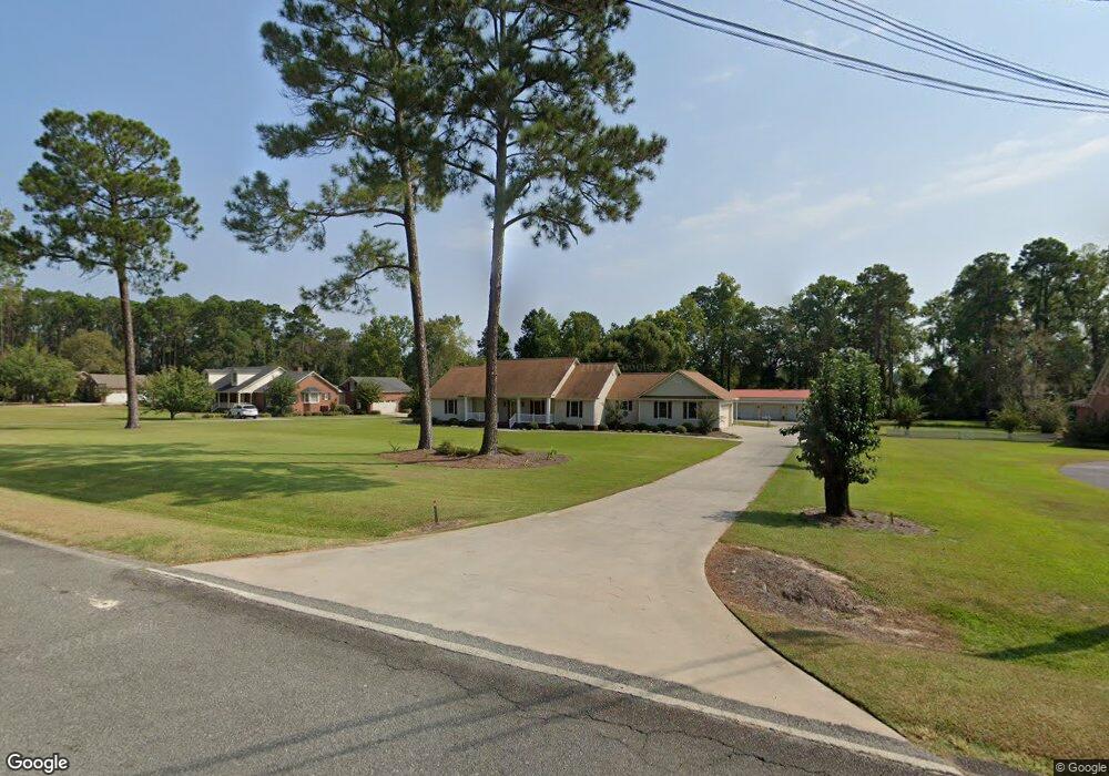
2011 Rutland Rd Tifton, GA 31793
Estimated Value: $324,000 - $427,000
3
Beds
2
Baths
2,806
Sq Ft
$131/Sq Ft
Est. Value
About This Home
This home is located at 2011 Rutland Rd, Tifton, GA 31793 and is currently estimated at $368,225, approximately $131 per square foot. 2011 Rutland Rd is a home located in Tift County with nearby schools including Annie Belle Clark Primary School, Matt Wilson Elementary School, and J.T. Reddick School.
Ownership History
Date
Name
Owned For
Owner Type
Purchase Details
Closed on
Feb 7, 1997
Bought by
Grimes Gary L and Grimes Judy F
Current Estimated Value
Purchase Details
Closed on
Jun 30, 1995
Sold by
Hargett Ralph L
Bought by
Farinholt Jeffery M and Farinholt Darla H
Purchase Details
Closed on
Apr 28, 1989
Purchase Details
Closed on
Apr 2, 1989
Sold by
P B M Investments Inc
Bought by
Hargerr Ralph L
Create a Home Valuation Report for This Property
The Home Valuation Report is an in-depth analysis detailing your home's value as well as a comparison with similar homes in the area
Home Values in the Area
Average Home Value in this Area
Purchase History
| Date | Buyer | Sale Price | Title Company |
|---|---|---|---|
| Grimes Gary L | $13,500 | -- | |
| Farinholt Jeffery M | $12,500 | -- | |
| -- | $8,500 | -- | |
| Hargerr Ralph L | $8,500 | -- |
Source: Public Records
Tax History Compared to Growth
Tax History
| Year | Tax Paid | Tax Assessment Tax Assessment Total Assessment is a certain percentage of the fair market value that is determined by local assessors to be the total taxable value of land and additions on the property. | Land | Improvement |
|---|---|---|---|---|
| 2024 | $3,203 | $148,816 | $11,600 | $137,216 |
| 2023 | $2,951 | $111,123 | $6,800 | $104,323 |
| 2022 | $3,239 | $111,123 | $6,800 | $104,323 |
| 2021 | $3,443 | $111,123 | $6,800 | $104,323 |
| 2020 | $2,913 | $97,742 | $6,800 | $90,942 |
| 2019 | $2,927 | $98,403 | $6,800 | $91,603 |
| 2018 | $2,923 | $98,403 | $6,800 | $91,603 |
| 2017 | $2,937 | $98,403 | $6,800 | $91,603 |
| 2016 | $2,939 | $98,403 | $6,800 | $91,603 |
| 2015 | $2,940 | $98,403 | $6,800 | $91,603 |
| 2014 | $2,946 | $98,403 | $6,800 | $91,603 |
| 2013 | -- | $98,403 | $6,800 | $91,603 |
Source: Public Records
Map
Nearby Homes
- 1808 Rutland Rd
- 26 Alan Ln
- 100 Elizabeth Dr
- 31 Henry Way
- 7 Deborah Dr
- 0 W Hutchinson Rd
- Tract 1 Whiddon Mill Rd
- 131 Oak Point Ave
- 106 Mill Ridge Cir
- W Hutchinson Rd
- 1901 Melba Dr
- 1610 Mallard Ln
- 1607 Mallard Ln
- 51 Logan Dr
- 0 Carpenter Rd
- 9 Country Club Place
- 577 Zion Hope Rd
- 11 Fairway Dr
- 523 Alabama Dr Unit 15 & PT 16
- 523 Alabama Dr
- 2013 Rutland Rd
- 2005 Rutland Rd
- 2010 Rutland Rd
- 4890 Frazier Cir
- 2008 Rutland Rd
- 2201 Rutland Rd
- 2014 Rutland Rd
- 2006 Rutland Rd
- 2001 Rutland Rd
- 2002 Rutland Rd
- 4804 Frazier Cir
- 2205 Rutland Rd
- 2202 Rutland Rd
- 2007 Bateman Dr
- 2005 Bateman Dr
- 4802 Frazier Cir
- 2003 Bateman Dr
- 36 Elizabeth Dr
- 4809 Frazier Cir
- 30 Elizabeth Dr