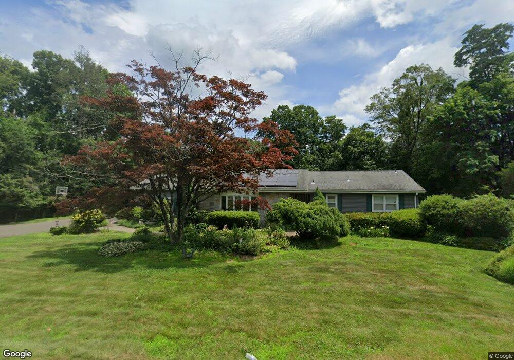
2011 Shepard Ave Hamden, CT 06518
Estimated Value: $403,004 - $442,000
3
Beds
2
Baths
1,616
Sq Ft
$265/Sq Ft
Est. Value
About This Home
This home is located at 2011 Shepard Ave, Hamden, CT 06518 and is currently estimated at $427,501, approximately $264 per square foot. 2011 Shepard Ave is a home located in New Haven County with nearby schools including Hamden Middle School, Hamden High School, and Laurel Oaks Adventist School.
Ownership History
Date
Name
Owned For
Owner Type
Purchase Details
Closed on
Aug 20, 1993
Sold by
Wallen Friedman Leny and Wallen Friedman M A
Bought by
Riccitelli Robert A and Ricitelli Michelle M
Current Estimated Value
Home Financials for this Owner
Home Financials are based on the most recent Mortgage that was taken out on this home.
Original Mortgage
$128,000
Interest Rate
7.11%
Mortgage Type
Unknown
Purchase Details
Closed on
Oct 27, 1989
Sold by
Est Gregory Ernest
Bought by
Wallen Friedmon Leny
Create a Home Valuation Report for This Property
The Home Valuation Report is an in-depth analysis detailing your home's value as well as a comparison with similar homes in the area
Home Values in the Area
Average Home Value in this Area
Purchase History
| Date | Buyer | Sale Price | Title Company |
|---|---|---|---|
| Riccitelli Robert A | $135,000 | -- | |
| Wallen Friedmon Leny | $155,000 | -- |
Source: Public Records
Mortgage History
| Date | Status | Borrower | Loan Amount |
|---|---|---|---|
| Closed | Wallen Friedmon Leny | $225,000 | |
| Closed | Wallen Friedmon Leny | $181,000 | |
| Closed | Wallen Friedmon Leny | $61,000 | |
| Closed | Wallen Friedmon Leny | $128,000 |
Source: Public Records
Tax History
| Year | Tax Paid | Tax Assessment Tax Assessment Total Assessment is a certain percentage of the fair market value that is determined by local assessors to be the total taxable value of land and additions on the property. | Land | Improvement |
|---|---|---|---|---|
| 2025 | $13,070 | $251,930 | $67,620 | $184,310 |
| 2024 | $9,619 | $172,970 | $47,390 | $125,580 |
| 2023 | $9,752 | $172,970 | $47,390 | $125,580 |
| 2022 | $9,596 | $172,970 | $47,390 | $125,580 |
| 2021 | $9,071 | $172,970 | $47,390 | $125,580 |
| 2020 | $8,689 | $167,160 | $82,600 | $84,560 |
| 2019 | $8,167 | $167,160 | $82,600 | $84,560 |
| 2018 | $8,017 | $167,160 | $82,600 | $84,560 |
| 2017 | $7,566 | $167,160 | $82,600 | $84,560 |
| 2016 | $7,582 | $167,160 | $82,600 | $84,560 |
| 2015 | $7,767 | $190,050 | $91,770 | $98,280 |
| 2014 | $7,589 | $190,050 | $91,770 | $98,280 |
Source: Public Records
Map
Nearby Homes
- 1925 Shepard Ave Unit 54
- 150 Chatterton Way
- 206 W Todd St
- 68 Todd St
- 2415 Shepard Ave Unit 23
- 35 Todd St Unit 103
- 35 Todd St Unit 302
- 24 Amos St
- 399 W Woods Rd
- 34 Lloyd St
- 26 Kelly Rd
- 270 Johnson Rd
- 151 Fans Rock Rd
- 3409 Whitney Ave Unit 23A
- 292 Deerfield Dr
- 774 Still Hill Rd
- 45 Booth Terrace
- 180 River Rd
- 240 Tom Swamp Rd
- 1378 Shepard Ave
- 285 Todd St
- 2010 Shepard Ave
- 2029 Shepard Ave
- 1985 Shepard Ave
- 2004 Shepard Ave
- 259 Todd St
- 2045 Shepard Ave
- 284 Todd St
- 2014 Shepard Ave
- 1994 Shepard Ave
- 1975 Shepard Ave
- 2055 Shepard Ave
- 1980 Shepard Ave
- 1965 Shepard Ave
- 27 Barbara Ln
- 256 Todd St
- 255 Todd St
- 40 W Todd St
- 2065 Shepard Ave
- 15 W Todd St
Your Personal Tour Guide
Ask me questions while you tour the home.