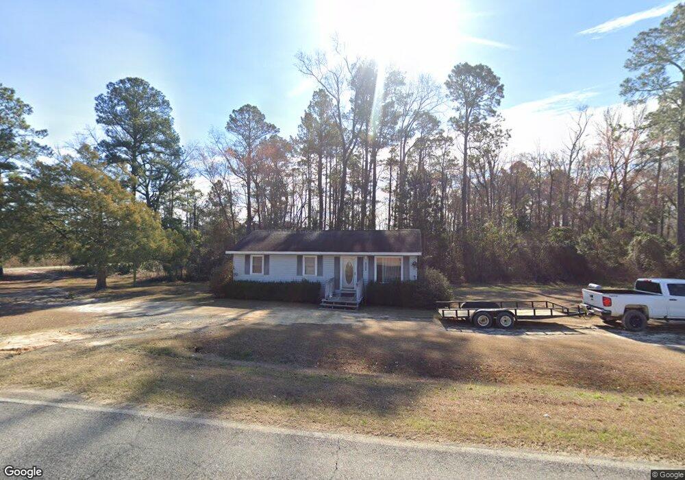
2011 Snellbridge Rd East Dublin, GA 31027
Estimated Value: $109,000 - $188,000
--
Bed
1
Bath
960
Sq Ft
$149/Sq Ft
Est. Value
About This Home
This home is located at 2011 Snellbridge Rd, East Dublin, GA 31027 and is currently estimated at $143,333, approximately $149 per square foot. 2011 Snellbridge Rd is a home located in Laurens County with nearby schools including Northwest Laurens Elementary School, Southwest Laurens Elementary School, and East Laurens Primary School.
Ownership History
Date
Name
Owned For
Owner Type
Purchase Details
Closed on
Nov 24, 2017
Sold by
Double D Svcs Inc
Bought by
Dollar Brothers Farm Managemen
Current Estimated Value
Home Financials for this Owner
Home Financials are based on the most recent Mortgage that was taken out on this home.
Original Mortgage
$1,580,280
Outstanding Balance
$1,330,457
Interest Rate
3.94%
Mortgage Type
Purchase Money Mortgage
Estimated Equity
-$1,187,124
Purchase Details
Closed on
Jan 3, 2006
Sold by
Dollar Derrick S
Bought by
Double D Svcs Inc
Purchase Details
Closed on
Nov 24, 1999
Sold by
Dollar Terah
Bought by
Dollar Derrick S
Purchase Details
Closed on
Aug 14, 1996
Sold by
Jim Walter Homes Inc
Bought by
Dollar Terah
Purchase Details
Closed on
Jul 31, 1996
Sold by
Mid-State Trust
Purchase Details
Closed on
Apr 30, 1996
Sold by
Hedrick James C
Purchase Details
Closed on
Sep 9, 1909
Create a Home Valuation Report for This Property
The Home Valuation Report is an in-depth analysis detailing your home's value as well as a comparison with similar homes in the area
Home Values in the Area
Average Home Value in this Area
Purchase History
| Date | Buyer | Sale Price | Title Company |
|---|---|---|---|
| Dollar Brothers Farm Managemen | $55,000 | -- | |
| Double D Svcs Inc | $24,501 | -- | |
| Dollar Derrick S | -- | -- | |
| Dollar Terah | $18,000 | -- | |
| -- | -- | -- | |
| -- | $24,200 | -- | |
| -- | -- | -- |
Source: Public Records
Mortgage History
| Date | Status | Borrower | Loan Amount |
|---|---|---|---|
| Open | Dollar Brothers Farm Managemen | $1,580,280 |
Source: Public Records
Tax History Compared to Growth
Tax History
| Year | Tax Paid | Tax Assessment Tax Assessment Total Assessment is a certain percentage of the fair market value that is determined by local assessors to be the total taxable value of land and additions on the property. | Land | Improvement |
|---|---|---|---|---|
| 2024 | $389 | $18,484 | $1,444 | $17,040 |
| 2023 | $368 | $17,305 | $1,444 | $15,861 |
| 2022 | $417 | $17,263 | $1,402 | $15,861 |
| 2021 | $432 | $17,530 | $2,070 | $15,460 |
| 2020 | $433 | $17,530 | $2,070 | $15,460 |
| 2019 | $433 | $17,530 | $2,070 | $15,460 |
| 2018 | $433 | $17,530 | $2,070 | $15,460 |
| 2017 | $433 | $17,530 | $2,070 | $15,460 |
| 2016 | $433 | $17,530 | $2,070 | $15,460 |
| 2015 | $434 | $17,530 | $2,070 | $15,460 |
| 2014 | $327 | $12,356 | $460 | $11,896 |
Source: Public Records
Map
Nearby Homes
- 467 Alton Stewart Rd
- 0 Alton Stewart Rd Unit 10628094
- 1739 Snellbridge Rd
- 117 Lovett Scott Rd
- 0 Old Carter Rd
- 0 Stone Church Rd Unit 10636232
- 0 Stone Church Rd Unit 25420128
- 0 Stone Church Rd Unit 25261642
- 84 J D Garnto Rd
- 509 Maddox Rd
- 0 Red Hill Cemetery Rd Unit 30103
- 0 Red Hill Cemetery Rd Unit 10564131
- 0 Hubert Fulford Rd Unit 22123639
- 6.98 ACRES Brewton Lovett Rd
- 3.5 ACRES Brewton Lovett Rd
- 9.56 ACRES Brewton Lovett Rd
- 1354 Lakeway Rd
- 250 Archers Pond Smith Rd
- Pendleton Rreek Rd
- 92 Paul Lord Rd
- 2012 Snellbridge Rd
- 1993 Snellbridge Rd
- 152 Alton Stewart Rd
- 1946 Snellbridge Rd
- 1931 Snellbridge Rd
- 2117 Snellbridge Rd
- 475 Lovett Scott Rd
- 483 Lovett Scott Rd
- 483 Lovett Scott Rd
- 452 Lovett Scott Rd
- 1898 Snellbridge Rd
- 440 Lovett Scott Rd
- 506 Lovett Scott Rd
- 222 Alton Stewart Rd
- 2194 Snellbridge Rd
- 0 Lovett Scott Rd Unit 20155553
- 1876 Snellbridge Rd
- 2063 Bay Springs Rd
- 1858 Snellbridge Rd
- 342 Lovett Scott Rd