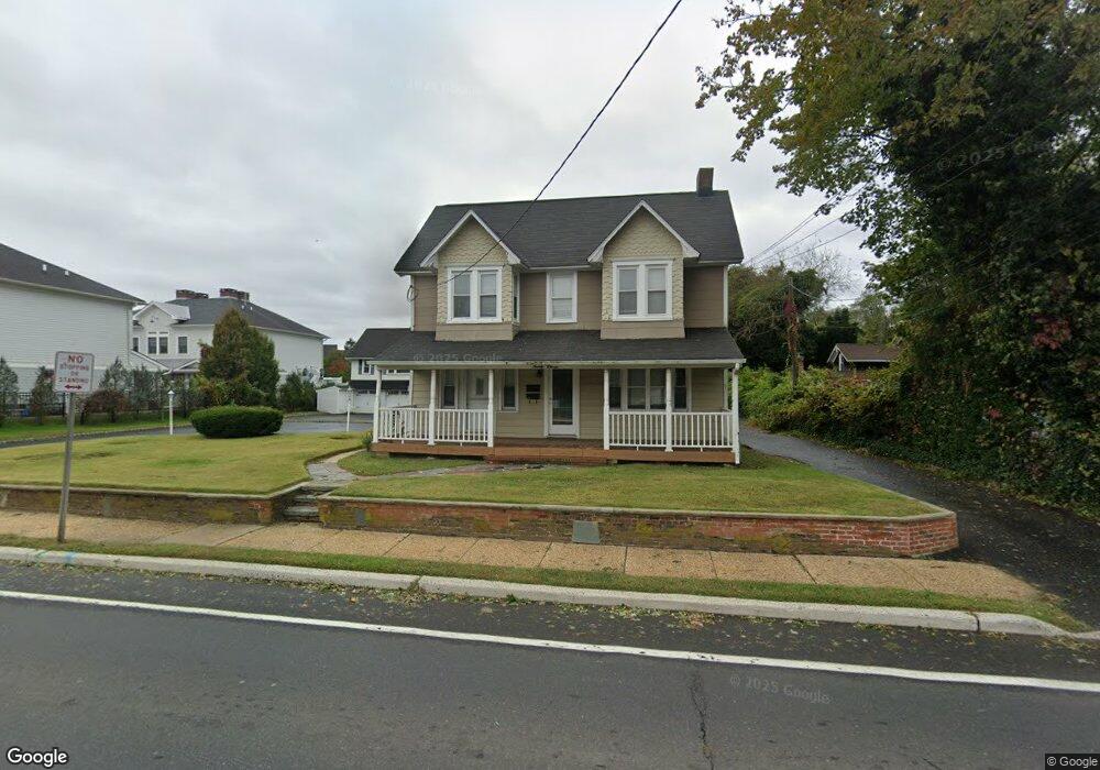
2011 State Route 71 Spring Lake, NJ 07762
Estimated Value: $1,098,441 - $2,461,000
3
Beds
2
Baths
1,790
Sq Ft
$869/Sq Ft
Est. Value
About This Home
This home is located at 2011 State Route 71, Spring Lake, NJ 07762 and is currently estimated at $1,556,110, approximately $869 per square foot. 2011 State Route 71 is a home with nearby schools including Spring Lake Heights Elementary School and St. Catharine School.
Ownership History
Date
Name
Owned For
Owner Type
Purchase Details
Closed on
Oct 29, 2024
Sold by
Durkin-Wignall Patricia
Bought by
2011 Nj Route 71 Investments Llc
Current Estimated Value
Purchase Details
Closed on
Apr 9, 2001
Sold by
Quest Partners
Bought by
Wignall Patricia Durkin
Home Financials for this Owner
Home Financials are based on the most recent Mortgage that was taken out on this home.
Original Mortgage
$262,500
Interest Rate
6.9%
Mortgage Type
Commercial
Create a Home Valuation Report for This Property
The Home Valuation Report is an in-depth analysis detailing your home's value as well as a comparison with similar homes in the area
Home Values in the Area
Average Home Value in this Area
Purchase History
| Date | Buyer | Sale Price | Title Company |
|---|---|---|---|
| 2011 Nj Route 71 Investments Llc | $995,000 | Scott Title Services | |
| 2011 Nj Route 71 Investments Llc | $995,000 | Scott Title Services | |
| Wignall Patricia Durkin | $350,000 | -- |
Source: Public Records
Mortgage History
| Date | Status | Borrower | Loan Amount |
|---|---|---|---|
| Previous Owner | Wignall Patricia Durkin | $262,500 |
Source: Public Records
Tax History Compared to Growth
Tax History
| Year | Tax Paid | Tax Assessment Tax Assessment Total Assessment is a certain percentage of the fair market value that is determined by local assessors to be the total taxable value of land and additions on the property. | Land | Improvement |
|---|---|---|---|---|
| 2025 | $13,668 | $1,398,600 | $644,500 | $754,100 |
| 2024 | $13,488 | $1,298,000 | $557,600 | $740,400 |
| 2023 | $13,488 | $1,204,300 | $487,600 | $716,700 |
| 2022 | $15,660 | $1,275,000 | $566,300 | $708,700 |
| 2021 | $15,660 | $1,160,000 | $514,800 | $645,200 |
| 2020 | $14,958 | $1,101,500 | $514,800 | $586,700 |
| 2019 | $14,890 | $1,085,300 | $514,800 | $570,500 |
| 2018 | $11,078 | $785,700 | $514,800 | $270,900 |
| 2017 | $10,638 | $782,200 | $514,800 | $267,400 |
| 2016 | $10,370 | $753,100 | $489,100 | $264,000 |
| 2015 | $9,892 | $720,500 | $463,300 | $257,200 |
| 2014 | $9,653 | $718,800 | $463,300 | $255,500 |
Source: Public Records
Map
Nearby Homes
- 15 Wyckham Rd
- 905 Wall Rd
- 1905 3rd Ave
- 1027 2nd Ave
- 2419 Kipling Ave
- 737 20th Ave
- 1813 Margerum Ave
- 19 Willow Ln
- 513 Mercer Ave
- 1838 Highway 35 Unit 36
- 1211 18th Ave
- 24 Old Mill Ct
- 1014 Glenn St
- 708 18th Ave
- 1820 New Jersey 35 Unit 34
- 1820 New Jersey 35 Unit Home Site 26
- 118 Warren Ave
- 1825 Pine Terrace
- 1024 17th Ave
- 1704 Grove St
- 2013 State Route 71
- 2010 State Route 71
- 2015 State Route 71
- 2006 State Route 71
- 2012 State Route 71
- 564 Church St
- 562 Church St
- 2014 State Route 71
- 2019 Highway 71
- 565 Church St
- 560 Church St
- 567 Church St
- 2023 State Route 71 Unit REAR
- 2023 State Route 71
- 2023 State Route 71 Unit Back
- 2023 State Route 71 Unit Front
- 2018 New Jersey 71 Unit 6
- 20 Wyckham Rd Unit 20
- 19 Wyckham Rd
- 18 Wyckham Rd